See them while you can: Climate change is reshaping iconic US destinations

As millions of Americans flock to the nation's coasts, islands and national monuments this summer, experts have a sobering message: Climate change is rapidly reshaping some of the United States' most iconic destinations.
Devastated tropical islands. Ruined coastal homes. A flooded capitol. The changes are unfolding in plain sight and at a rapid and terrifying pace, experts told USA TODAY – with no sign of stopping.
Some of the most obvious and dramatic changes can be seen at the bustling coast, where rising seas mean summer vacation spots face a supercharged risk. There, the natural rhythm of water meeting land increasingly results in flooding and erosion that eats away at roads, homes and businesses.
Here is a look at some of the nation's most famous destinations, which are being altered by a warming world:

California's Big Sur Coast Highway is falling into the ocean
One of California's most scenic and best-known attractions is the Big Sur Coast Highway, which clings to the side of cliffs and offers breathtaking views of the Pacific Ocean.
But it's increasingly inaccessible due to climate change-induced landslides, cliff collapses and rockfalls.
“We have much more intense, prolonged winter storms that bring heavy rain and wind. As a consequence, the rate of failure due to landslides has increased significantly,” said Peter Swarzenski, interim acting chair with the U.S. Geological Services’ Pacific Coastal and Marine Science Center.
The road has been in an ongoing fight against gravity since it was first constructed in the 1930s. But now, a new level of damage is coming from increasingly furious winter storms and climate change-exacerbated wildfires that lead to soil erosion.
The end result: hundreds of millions of dollars in damage that require closures so frequent the California Department of Transportation maintains a website listing them.
Highway 1: California's Pacific Coast Highway is falling into the ocean. Is this the end of the road?

A massive storm on March 30 caused a section of the roadway a dozen miles south of Carmel to fall into the ocean. Locals only had limited access in and out and it took six weeks to reopen.
On June 23, a section of the highway at Paul's Slide only opened after being closed for a year-and-a-half due to a major slide that poured as much as 500,000 cubic yards of material across the roadway.
Such closures "used to happen once every few years. Now it’s almost every year," said Swarzenski.

Sea level rise threatens Outer Banks coastal escapes
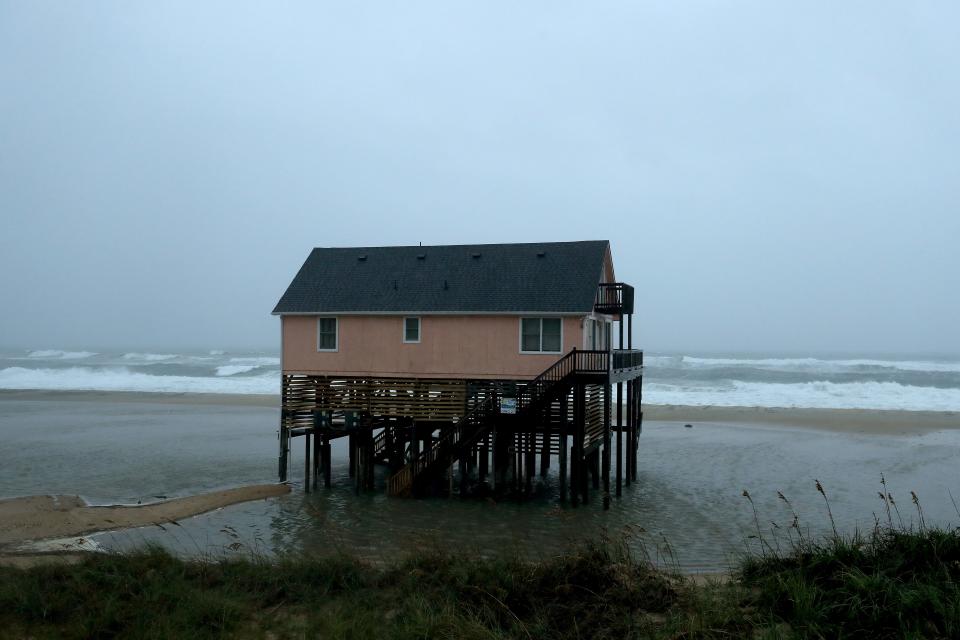
More than 5 million visitors a year flock to the sandy beaches of the barrier islands off North Carolina, visiting lighthouses and soaking up the sun. But it’s hard to miss the clear evidence that the warming climate is changing this fringe of islands.
While flooding of the low lying oceanfront highway has always been an issue during storms, today it occurs more often.
The impacts of higher sea levels and high tide flooding aren’t just visible along the beach. They’re evident on the inland side of the islands, along the Albermarle Sound in the Alligator River National Wildlife Refuge, where scrubby freshwater bogs are being overtaken by salt marsh. Ghost forests are scattered across the landscape as salt water intrusion kills trees. Some local landmarks that once stood on solid ground are now sitting in the water.
High tide flooding – frequently referred to as sunny day flooding – already occurs twice as often along the Outer Banks as it did in 2000, according to the National Oceanic and Atmospheric Administration, and that’s only expected to increase.
The agency expects high tide flooding to triple by 2030, and to be 10 times higher by 2050.

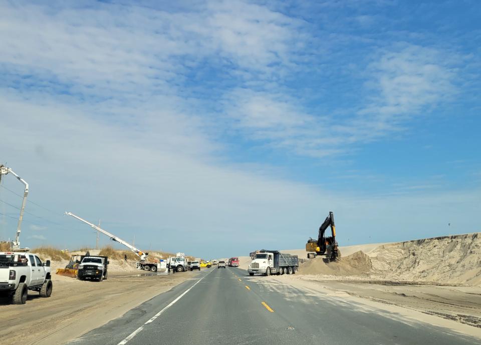
This year has seen major projects taking place along the beach, to fight the rising tides and maintain the oceanfront highway. The roadway sees so much activity from dune over wash and flooding the North Carolina Department of Transportation maintains a Facebook page just to share NC 12 updates with the public.
A new bridge opened in 2022 to take motorists around some of the most flood-prone spots.
Communities along the Outer Banks are grappling with hard questions about adding sand to replace vanishing dunes and when to retreat from development in some oceanfront areas.

Washington, DC's historic sights are sinking
Some of the most iconic tourist sights in Washington, D.C., are sinking.
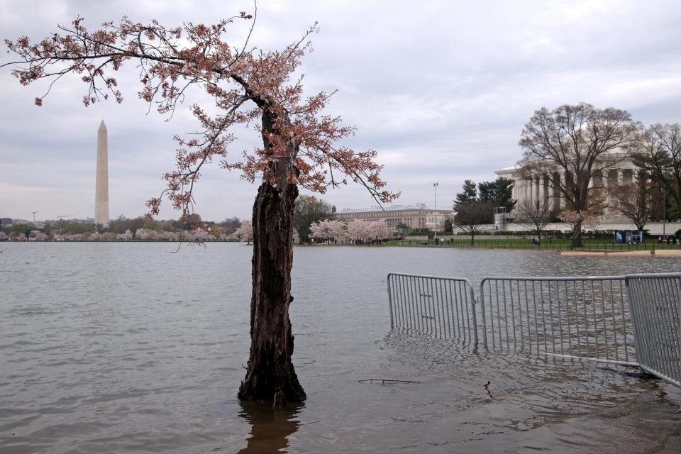
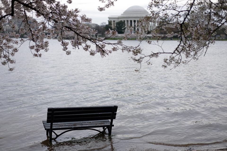
The man-made Tidal Basin, flanked by treasured monuments including the Thomas Jefferson Memorial and the Martin Luther King, Jr. Memorial, and the cherry trees that are a symbol of international friendship, are under siege. Experts say rising water levels, urbanization and subsidence – the sinking of the land – are contributing to the problem.
Over the last century, sea levels in the area have risen over 13 inches, with signs of acceleration. Today, the Tidal Basin's walkways flood at certain times of day. At the Jefferson memorial, the tops of hand railings along walkways are under water. That’s not how it was 15 or 20 years ago, said Seri Worden, senior director of preservation programs at the National Trust for Historic Preservation.
“There are certain areas of the Tidal Basin when you're walking, say, from the Jefferson Memorial towards the MLK Memorial, where you cannot walk along the edge of the Tidal Basin at all because it's so flooded and so muddy and slippery, it's closed off,” she said. “And that's really a shame for one of our most important monuments in the country.”

The rising water levels due to climate change are also killing off cherry trees that line the basin. When walkways are flooded, people end up trampling the trees’ roots. Plus, rising temperatures year after year are causing the peak bloom season to occur earlier and earlier.
In 70 years, the entirety of the Tidal Basin walkways could be under water if nothing is done, Worden said.
The National Park Service has begun construction on a $113 million project to restore the seawall and widen walkways, according to Superintendent of National Mall and Memorial Parks Jeff Reinbold. That should curb the twice-daily flooding, he said.
“We’re confident in the ability of the sea walls to address the majority of the impacts we’re going to see well into the future,” Reinbold said.
Still, other experts think the Tidal Basin will need a longer-term plan that might include changing the way visitors experience the monuments there. “Otherwise, we might lose them altogether,” Worden said.

Rising seas, flooding and heat in Key West
When it comes to sea-level rise, Key West, Florida, is "one of the most vulnerable places in the nation to rising sea levels," according to the Partners for Livable Communities.
Like many parts of South Florida, Key West is quite flat, with many sections, including the downtown hub of tourist activity, reaching no more than 3 feet above sea level.
Grimly, Key West could experience up to 7 feet of sea level rise by 2100, NASA reports. Such a dramatic rise would put much of the Keys underwater.

But it's not just the slow march of sea-level rise that worries locals: It's also the extremely hot summer days and ferocious hurricanes, Sheetal Almas, the adaptation and energy coordinator for the city of Key West, told USA TODAY. While Key West has always had to deal with heat and hurricanes, climate change is supercharging these threats.
The city is well aware of its vulnerability and is developing a Climate Adaptation Plan to assess the multiple threats, Almas said. "We're seeing what the city can do to be more resilient," she said.
Potential visitors to Key West should pack flexibility into their vacation schedules, Almas said, especially if they're visiting during the heart of hurricane season, from mid-August to mid-October. She recommends purchasing travel insurance and "having a way to get off the island" should evacuation be necessary.

Hawaii faces wildfire threats ‒ and more
Hawaii may have a reputation as an idyllic island getaway, but tourism on the island faces several headwinds.
Last year, Fodor's Travel named Maui among 10 destinations on its 2023 “No List” that tourists should reconsider visiting because of the threat of environmental damage caused by over-tourism and climate change.
And then came the wildfires.
After fires devastated the town of Lahaina, many people were displaced from their homes and forced to live in hotels or leave the island, bringing to light their own concerns about tourists taking up housing accommodations on the island and displacing local families. More than 100 people died in the fires.
The islands of Maui, Oahu and The Big Island are susceptible to more devastation from wildfires and other climate threats this summer, said Abby Frazier, a climatologist who studies the spatiotemporal dynamics and impacts of climate change and climate variability.
Frazier joins other experts who have been warning that climate change will reshape the Aloha State. Researcher Chip Fletcher previously told USA TODAY that Hawaii will face more wildfires, hotter sea surface and air temperatures, more coastal erosion and more extreme rain.
The islands also face sea level rise, an increase in drought and storm frequency and a change in rainfall and stream flow pattern and variability, according to the report “Climate Change and the Visitor Industry” produced by The University of Hawai‘i Sea Grant Center for Sustainable Coastal Tourism and funded by the Hawai‘i Tourism Authority.
“Over the next couple of decades climate change is expected to have an increasingly negative impact on Hawai‘i’s tourism sector, the state’s primary economic engine,” the report said.
Contributing: Marc Ramirez, USA TODAY; Gareth McGrath, USA TODAY NETWORK
This article originally appeared on USA TODAY: These iconic US destinations are threatened by climate change


