
Storm brings more rain to B.C. as officials stress need to prepare, listen to authorities
THE LATEST:
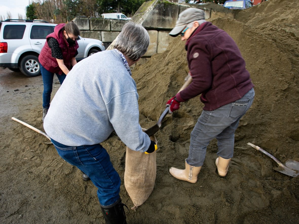
The third in a series of Pacific storms bringing torrential rain to already-flooded areas of southwest B.C. has arrived. Up to 100 millimetres of rain is predicted for the Fraser Valley between Tuesday and Wednesday.
Highway 99 between Lillooet and Pemberton closed at 4 p.m. PT due to storm.
The third in a series of storms that have increased in intensity is bearing down on B.C., causing major concerns for communities dealing with the consequences of previous storms over the past two weeks.
CBC meteorologist Johanna Wagstaffe says 10 to 15 millimetres could fall within a mere three hours on parts of the South Coast on Tuesday, and freezing levels will rise rapidly in altitude — which means more snowmelt.
Environment Canada issued rainfall warnings and special weather statements for much of the province, and has predicted up to 100 millimetres of rain Tuesday into Wednesday for Metro Vancouver, Whistler, the Sunshine Coast and the Fraser Valley, including Abbotsford, Chilliwack and Hope.
"This could be the most intense storm yet," said B.C. Public Safety Minister Mike Farnworth.
Speaking at a late-morning news briefing, Farnworth said people living in flood zones must listen to local authorities and evacuate immediately if asked. British Columbians should also take alerts issued by Environment Canada and Drive BC very seriously, he said.
WATCH | Dikes reinforced, B.C. highways closed as floodwaters rise:
Up to 200 millimetres of rain is also in the forecast for northern and western parts of Vancouver Island and the Central Coast.
A winter storm warning is in effect for the North Coast, which could see up to 40 centimetres of snow on Tuesday.
A flood watch is in effect for the Fraser, Tulameen, Coldwater, Similkameen, Coquihalla and Sumas rivers.
A flood warning means river levels have exceeded or will exceed their banks, and nearby areas will flood as a result. A flood watch means river levels are rising and may spill their banks.
Hope, Abbotsford mayors confident
The mayors of two Fraser Valley communities that have been hit hard by flooding this fall say they are confident their residents can make it through these next two days of rain.
"I am pleased to share that at this point, we are holding our own," Abbotsford Mayor Henry Braun said Monday afternoon. "Unless we get a 200 millimetre dump Tuesday and Wednesday — that's a whole different ball game, then."
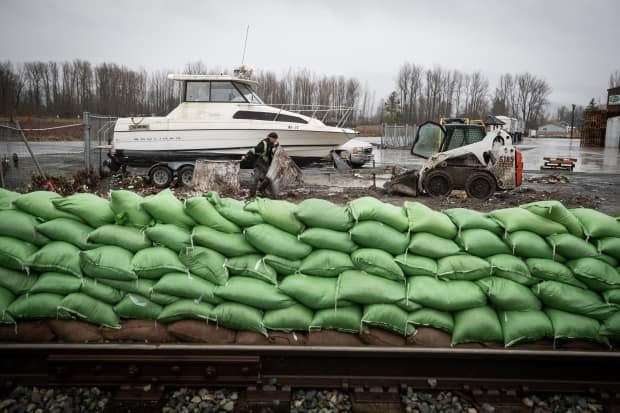
Although the Nooksack River in Washington overflowed Sunday, water did not cross over from the state to the eastern part of the Sumas Prairie. Braun said that was good news, since it remains the area of the city hardest hit by flooding.
Hope Mayor Peter Robb said his community has done all it can to prepare for the next storm.
"I believe we're ready," he said.
Local states of emergency are in place for both communities, and evacuation alerts and orders have been issued.
Robb is encouraging residents to have an emergency bag prepared in case they are told to leave their homes.
According to Farnworth, 500 Canadian Armed Forces troops are also working on flood defence, as well as transporting health personnel in and around flood-affected areas.
He said Canadian Forces Base (CFB) Comox is on standby with air assistance and CFB Esquimalt, home of the Pacific Naval Fleet, is also ready to step in.
"We aren't in the clear yet," he said.
Fraser Valley region calls for more help
The Fraser Valley Regional District (FVRD), which includes the communities of Abbotsford and Hope, said Tuesday the province had exacerbated the flooding emergency by not responding to earlier requests for emergency funding.
It is calling for more funding as the third storm system settles in over the region.
District chair Jason Lum said the FVRD has made more than 50 different requests to the B.C. government since the mid-November flooding event that have gone unanswered. Others, he said, were answered too late.
"The response system is broken," said Lum.
Lum said he's worried the situation could worsen while the district is still chasing funding for earlier flood damage.
Responding to Lum's allegations Tuesday, Farnworth said local governments were empowered to take action themselves during states of emergency.
"To be clear, the claim that local governments need to wait on the province to receive authorization to take public safety actions is incorrect," he said.
Emergency Management B.C. staff had reached out to Lum and the FVRD after Tuesday's statement, Farnworth said, "to ensure they have the support they need."
Highway 99 closure
B.C. Transportation Minister Rob Fleming announced Tuesday that Highway 99 between Pemberton and Lillooet would close at 4 p.m. until further notice due to weather conditions. The next update on the route is set to come Wednesday afternoon.
A travel advisory was also issued for Highway 20 in the Bella Coola Valley area, and officials are asking non-essential travellers to stay off that stretch of road due to avalanche and flood risks.
Many highways remain closed after washouts and landslides two weeks ago, and others are open for essential travel only.
Highway 1 between Hope and Popkum in the Fraser Valley remains closed, but the 80-kilometre stretch from Hope north to Boothroyd has been reopened.

"The situation is very dynamic, and I would encourage everyone to follow DriveBC for the latest information," Fleming said Monday.
Highway 3 between Hope and Princeton has also reopened, allowing for commercial vehicles and other essential travel.
Officials are advising residents to stay off the roads if they can during this latest storm.
Drivers on the South Coast and Vancouver Island will remain limited to purchasing 30 litres of fuel at a time until Dec. 14 in order to preserve supplies for emergency and essential vehicles responding to the heavy rains and severe flooding.
The order was introduced on Nov. 19 and originally set to expire Dec. 1.
Essential vehicles will continue to have unrestricted access to fuel as required, using predominantly commercial trucking or cardlock gas stations.
Interior cleanup continues
Major cleanup efforts are underway in the Southern Interior communities of Merritt and Princeton, as municipal officials hope the Coldwater, Tulameen and Similkameen rivers don't breach their banks.
All 7,000 residents of Merritt were evacuated two weeks ago when the Coldwater River overwhelmed the city and its wastewater system.
City crews, contractors and members of the Canadian Armed Forces have since reinforced flood defences along the Coldwater River in anticipation of Tuesday's atmospheric river.
WATCH | Greg Lowis, Merritt's emergency public information officer, on the city's current situation:
Avalanche awareness
Avalanche Canada is warning that Tuesday's heavy rain on top of newly accumulated snow on South Coast mountains is a recipe for rapidly changing and dangerous avalanche conditions.
The non-profit safety organization rates avalanche risk on a scale of one to five, with five being an extreme risk.
On Tuesday, the danger rating at the alpine level is rated high at a four out of five and there is a considerable risk at the treeline level with a three rating.
Avalanche Canada's website says substantial "storm slabs" could form in the region's upper elevations before they are hammered by afternoon rain, and they pose a substantial avalanche threat.
"We will see a rapid evolution of avalanche conditions over the day," the organization warned.

