
Firefighters brace for lightning, high winds across B.C.'s southern Interior as storms loom
Much of B.C.'s Interior is being warned about the risk of severe thunderstorms Thursday, as an unsettled weather system rolls north from the United States and amplifies fire risk.
Environment Canada has issued severe thunderstorm watches for much of the region, from the Prince George area down to the Similkameen, Okanagan and the Kootenays.
The weather agency said "conditions are favourable for the development of severe thunderstorms that may be capable of producing strong wind gusts, large hail and heavy rain."
"Intense lightning is likely with any thunderstorm that develops," the alert read.
Fire risk high to extreme
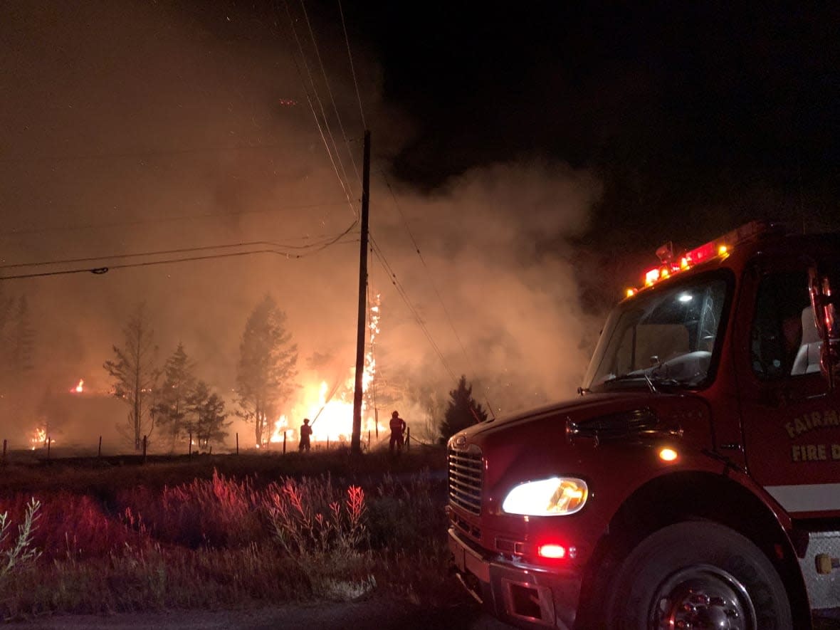
Fire risk in the same area of the province is mostly high, with pockets of extreme risk in the West Kootenay. A fire danger rating of "high" or more means forest fuels are very dry and new fires could "start easily, burn vigorously, and challenge fire suppression efforts," according to the province.
The B.C. Wildfire Service website showed spot fires caused by lightning strikes on Wednesday dotting the coastal, Kamloops, southeast and Cariboo fire centres, including 10 starts on Vancouver Island, but all remain small.
B.C. Wildfire Service information officer Karley Desrosiers said lightning is normal for July and August in parts of B.C., especially when temperatures get warm and there is more moisture in the air.
"We have not had nearly as much lightning as we did last year,'' she said. "It was an exceptional year for lightning.''
Neal McLoughlin, the superintendent of predictive services for the B.C. Wildfire Service, said Wednesday crews were already monitoring the weather pattern coming from the U.S.
He said the weather could bring high winds that could speed the spread of active fires, without bringing much rain.
"Although [rain] may subdue conditions for a day or two, our indices are going to continue to climb and we're not going to see enough rain to put the fires out."
Olalla residents can return home
Residents of the British Columbia community of Olalla are now allowed to return home after being forced out by a threatening wildfire last week.
Environment Canada posted heat warnings for the Fraser Canyon, north Thompson and inland sections of the north and central coast as temperatures in the mid- to high 30s were expected to continue through Friday in the Interior.
The weather office said Thursday's forecasted thundershowers were likely to pack winds gusting to 80 kilometres per hour, conditions the wildfire service warned could complicate work on the fire that had been threatening Olalla.
The blaze is located 21 kilometres southwest of Penticton and has scorched about 67 square kilometres.
The fire remains uncontrolled, and while the Regional District of Okanagan-Similkameen rescinded almost half of the nearly 500 evacuation orders covering properties closest to the blaze, 273 within the region remain in place.
Nearly 400 properties are under an evacuation alert, which means they have to be ready to leave at a moment's notice.
The district said evacuation alerts for residents of the nearby village of Keremeos have been lifted, but the Apex Mountain resort and surrounding homes remain on evacuation order.
As of Thursday morning, there were five wildfires of note across B.C. — fires that are particularly visible or pose a risk to public safety. The fire near Lytton, B.C., is no longer considered of note, nearly a month after it started burning.
A new fire near Chetwynd, B.C., called the Hasler Lake fire, has been upgraded to a fire of note. The B.C. Wildfire Service said the fire, though less than one square kilometre in size, is "highly visible" from Highway 97.

