
Severe thunderstorms, heavy rain possible in Manitoba Saturday evening

Severe thunderstorms and a deluge of rain Saturday evening could dampen plans to bask in the summer heat for some Manitobans.
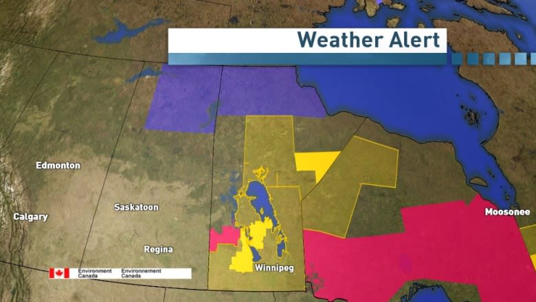
Environment Canada has issued a number of watches and warnings for southern and northern Manitoba.
Severe thunderstorm watch
Virtually all of southern Manitoba, from the Interlake to the U.S. border, including the city of Winnipeg, is under a severe thunderstorm watch.
That watch also includes Thompson, Island Lake and Norway House.
Environment Canada said a cold front will push eastward across southern and central Manitoba and could trigger severe thunderstorms into this evening as it encounters the hot and humid air mass.
The weather agency said large hail and damaging wind gusts are the main threats.
Rainfall warning
Meanwhile, a rainfall warning has been issued for Brochet, Churchill and Tadoule Lake in northern Manitoba.
Heavy rain associated with a slow-moving low pressure system could bring 40 to 60 millimetres of rain, with the possibility thunderstorms may bring even higher amounts in those communities, according to Environment Canada. The rain should start to diminish Sunday afternoon or evening.
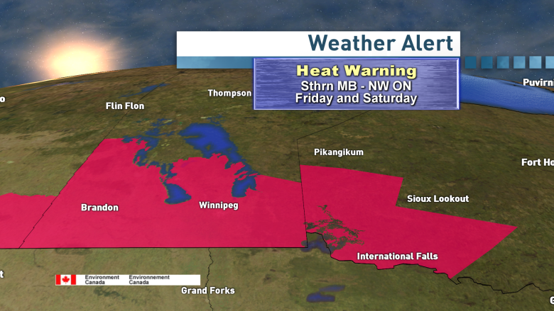
Heat warning continues
On top of those warnings, a heat warning remains in effect for southern Manitoba.
Winnipeg hit CBC meteorologist John Sauder's forecast high of 33 C in Winnipeg on Saturday, with humidity making it feel like 39.
Sauder said the heat will end when a cold front arrives in the Red River Valley on Saturday evening, bringing a line of thunderstorms.
Sunday's forecast high is 24 C in Winnipeg.
