
Severe weather, including tornadoes, could hit the Midlands. Here’s when it’s expected
Severe weather is predicted to hit the Columbia area as storms are in the forecast for multiple days.
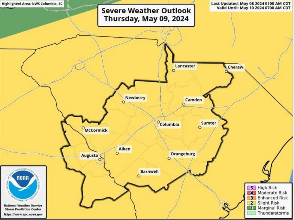
Effects from the storms are expected to begin Wednesday and could continue to be a threat through Friday, according to the National Weather Service.
Multiple rounds of severe storms could include damaging winds, hail, and even an isolated tornado, National Weather Service meteorologists said Wednesday morning in a severe weather briefing. Flooding is also possible in urban areas and near small streams, the National Weather Service said.
The timing for when the storms could hit the region is varied. The northern portion of the Midlands is expected to feel the greatest impact Wednesday afternoon through Thursday morning, while the central and southern areas of the Midlands will be at greatest risk on Thursday and through that night, according to the briefing.
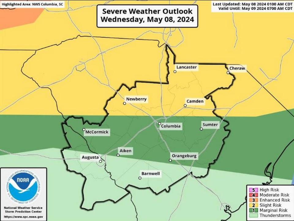
Both Richland and Lexington counties, and all of the Midlands, are included in the area where a hazardous weather outlook was issued, the National Weather Service said
Winds with powerful 60-70 mph gusts are possible, according to the briefing.
In addition to the dangerous winds, strong to severe thunderstorms on Wednesday might also produce hail, the National Weather Service said.
More damaging winds, large hail and even a brief tornado is more likely on Thursday and Thursday night, according to National Weather Service.
Those same severe weather effects remain a threat on Friday into the early afternoon, according to the briefing.
Powerful winds and tornadoes could cause considerable damage to trees and branches, in addition to mobile homes, roofs and outbuildings. Vehicles would also be under siege in the case of a tornado.
Damage to trees and branches creates the possibility of downed power lines and outages.
As of Wednesday morning, no warnings or watches have been issued. That could change as storms move closer.
Rain is also included in the forecast.
More than an inch of rain could accumulate through Friday in Columbia, the forecast shows. Localized amounts in other areas of the Midlands could be higher, especially in the case of thunderstorms.
Conditions are expected to clear over the weekend, with no rain in the forecast and temperatures reaching highs around 80 on Saturday and Sunday.

