
Tornado warnings issued in northwestern Ontario amid severe storms
Favourable conditions for twister development in Manitoba and northwestern Ontario Wednesday evening have prompted tornado watches and warnings from Environment and Climate Change Canada (ECCC).
Current tornado warnings (northwestern Ontario)
Red Lake - Woodland Caribou Park

Expired tornado warnings (Manitoba)
Falcon Lake and West Hawk Lake
Shoal Lake Reserves
L.G. Of Pinawa incl. Seven Sisters Falls
R.M. Of Lac Du Bonnet
R.M. Of Reynolds incl. Ste. Rita Hadashville and Rennie
R.M. Of Whitemouth incl. Elma
Bloodvein
Mun. Of Bifrost-Riverton incl. Arborg Hnausa and Hecla.
R.M. Of Brokenhead incl. Beausejour and Garson
R.M. Of Springfield incl. Anola and Birds Hill Prov. Park
Jackhead Res.
Moose Creek Prov. Forest Pine Dock and Matheson Island
R.M. Of St. Clements incl. Grand Beach Brokenhead and Libau
R.M. Of East St. Paul incl. Birds Hill
R.M. Of Grahamdale incl. Gypsumville Moosehorn and Camper
R.M. Of St. Andrews incl. Selkirk Lockport and Ponemah
Grand Rapids and Easterville
Peguis Res.
Fisher River Res.
R.M. Of West St. Paul incl. Middlechurch and Rivercrest
R.M. Of Rockwood incl. Teulon Stonewall and Stony Mountain
R.M. Of Rosser incl. Meadows
9:38 PM CDT: Severe thunderstorms have prompted tornado warnings in northwestern Ontario Wednesday night as the storms leave Manitoba.
Golf ball to baseball size hail has been reported with these thunderstorms as they moved through Manitoba.
"This is a dangerous and potentially life-threatening situation. Take cover immediately, if threatening weather approaches," ECCC said in its warning.
The agency added: "Go indoors to a room on the lowest floor, away from outside walls and windows, such as a basement, bathroom, stairwell or interior closet. Leave mobile homes, vehicles, tents, trailers and other temporary or free-standing shelter, and move to a strong building if you can. As a last resort, lie in a low spot and protect your head from flying debris.”
For more information on the threat for severe thunderstorms in Manitoba and northwestern Ontario Wednesday evening and overnight, see the full forecast below.
Wednesday
Areas: Saskatchewan, Manitoba and northwestern Ontario
Timing: Evening and overnight
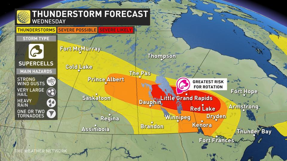
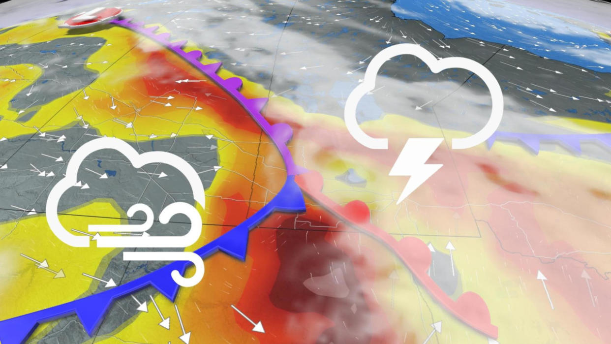
Weather: The low in the Prairies continues to move east, bringing the risk of severe weather to Manitoba and northwestern Ontario, with some lingering impacts still in Saskatchewan.
The greatest threats with today's storms will be strong wind gusts, large hail, and a small threat of tornadoes. The region where severe storms will be more widespread will be in Manitoba's Interlake region and into northwestern Ontario.
RELATED: Four simultaneous heat domes break major records across the globe
Due to the later timing of these thunderstorms, they may be strong enough to persist into the overnight hours. Nocturnal thunderstorms present their own risks because they are difficult to see coming in the dark.
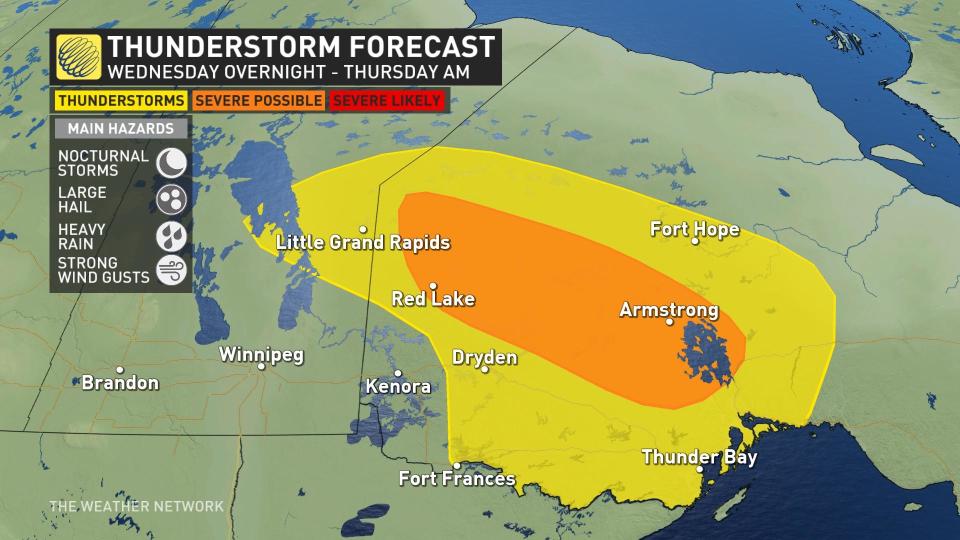
If you are at the cabin or camping in northwestern Ontario, be sure to charge your electronics and keep your phone on to stay updated with the ever-changing weather alerts.
Stay with The Weather Network for the latest on conditions across the Prairies

