
A short-lived warm spell for Alberta, but don’t get too used to it

Alberta has had anything but a traditional winter this season.
A lack of snowfall and a lack of cold seems to check off every box on the El Niño checklist.
RELATED: Alberta government declares ‘early start’ to wildfire season
The good news is this warmth you have been experiencing in recent weeks will continue for the time being, at least in the short range, anyway. But, don't get too excited. Just enjoy it while you can because there will be a pattern change soon enough.
What Alberta can expect in the short term
Temperatures will get a boost over the next few days with the influence of the jet stream ushering in warm, downsloping winds. Albertans are no stranger to the winter weather phenomenon, and while it it is here, this is what you can expect.

Thursday will see temperatures in the mid- to upper-single digits, which will be anywhere from four to 10 degrees above normal.
Friday will features the warmest air of the week, with many in northern Alberta expected to soar to more than 10°C above the normal temperature.
DON’T MISS: Canadians went on a vacation this winter and didn’t even know it
As warm as it may seem for this time of the year, it will not be a record-breaking air mass. Calgary has seen a February temperature that has exceeded 22°C, occurring on Feb. 27, 1992.

There will be an abundance of sunshine to accompany this warm weather, giving you a perfect combination if you are skiing in the Rockies or even just out for a nice stroll. Enjoy this pattern while it is here as it really does not lock in. Expect another blast of arctic air to close out the month of February.
When Alberta will see winter return
The jet stream will take a dive to the south, with bitter temperatures for British Columbia first before spreading into Alberta. These temperatures will be nearly 25 degrees colder than the weather we will get this week.
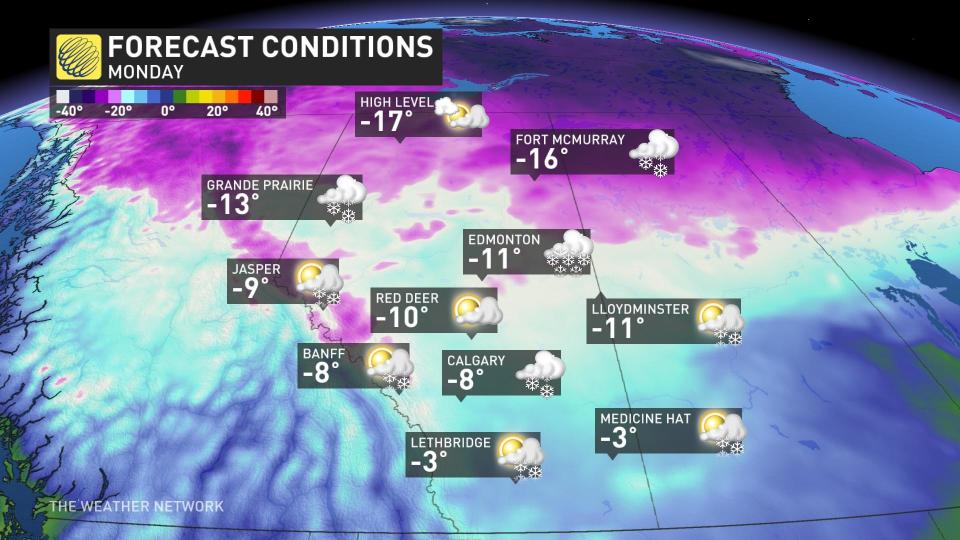
Those forecast temperatures seen above are the daytime highs, before the wind chill is factored in. A reminder that winter patterns can turn bitter very quickly and to keep the jacket at the ready.
However, with the cold means there could be some beneficial news for skiers and snowboarders alike. The cold air, coupled with some Pacific moisture, will bring in some substantial snowfall if model predictions hold true.
The Rockies will see the snow sometime next week, something desperately needed for many resorts after a challenging season.

Stay with The Weather Network for all the latest on conditions across Alberta.

