
Weather whiplash expected in Quebec following a spring tease
Brace yourself, Quebec, Wednesday is going to be an even wilder ride than Tuesday.
A potent low-pressure system that brought rare February thunderstorms and hail to parts of Ontario began to make its presence felt in Quebec Tuesday, with scattered rain, thunderstorms, record warmth and flurries. Roads became slippery during that time, so people should prepare for more travelling impacts on Wednesday with additional precipitation and a possible flash freeze.
DON’T MISS: Earth just experienced its hottest 12 months in recorded history
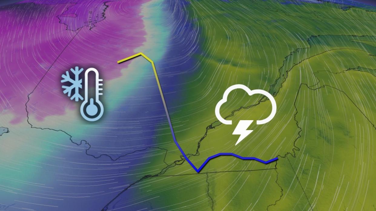
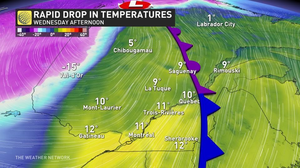
Wednesday will see the effects ram up, as we could see a 10- to 15-degree drop in some locales in mere hours –– freezing pooling water on the roadways, so travelling will be hazardous.
As well, with the strong winds, also comes a chance of localized power outages, so make sure the devices are charged as conditions begin to deteriorate.
New records set Tuesday
Just like what Ontario experienced, Tuesday saw thunderstorms infiltrate western Quebec, alongside mild temperatures.
In fact, Mont-Tremblant and St-Anicet set new, all-time February temperature records.

Mont-Tremblant reached a high of 15.3°C, beating out its previous record of 11.8°C from 2000. St. Anicet hit an astounding 19.4°C on Tuesday, surpassing its old record of 17.0°C from 2017.
Wednesday into Thursday:
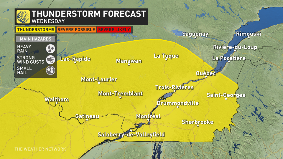
Multiple rounds of showers and even some embedded thunderstorms are possible for southern Quebec through Wednesday morning, with another round taking aim for the afternoon and evening, as well.
Widespread wind gusts will pick up Wednesday evening, as an arctic air mass takes over. Strong gusts between 60-80+ km/h can be expected.
As the winds pick up, a quick transition to accumulating snow, and snow squalls is likely for western Quebec, with more widespread snow expected across the east. Visibility will be greatly reduced amid the howling winds.
Drivers will face yet another dangerous threat as temperatures drop, and the risk for a flash freeze spans the province later Wednesday, and into Thursday.

Temperatures in Mont Laurier and Gatineau will drop down 10-15°C in just a three- to four-hour period Wednesday afternoon and evening, then occurring in Montreal in the overnight period.
With the milder temperatures, rain and snowmelt, it will cause icy conditions across the province as the colder temperatures will quickly freeze everything.
The good news is there will be warmer weather by the weekend. An extended stretch of exceptionally mild temperatures will return to southern Quebec by Saturday. Temperatures will soar well above seasonal through this weekend and early next week, with high temperatures more typical of late April and possibly even early May –– reaching the mid- to upper-teens in many places, while a few spots could reach 20°C early on.
Stay tuned to The Weather Network for the latest forecast updates for Quebec.

