
Storm system Saturday p.m. update: Get ready for 24 hours of rain and wind across NC
A low-pressure system moving up the East Coast this weekend could bring record rainfall to parts of North Carolina on Sunday from the foothills to the beaches.
That deluge we had last Sunday, when 1 to 2 inches of rain landed in people’s gauges?
“We’ll be getting more this Sunday,” said Chrissy Anderson, a National Weather Service meteorologist in the Raleigh office.
How much rain is coming?
The forecast for heavy rain, updated Saturday afternoon, reaches from Hickory to the coast, including in and around Raleigh, Anderson said. Rainfall amounts are expected to total 2 to 4 inches, with higher amounts possible in some areas. In particular, the southeastern section of the state could see higher amounts – east of Interstate 95 and south of Interstate 40.
Rainfall records for Dec. 17 in North Carolina range from 1.3 inches to 1.6 inches, Anderson said, “So we will probably break some daily rainfall records.”
Creeks and rivers will rise and low-lying areas likely will flood, Anderson said. The National Weather Service also warned of the potential for flooding in urban and poor drainage areas.
What about wind?
Wind gusts of 25 mph to 35 mph can be expected as the system moves through, Anderson said, which can be enough to drop tree limbs on power lines and cause outages.
Forecasters also say there could be some local thunderstorms.
What’s bringing all this rain?
The system on its way originated in the Gulf of Mexico and will move into Florida before heading north. It’s expected to travel all the way to the northeast into next week.
When will the storm and rain get here?
Rain likely will begin in the southern part of the state late Saturday night, Anderson said, and move across the rest of the state through the day Sunday.
In Raleigh, rain is expected to begin after 5 a.m. Sunday and continue through the day, bringing 1 to 2 inches of rainfall. Rain is expected to continue through the night, with more showers going into the wee hours of Monday morning. Another 1 and 2 inches of new precipitation are possible.
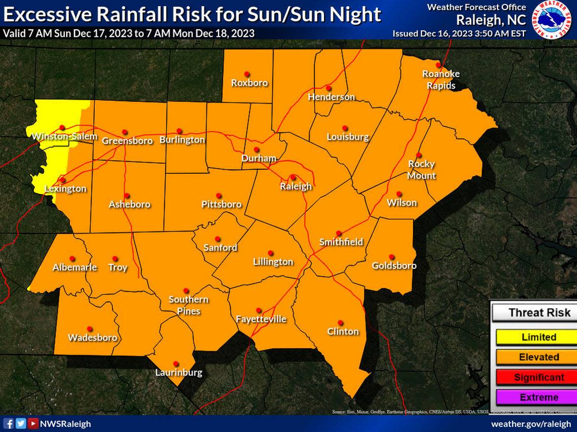
According to the National Weather Service, the Triangle and much of Central and Eastern North Carolina are also at an elevated risk for severe thunderstorms between 7 a.m. Sunday and 7 a.m. Monday.
The system should move out of North Carolina Monday morning, but a slight chance of rain remains through the day.
It is supposed to be breezy Monday ahead of a high-pressure system that will move in from the northwest, Anderson said, bringing clear skies and cold air. In Raleigh, the high will be 57 degrees on Monday but on Tuesday and Wednesday, the high is expected to be only in the 40s.
Any advice from the National Weather Service?
▪ Pay attention to watches and warnings.
▪ “Turn around; don’t drown.” Don’t drive through standing water, and be especially careful at night when it’s more difficult to see water on the pavement.
▪ Don’t drive around barricades where streets have been closed.
▪ And, from Anderson: “Definitely get your Christmas shopping done on Saturday.”

