
Hurricane Lee keeps getting wider, expanding the zone that could feel its winds and waves
Coastal New England was blanketed by hurricane, tropical storm and storm surge watches on Thursday ahead of a potential landfall from Hurricane Lee this weekend.
The storm, which dropped to a Category 1 on Thursday, was heading north after a forecasted turn and already picking up the pace. The storm’s wind field exploded over recent days, upping the chances that Lee’s waves and winds could affect even more spots along its path.
While Florida and the northern Caribbean started feeling Lee’s rough surf and rip currents earlier this week, the effects will spread north up the U.S. East Coast through the week as Lee moves north.
Forecasters said Lee could scrape Bermuda on Thursday even as it remained hundreds of miles offshore. The island was under a tropical storm warning.
As Hurricane #Lee passes well to the east of South Florida, light northerly winds & abundant moisture will continue to persist across our area today.
Scattered storms will be possible this afternoon with the best️coverage over inland east coast suburbs and Miami-Dade County. pic.twitter.com/QWFgznIe7B— NWS Miami (@NWSMiami) September 14, 2023
On Friday, Lee’s outermost winds and waves could reach New England, from Rhode Island to Maine. Cape Cod Bay and Nantucket, in Massachusetts, remained under a storm surge watch. A hurricane watch was issued for down-east Maine to the U.S. Canada border, where the latest forecast suggests Lee could make landfall. Some spots could see two to four feet of storm surge, the hurricane center said Thursday.
By the time Lee reaches the northeast coast, the hurricane center said it may be down to a tropical storm, but with an even larger wind field. Its forecast track takes it north into cooler waters, patches of drier air and more wind shear, which can topple storms.
“It can’t be stressed enough, that regardless of Lee’s designation, it will remain a large and dangerous cyclone while it approaches eastern New England and Atlantic Canada,” forecasters wrote Thursday morning.

As of the 11 a.m. Thursday update, Lee was about 245 miles west-southwest of Bermuda and had 90 mph maximum sustained winds — a Category 1 storm. It was headed north at 14 mph and had hurricane-force winds that expanded about 90 miles from its center. Its tropical storm-force winds expanded out about 310 miles from its center.
READ MORE: Hurricane Lee’s waves and a cold front approach Florida. What it means for our weather
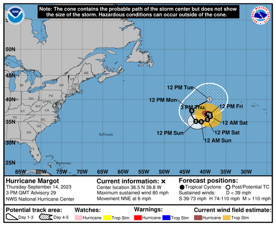
Hurricane Margot and a disturbance
The hurricane center is also keeping an eye on two other systems in the Atlantic — Hurricane Margot and a disturbance with a good shot at developing by the weekend. Neither poses an imminent threat to land.
As of 11 a.m. Thursday, Hurricane Margot was a Category 1 storm with 80 mph winds, moving north-northeast at 6 mph. It’s forecast to whirl around in the middle Atlantic far from land. The latest track calls for Margot to complete a full loop as it inches north, into colder waters that could cool the system down into a tropical storm by this weekend.
Forecasters are also tracking a disturbance in the far east Atlantic, a broad area of low pressure. The hurricane center pegged its chances of strengthening into a tropical depression at 90% in the next week or within the next two days.
The next storm name on the list is Nigel.


