
Taming the American River means losing some trees. We caused this by living here | Opinion
Since the founding of Sacramento, residents have treasured the beauty of the American River while living in fear of its destructive power.
Were the American to defy its man-made banks in a series of historic storms, hundreds of thousands of residents would face a flood disaster modern-day Sacramento has never seen.
Opinion
The more we try to tame the river — as when the Folsom Dam was constructed in 1955 to deny the river its floodplain — the more we disfigure it. This ugly trade-off has marked the passage of time in Sacramento and is as central to the essence of this community as the state Capitol or the Tower Bridge.
A proposal to shore up some erosion spots along the lower American River is the most recent flashpoint in the trade-off between public safety and nature.
The Army Corps of Engineers is currently leading a series of river projects in Campus Commons and River Park. In the next phase, upstream of Sacramento State, the Corps proposes removing about 600 trees and fortifying locations above Watt and Howe avenues with tons of rock and earth.
The scale and size of this work is being resisted by some local residents who treasure the river parkway’s extraordinary beauty.
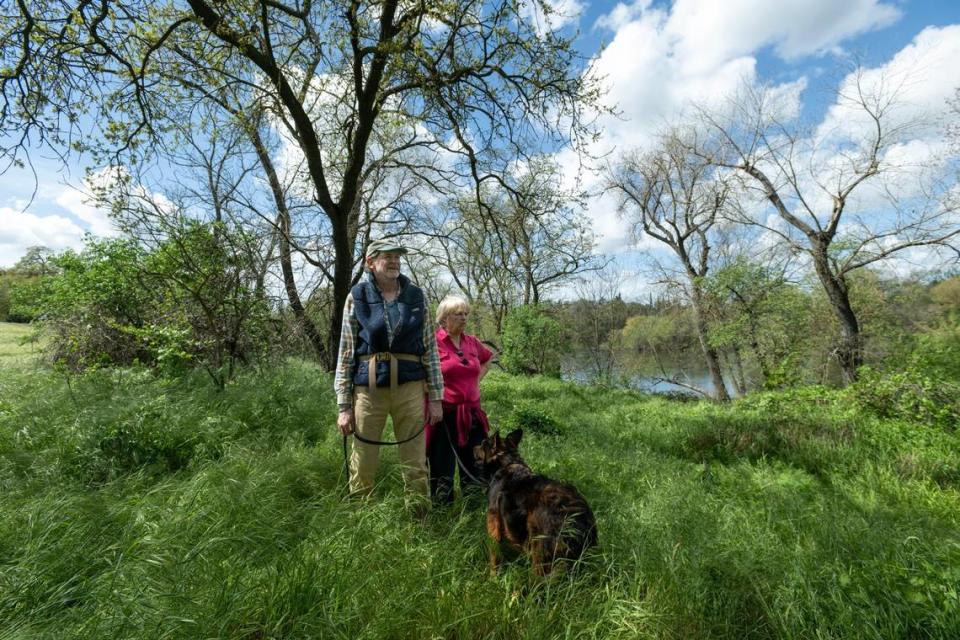
“We don’t see the need for this level of destruction they got planned,” said William Avery, a retired Sac State biology professor who lives near the river at Larchmont Park.
In one sense, Avery is not wrong.
Near River Park and Campus Commons (where the levee failed back in a historic 1950 storm), work done by the Corps has left the area resembling a barren landscape. The Corps says this is not how all the erosion work will look above Howe Avenue. In one stretch east of Watt Avenue, for example, the new rock will be placed under an existing parking lot, to be repaved as if nothing ever happened once the construction is over.
William Polk, project manager for the Corps, is convinced that the sites it has chosen for work “are still at high risk for erosion.” Here, the levees remain at risk because the flanks aren’t strong enough to handle the forces of flood.
I fear the incredibly destructive force of a river carrying more water than any of us have ever seen, save those few who remember the flood of 1950. In this era of climate change and more dramatic swings in weather, water managers have to simultaneously plan for more intense drought and floods. We must prepare for this river to carry 40% more water in a flood than it can safely handle today.
The Corps has no choice but to prepare for some truly terrifying weather scenarios.
“We’ve got to make sure that we get something that is going to handle the potential for these high velocities occurring,” said Corps consultant Brian Boardman.
The Corps’ flood control weapon of choice is rock — and a lot of it — plus earth to promote a new tree canopy over many years.
Where the project is lacking is in comprehensive outreach. The Corps hasn’t talked to Avery and other concerned neighbors. Nor can the Corps say how many large heritage oaks will be removed, an imprecision that doesn’t inspire confidence among skeptics.
The army’s draft environmental document detailing these projects, while technically in English, satisfies narrow legal requirements but is far from digestible public information. The analysis “is organized and presented in such a way that it is nearly impossible for all but the most experienced reviewers to navigate and understand,” wrote Sacramento County Parks Director Liz Bellas, who is calling for a stop to the proposed work east of Howe Avenue pending more review and public engagement.
Ideally, the Corps and Sacramento’s savvy flood protection community would have anticipated community concerns months ago and gotten ahead of things to give concerned residents like Avery every possible answer and reason why there is no choice other than to prepare for bigger floods.
One of the most terrifying moments in my 33 years here came at the onset of 1997: The Folsom Dam was making maximum releases of 115,000 cubic feet per second. As I stood near the Arden Bridge with my family and watched the river, there was nothing beautiful about the parkway that day. The river sounded like a freeway, and it was one — its water barreling downriver toward the Sacramento at tremendous speed and force.
It’s hard to imagine 40% more water in the river than I saw back then in 1997. But that’s exactly what the new flood protection system can accomplish once all the work is done. It is only a matter of time until the American River watershed becomes the bull’s-eye of a series of atmospheric rivers, like what happened in that year and in 1986 and 1950.
In this beautiful start to spring, everything seems so peaceful. But we can’t ignore the fact that we’re due for a big storm.
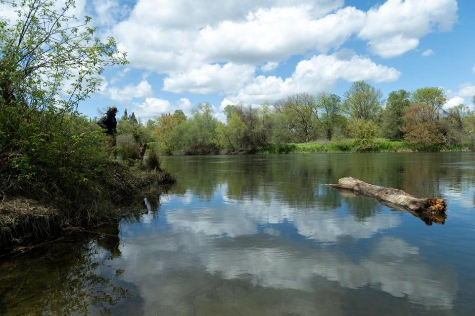
Near Avery’s home, close to Larchmont Park, the levees have always held. Skinny dirt trails through tall grass lead to the river’s edge in places named by the neighbors, such as Pirate’s Cove and Bill Griffith’s Put-In, named after the late, legendary local kayaker. The roots of tall alders hold the bank in place.
Avery doesn’t want to lose his river. He doesn’t want lines of rock, even if buried and revegetated, as the solution.
“We would like to retain the riparian forest,” he said.
Hopefully, more outreach is on the way. But in the end, the Corps is not to blame here. We all are. Our collective foothold in Sacramento has created this imperative for public safety to be paramount on this stretch of river. The American is as beautiful as it is dangerous.

