
What’s the timeline for Northern California blizzard and rain? Here’s latest forecast, totals
Hurricane-level gales and steady snowfalls rocked the Sierra Nevada Mountains on Thursday but marked only the beginning of a blizzard that potentially could shatter weather records and send avalanches gushing through backcountry this weekend.
The highest points on Interstate 80 and Highway 50 — Donner Pass and Echo Summit, respectively — measured about one to two feet of snow overnight with gusts upward of 50 mph, said Craig Shoemaker, a meteorologist with the National Weather Service in Sacramento.
Treacherous gusts could snap trees and damage power lines. The heaviest snowfall is expected on Saturday, the weather service said.
“That’s what makes (the blizzard) so bad, because it’s lasting so long,” Shoemaker said. “There’s going to be very little break in the snow.”
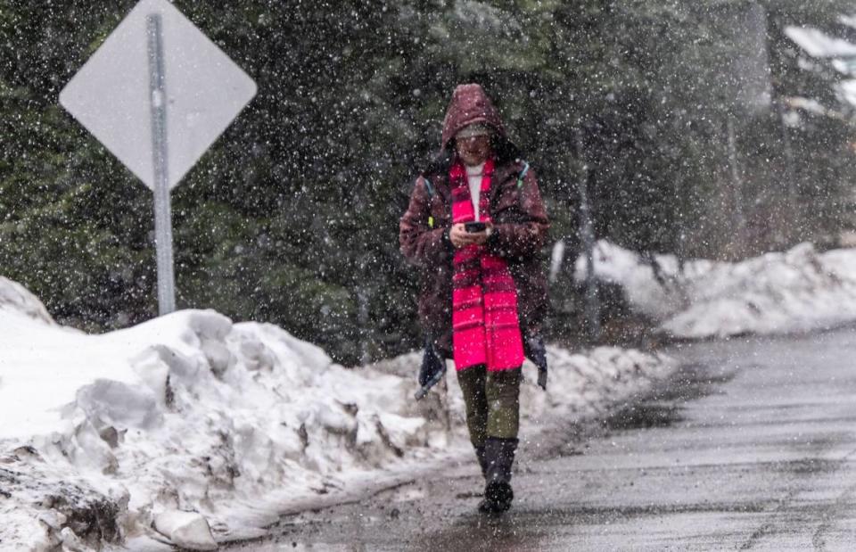
Mountain communities on Friday appeared ready to hunker down for the weekend after prepping for the storm on Wednesday and Thursday. Even for foothill areas closer to Sacramento, many weren’t taking chances.
“Now heads up, we’re expecting storms,” Murriel Oles said as she stood Friday before election aides in her training session in Rocklin.
She told the Placer County poll workers that voters might stay home because of the inclement weather. But, she told volunteers, as the workers set up polling places over the weekend and on Election Day, they needed to keep an eye out for the storm — and they might have to bring outdoor signs inside.
Oles singled out a large, lightweight rectangular sign with clear plastic pockets for 15 pages of election information.
Be careful putting this one together, she warned them, or else “you may find yourself parasailing over Placer County.”
Power outages
Outage data from the state’s largest utilities showed customers steadily losing electricity as the blizzard continued its warpath in the High Sierra.
Just after 5 p.m., there were 6,491 customers in the Sierra counties — Calaveras, El Dorado, Mariposa, Mono, Nevada, Placer, Sierra, Tuolumne and Yuba — interrupted from the grid, the majority powered by Pacific Gas and Electric. The evening uptick in outages accounted for about half of all outages statewide at dinnertime, according to the data, which is compiled by the Governor’s Office of Emergency Services.
In El Dorado County, roughly 2,300 customers of PG&E and Liberty Utilities were in the dark. In Placer, there were 115 homes were without power just before 2:30 p.m.
The strongest jet stream is predicted to unleash over mountain passes Friday night, which could topple the state’s highest recorded wind speed of 199 mph, measured in 2017 on Ward Peak, just west of Tahoe, said Colin McCarthy, a popular stormchaser on social media who is a student at UC Davis.
How long will the storm last?
According to the weather service, the winter storm will continue into Monday.
Blizzard conditions are expected in areas above 2000 ft this afternoon through Saturday. It is EXTREMELY dangerous to travel through the mountains at this time! AVOID travel! Stay up to date with the forecast at https://t.co/7FMe5twj20 by entering your zip code. Stay safe! #CAwx pic.twitter.com/ANf1qmEmBe
— NWS Sacramento (@NWSSacramento) February 29, 2024
“Blizzard conditions are expected in areas above 2000 ft (Friday) afternoon through Saturday,” the weather service wrote on X, formerly called Twitter.
Sunday and Monday could see moderate conditions.
Here’s the weather service’s timeline:
On Friday, parts of Northern California could see heavy rain, extreme snow and strong winds, reaching up to 60 mph.
Saturday could see moderate to heavy rain and snow with strong gusts over the Sierra.
On Sunday, the weather service predicts moderate impacts with lingering rain and snow showers.
Monday could see mountain snow.
What’s in the forecast for Sacramento?
The weather service has issued a wind advisory in effect until 10 a.m. Saturday for the Southern Sacramento Valley and Northern San Joaquin Valley.
Wind Advisory in effect for the northern and central Sacramento Valley Thursday through Saturday morning. Strong southerly wind gusts up to 50 mph are expected. Be prepared for difficult driving conditions, localized power outages, & downed tree branches & weakened trees. #cawx pic.twitter.com/0o1FwSvu4k
— NWS Sacramento (@NWSSacramento) February 28, 2024
This includes the cities of Sacramento, Fairfield, Suisun, Stockton, Modesto, Grass Valley and Jackson.
Gusts are expected to range from 20 to 50 mph.
“Gusty winds could blow around unsecured objects,” the advisory stated. “Tree limbs could be blown down and a few power outages may result.”
As the storm courses through Northern California, rain is in the forecast for Sacramento.
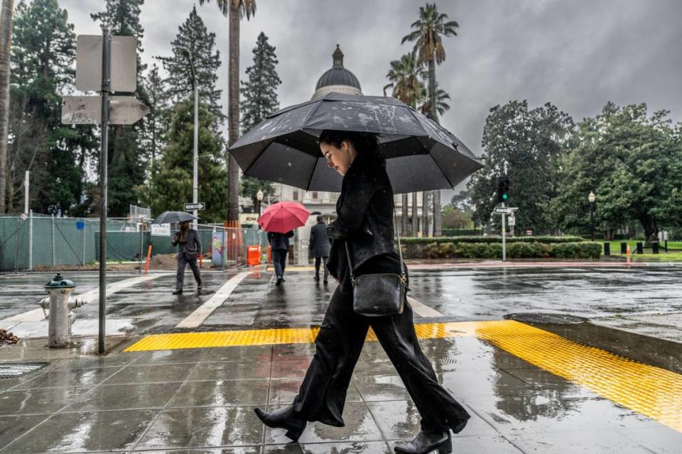
On Friday evening, the forecast shows a 100% chance of precipitation and possible thunderstorms. About half an inch of rainfall is possible. Gusts could reach 40 mph. The low will be around 44 degrees.
Saturday’s forecast shows an 80% chance of precipitation with gusts ranging from 11 to 32 mph. Thunderstorms are possible, and about a quarter of an inch of rain or more is expected. Temperatures show a high near 52 degrees and a low around 40.
Sunday will see partly cloudy skies with a 40% chance of precipitation. Winds could reach up to 18 mph. The high will be near 54 degrees and the low will be around 38.
Monday — the last expected day of the storm — will see a slight chance of showers but mostly sunny skies. Temperatures see a high near 56 degrees and a low around 42.
How much rain has fallen in Sacramento so far?
Sacramento saw little impact from the rain on Thursday night, Shoemaker said.
He added Sacramento’s downtown measured about 0.18 inches of rain and the Executive Airport experienced 0.2 inches of rain over 24 hours.
From Friday until Sunday, the capital city is predicted to get about 1 inch of precipitation. Wind gusts are expected to peak Friday at 40 mph, as gales decrease about 10 mph each day through the weekend, Shoemaker said.
But area residents driving east will see heavier rainfall — Folsom experienced about 0.35 to 0.5 inches of rain with Roseville and Auburn experiencing similar totals, he said.
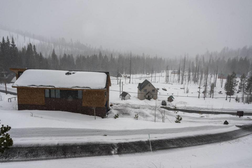
How much snow has fallen in Tahoe so far?
In the past 24 hours, the UC Berkeley Central Sierra Snow Laboratory — located at Donner Pass near — reported approximately 19 inches of snowfall.
“Snowpack at the lab is now 102% of median to date,” the Central Sierra laboratory wrote on X.
We have received 19.1" (48.5 cm) of #snow in the last day. Snowpack at the lab is now 102% of median to date.
Conditions have already deteriorated this morning with gusty winds and significantly reduced visibility. The next 24 hours will be the heaviest portion of the storm. pic.twitter.com/B9BiHMH216— UC Berkeley Central Sierra Snow Lab (@UCB_CSSL) March 1, 2024
Overall, the laboratory reported a total of about 21 inches of new snow within the past seven days.
“The next 24 hours will be the heaviest portion of the storm,” the lab wrote.
As of Friday, here’s how much snow has fallen at ski and snowboarding resorts in Tahoe so far this season, according to their websites:
Sugar Bowl Ski Resort: 220 to 286 inches
Kirkwood Mountain Resort: 241 inches
Heavenly Mountain Resort: 147 inches
Palisades Tahoe: 242 inches
Mt. Rose Ski Tahoe: 180 to 240 inches
Northstar California Resort: 212 inches
“12” on the upper mountain, 11” at the Alpine base, and 9” in the Palisades base as of 5am,” Palisades Tahoe wrote on X.
“It is still snowing everywhere and tonight’s conditions are expected to be intense.”
12” on the upper mountain, 11” at the Alpine base, and 9” in the Palisades base as of 5am. It is still snowing everywhere and tonight’s conditions are expected to be intense. pic.twitter.com/9zLiK7rDY1
— Palisades Tahoe (@palisadestahoe) March 1, 2024
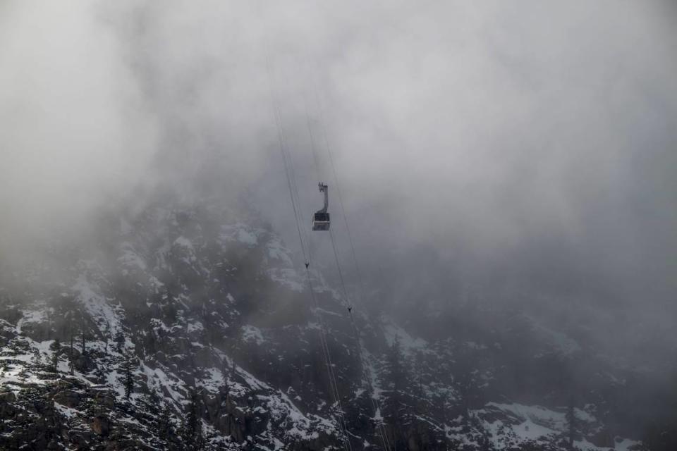
What’s in the forecast for Tahoe?
A blizzard warning is in effect for the greater Lake Tahoe region through 10 a.m. Sunday.
This includes the cities of Stateline, Markleeville, Incline Village, Tahoe City, Glenbrook, Truckee, and South Lake Tahoe
A Blizzard Warning is in effect for areas above 2000 ft today-Sunday. Conditions will begin to deteriorate quickly in the mountains this afternoon, with high winds and heavy snow causing white out conditions at times. Travel is HIGHLY discouraged!! #CAwx pic.twitter.com/3dC8ZO9W7o
— NWS Sacramento (@NWSSacramento) February 29, 2024
“A Blizzard Warning means severe winter weather conditions are expected or occurring,” the advisory says. “Falling and blowing snow with strong winds are likely.”
Whiteout conditions and power outages are possible, and travel conditions could be dangerous.
Between 2 and 5 feet of snow are expected for communities around the lake with gusts around 60 mph; snow levels above 7,000 feet elevation could reach 4 to 8 feet with gusts at around 110 mph.
The forecast for the greater Lake Tahoe area shows cloudy skies, snow and gusty winds.
On Friday, the evening forecast shows heavy, blowing snow. Up to 34 inches of new snow is expected for areas above 7,000 feet. Gusts could range from 25 to 55 mph in the slopes, and can sweep at speeds up to 140 mph in the ridges. The lowest temperatures will be between 16 and 26 degrees.
Saturday will also see heavy, blowing snow with up to 20 inches in accumulation possible in areas above 7,000 feet. Winds could gust at speeds of 15 to 50 mph on mountain slopes and up to 125 mph on the ridges. The high will be around 35 degrees and the low near 13.
Snow is likely on Sunday with gusts continuing to sweep through the region at speeds ranging from 15 to 40 mph in the slopes. Ridge gusts could reach up to 90 mph. Temperatures will reach a high near 34 degrees and a low around 9.
On Monday, the forecast shows mostly cloudy skies with a chance of snow. The high will be near 40 degrees and the low around 11.
Avalanche warning for Tahoe’s backcountry
The Sierra Avalanche Center in Truckee has issued a backcountry avalanche warning in effect until 5 p.m. Sunday for the Sierra Nevada, including the greater Lake Tahoe area.
HIGH to EXTREME avalanche danger is expected in the backcountry through 5 PM Sunday for the Central Sierra slopes between Yuba Pass and Ebbetts Pass, including the Greater Lake Tahoe area. More info at: https://t.co/ilp7hXfgCr#Nvwx #CAwx pic.twitter.com/c5nIj5ivU4
— NWS Reno (@NWSReno) March 1, 2024
The center’s daily forecast, which ranks avalanche risks on a scale of 1 to 5, shows Friday’s avalanche danger is at a 4, or “high,” in the backcountry areas of the Sierra.
“High intensity snowfall combined with gale force winds has created dangerous avalanche conditions in the backcountry,” the forecast says. “Natural avalanches are expected in the backcountry as these conditions further intensify today and tonight.”
Yosemite closed through weekend
The storm has forced the closure of Yosemite, National Park rangers said Thursday. The closure remains in effect through noon Sunday, rangers said.
“Visitors currently in the park should leave as soon as possible, and no later than noon tomorrow, March 1,” the park service said on social media.
How’s the Sierra Nevada snowpack?
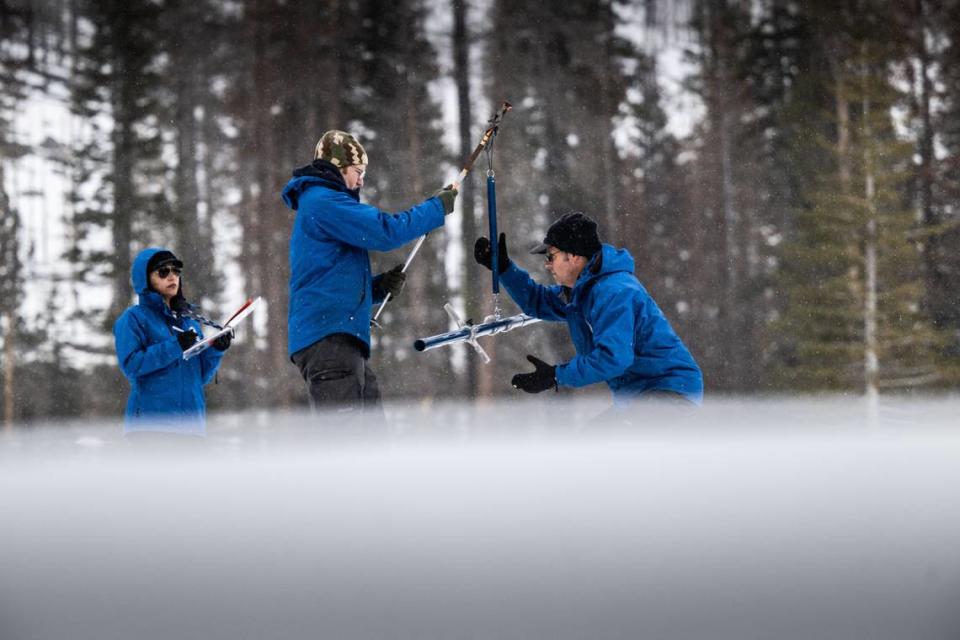
New snow survey results from the California Department of Water Resources show an improvement for the Sierra Nevada snowpack.
According to a news release from the department, results from the survey measured the snow depth at around 48 inches. The snow water equivalent — a key component of the department’s water supply forecast — was at 18 inches.
“While we are in a much better position today than we were a month or two ago, the snowpack is only at 70% of average for the April 1 peak,” Angelique Fabbiani-Leon, a hydrometerologist with the department, said to reporters at Phillips Station on Thursday morning.
The current storm could help with the snowpack, she said. However, several additional storms will be necessary to get the Sierra Nevada snowpack to 100% of average by April 1.
Residents are ready to embrace the storm
Highway 50 mountain community residents, armed with the experience of storms in years past that buried their homes with snow, said they were prepared for the blizzard.
It’s commonplace to stock up on food, generators and wood to keep warm this time of year. It’s people who are unprepared who may encounter difficulties — area resident Scott O’Neill said he’s seen motorists who don’t have equipment such as snow chains and walk around in dangerous temperatures in sandals.
The Strawberry resident — an unincorporated El Dorado County community — said he’s looking forward to taking out his snowmobile and traversing the soft white blanket.
Neighbor Lydia Samaniego agreed — she recalled how peaceful the world becomes when enough snow prompts authorities to close highways, seemingly stopping time.
“It’s beautiful,” she said.
What do you want to know about life in Sacramento? Ask our service journalism team your top-of-mind questions in the module below or email servicejournalists@sacbee.com.
The Fresno Bee contributed to this story.

