
Tornado threat results in power outages and more rainfall across Windsor-Essex region

Dozens of power outages are reported across Windsor-Essex and Chatham-Kent this morning, leaving thousands of homes without electricity.
Despite a Tornado warning put in place late Thursday night, brining high winds and reports of funnel clouds, Environment Canada says there is nothing confirmed as of yet about anything touching down across the region.
Meteorologist Mitch Meredith says while it's possible a tornado touched down in the region, it's still too early to tell.
"We did warn for quite a while, like almost an hour, for a few signatures on radar that were moving quickly through the Detroit River and down into Lake Erie. Um, but we can't confirm," he said.
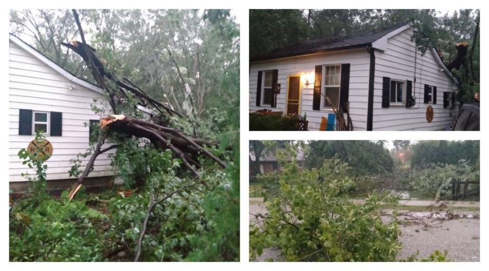
Storm damage is shown around an Elizabeth Street home in Comber, Ont., following an August storm. (Dave Braukis)
According to Meredith, there's been lots of damage report across the area, with downed trees, power outages and poles down but they can't confirm if there was a twister.
"The challenge with this event is it pretty much was at dark and people were, um, kind of staying inside and hiding. So you're not going to get as many photos and videos that we usually do."
Due to "significant storm damage," Hotel Dieu Grace Healthcare Children's Centre walk-in counselling clinic is closed until further notice. In addition to this, all regional children's centre buildings are closed.
When the tornado warning was issued at 10:36 p.m. Thursday, the weather authority said it was tracking severe thunderstorms that were "possibly producing a tornado," with affected areas including Amherstburg, LaSalle, McGregor, Colchester and Harrow.
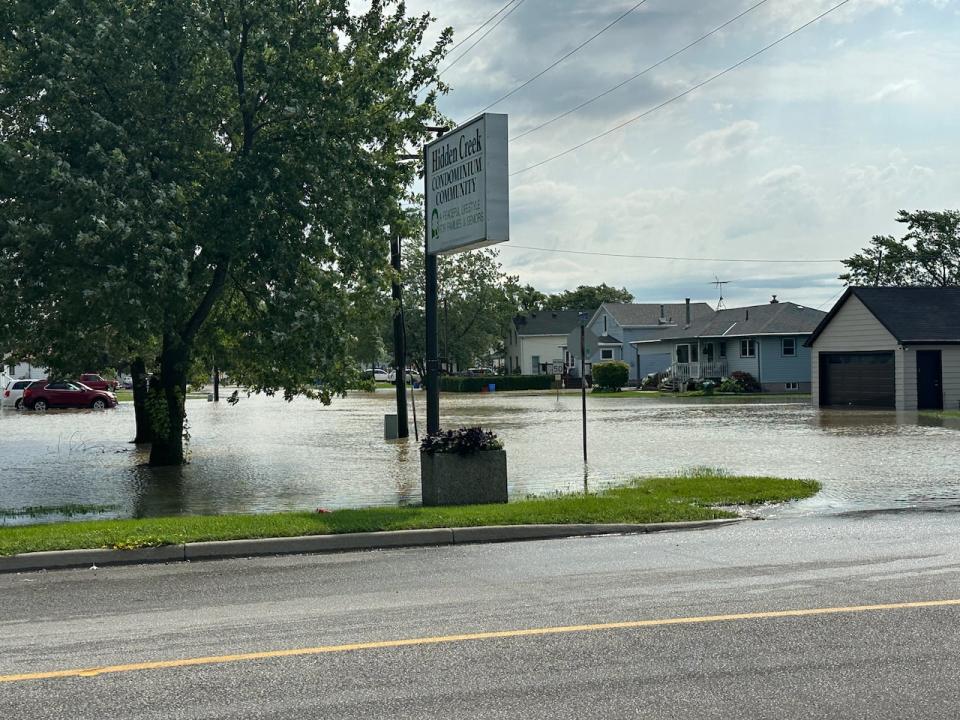
Flooding across Hidden Creek Condominium Community in the town of McGregor, Ont. (Dale Molnar/CBC)
Meredith says there were likely some gusts in excess of 100 km/hour in parts of Windsor-Essex — although Windsor's airport reporting station remains offline since Wednesday night's storm.
Chatham reported wind gusts of 85 km/hour, says Meredith, with reports over 100 km/hour in Michigan.
Calmer and cooler weather is projected going forward, according to the weather agency.
"The big instability in the air mass that featured in the warm front sort of shifted out. There's going to be still a risk of a thunderstorm over the next few days, but it's not going to be any of the large scale storms coming in from the prairies."
There was also additional rainfall reported in parts of Essex County that were hardest hit during the previous rainfall event.
Another 26 millimetres in Harrow, and 66 at Point Pelee.

