
'It's going to be a wild ride': Warning issued ahead of windstorm with up to 100 km/h gusts
Environment Canada has issued a wind warning for Toronto and surrounding regions ahead of a major windstorm predicted for Sunday.
The national weather agency says residents should be on the "lookout for adverse weather conditions" and take necessary safety precautions.
The wind warning comes shortly after Hydro One predicted the windstorm could cause hundreds of outages across southern Ontario.
The provincial utility said it is preparing to respond to any outages that could result from damage to its equipment.
"Hydro One's crews are being moved into position to assess damage and quickly and safely restore power to affected customers," it said in a news release on Saturday.
Blustery weather to begin before noon
Environment Canada, meanwhile, said the blustery weather is expected to begin before Sunday at noon, with "damaging" westerly winds and frequent wind gusts of 70 to 100 km/h.
"It's going to be a wild ride," Peter Kimbell, warning preparedness meteorologist for Environment Canada, told CBC Toronto on Saturday.
The winds will be strong enough to blow shingles off roofs and bring down trees and tree branches. Vehicles on the road will be buffeted by the winds and the weather could even cause traffic accidents, he said.

"People should brace for very strong winds, persisting for a prolonged period of time, their peak being Sunday afternoon and early evening. That's going to combine with a little bit of light snow Sunday night and early in Monday to provide possible blowing snow impacts as well."
Areas near the Great Lakes are forecast to experience the strongest winds. Winds are expected to be strongest in the Niagara Region and Prince Edward County near Lake Ontario.
The very strong winds will gradually ease on Monday.
Between 2 and 5 cm of snow in forecast
Snow in the form of flurries is expected on Sunday afternoon as well, with Toronto forecast to receive between two to five centimetres by Monday morning.
The mix of wind and snow could mean blowing snow.
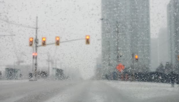
"Any fresh snow that falls will be whipped up by the very strong winds, creating whiteout conditions in blowing snow at times," Environment Canada says.
Travel could be hazardous if visibility is suddenly and significantly reduced, the federal weather agency said.
Between 10 to 20 mm of rain forecast
Environment Canada is predicting between 10 to 20 millimetres of rain will fall between Saturday and Sunday nights.
The rain is expected to start before midnight on Saturday and the heaviest period of rain will be between roughly 3 a.m. and 9 a.m. on Sunday. There is also the risk of a thunderstorm.
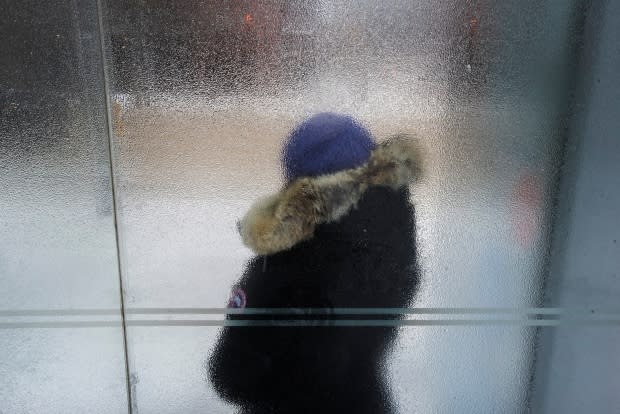
Temperatures, meanwhile, are expected to be above freezing until Sunday afternoon. Saturday's low is expected to be 2 C, Sunday's high is forecast to be 8 C but dropping to 0 C in the afternoon and –7 C at night.
On Monday, the high temperature is forecast to be –6 C, with a low at night of –14 C. The forecast calls for a cloudy day with a 60 per cent chance of flurries.
Surfaces, including sidewalks, are expected to be slippery on Sunday night and Monday morning due to the drop in temperature and subsequent freezing.
Water safety warning
The combination of rain, high winds and warm temperatures has prompted the Toronto and Region Conservation Authority (TRCA) to issue a water safety and shoreline hazard warning that will remain in place until Monday.
According to the warning, residents are urged to "exercise caution" around all bodies of water, including along the Lake Ontario shoreline. Children and pets should be kept away from slippery and unstable banks.
People are also urged to stay away from waterways even if they appear frozen over.
Given the amount of snow on the ground, expected rainfall, increase in temperatures and strong winds, the TRCA said snow is expected to melt over the weekend.

"Due to the total precipitation expected on Saturday and Sunday for the majority of the GTA, along with snowmelt caused by increasing temperatures, and due to the potential for ice breakup, all rivers within the GTA may experience higher flows and water levels, resulting in potential flooding and hazardous conditions," the warning reads.
"Ponding may occur in low-lying areas," it adds.
Ice jams and localized flooding have been noted at the lower Humber River in the area of Old Mill Road in Toronto, the Humber River near Broda Drive in Vaughan. An ice jam has also been reported in Bolton at King Street E. and Old King Road.
Hydro One said having an emergency kit is a good way to prepare for an extended power outage. That kit should include water, cash, a battery-powered flashlight, candles, matches, canned food that won't spoil and a can opener.
