
Hat trick of dynamic storms looms over Ontario’s weekend forecast
Like an energetic infomercial jarring you from a half-conscious slumber, the forecast for Ontario this weekend features a long string of “but wait, there’s more!” as multiple systems take aim at the province through Monday.
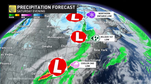
Three different low-pressure systems will affect the province this weekend, complete with a potential for lake-effect snow. The last of these systems is worth watching for its larger-than-normal uncertainty and its potential for hazardous weather across southern Ontario.
SEE ALSO: From blizzards to record warmth: Nunavut experiencing weather turmoil
Round one: Friday - Saturday
First round arrives Friday into Saturday
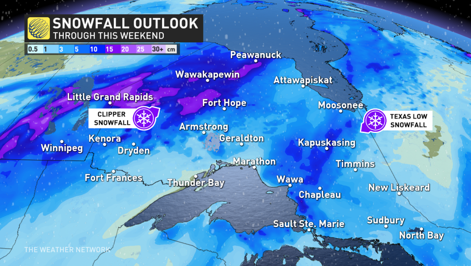
Our first weekend system is an Alberta clipper that’ll track into northern Ontario late Friday into early Saturday. Heavy snow will blanket northwestern Ontario through the beginning of the weekend.
Luckily for travellers, the heaviest snow will remain north of the Trans-Canada Highway, with only a brief period of snow falling over the major thoroughfare.
Folks around Thunder Bay won’t see as much snow as their neighbours, with snow amounts tapering off along Lake Superior’s western shores.
Second round arrives Saturday and lingers to Sunday
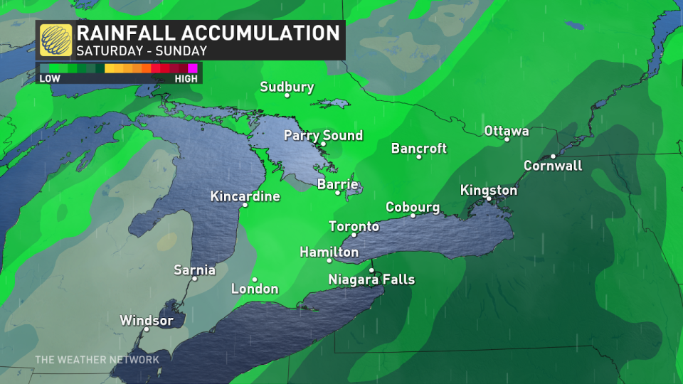
Ontario’s second low-pressure system will migrate north of the border, tracking over the Great Lakes on Saturday with effects spilling over into Sunday.
Forecasters are confident that southerly winds ahead of this system will drag unseasonably mild and moist air across southern Ontario, allowing daytime highs on Saturday to climb into the teens—an uncommon sight for December.
DON'T MISS: Is it safe? How thick does ice need to be to walk or skate on?
Snow will fall to the north of the storm’s track, which looks to keep the wintry weather across northeastern Ontario. Precipitation amounts will remain relatively light with this system, largely due to the influence of the Alberta clipper before it and the next system brewing down the line.
Impactful system likely for Sunday and Monday
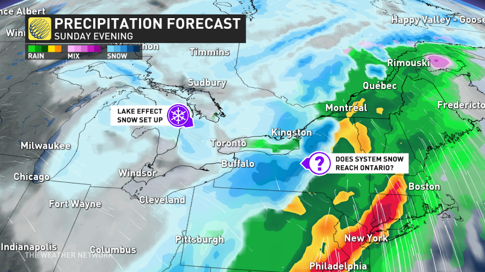
Our third and final system is the one that could be a doozy with significant impacts for some parts of Ontario.
The track of any winter storm is often the keyword that unlocks the storm’s full potential. A slight shift—on the order of a few kilometres in one direction or another—can have dramatic differences for communities that could see warmer temperatures and rain or colder temperatures with accumulating snow.
A low-pressure system is likely to develop over the U.S. Midwest on Sunday and strengthen as it tracks into New England through the day. The precise track of this storm is key to its impacts for folks across Ontario.
The greatest question right now is whether or not the storm’s snowfall will move across Ontario or remain stateside. Model guidance is still struggling with this fine line right now. Areas most at risk for snow from this storm include the Niagara Peninsula and eastern Ontario.
Highlighting the uncertainty: Depending on the timing, the low in northern Ontario could even help nudge this third system farther east, allowing it to miss Ontario altogether.
Continue checking back through the day Friday as forecasters work to nail down the track and eventual impacts of this late-weekend system.
Going somewhere? Check out the current highway conditions before heading out!
Stay with The Weather Network for all the latest on conditions across Ontario.

