
Unlikely upset: Ontario is overheating Las Vegas, Nev., this week
Las Vegas, Nev., is known for its subtropical, desert climate, but parts of Ontario have the upper hand on hotter temperatures this week.
Ontarians have been used to the abnormal, fall heat for several days now, a feat that will be more impressive if it can continue to surpass parts of the U.S. Southwest on Tuesday.
RELATED: How a giant blockade over Canada will shatter October heat records
On Tuesday, southern Ontario will be basking in the high 20s, approaching the 30-degree mark. There is a reasonable chance at least one community will achieve it, a daytime high that's usually reserved for July, not October.

Some models even indicate that Pearson, Buttonville, Tottenham, Ottawa and Pembroke airports could hit 30°C, with eastern Ontario getting close on Wednesday, as well.
If Ottawa hits 30°C Tuesday or Wednesday, it would become the latest 30°C reading in city history. The previous latest was Sept. 27, 2017.
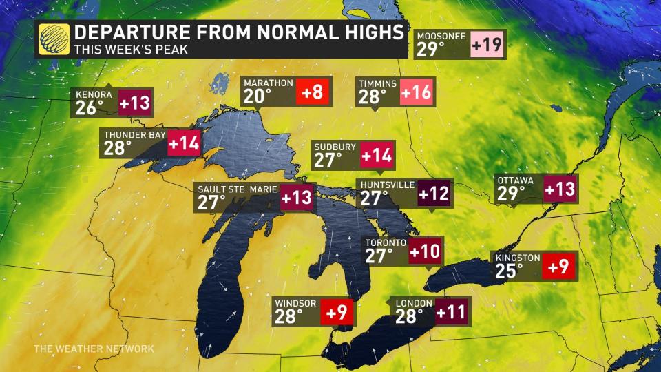
This week's peak highs will come in anywhere from nine to 13 degrees above normal in the region. The difference is even greater the farther north you go. Moosonee, Ont., will be as much as 19 degrees above normal this week.
On Monday, Las Vegas topped out at 23°C, with Toronto more than 4°C warmer. Sunday featured a temperature of 24°C as a daytime high, with Toronto soaring to 26.9°C.
Toronto's Pearson International Airport recorded a reading of 27.3°C on Monday, warmer than 26 days in the month of August. If the airport hits 29.6°C tomorrow, it will be warmer than any day in the month of August this year.
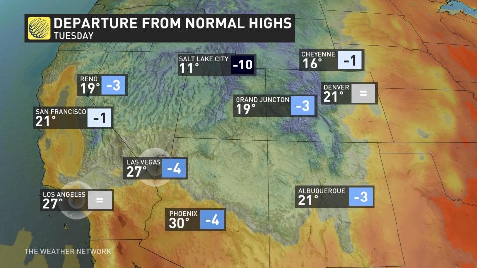
Meanwhile, in the American Southwest, the temperatures will be cooler than normal for the region, albeit still in the upper 20s and possibly at the 30-degree mark for Phoenix, Ariz. Las Vegas is forecast to hit 27°C, which is four degrees below normal, while Albuquerque, N.M., is projected to hit 21°C, a tally that is three degrees off the norm.
So, Ontario communities such as Windsor, Hamilton and Toronto could easily surpass Las Vegas for a third consecutive day and even tie Phoenix.
The surprising news doesn't end there, either.
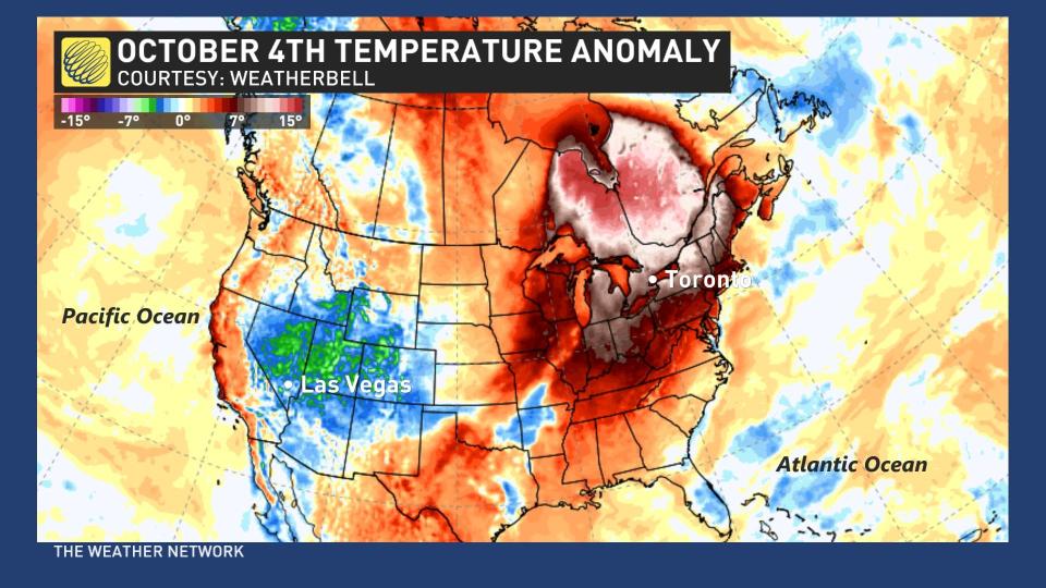
Come Tuesday, Oct. 4, it's quite possible that even Hudson Bay could even be warmer than parts of the southwestern U.S.
Reason for potential record-breaking heat in Ontario
Many communities across Ontario could see their warmest October days ever recorded this week as a large ridge of high pressure builds in the atmosphere high over the Great Lakes region.
Moosonee’s predicted high on Wednesday could shatter the community’s warmest temperature ever recorded in October, which would be an astounding feat after it witnessed its hottest-ever September temperature just a few weeks ago.
The flashback to summer that has been stationed over Ontario is courtesy of an atmospheric blocking pattern known as an Omega block.
Named for its resemblance to the Greek letter, Omega, this kind of blocking pattern sees a ridge of high pressure bookended by troughs on either side, essentially locking the ridge in place for days on end.
It's not just the daytime highs that are remarkable for October.
Toronto’s overnight low on Wednesday could remain at 20°C, which would become the city’s warmest October low -- beating a 19.4°C morning recorded back in October 2002.
Enjoy the heat while you can, Ontario, as temperatures will fall back to Earth in a hurry by the end of the week.
WATCH: Canada's 2023 Fall Forecast: Is a 'super' El Niño possible?
With files from Dennis Mersereau, a digital journalist at The Weather Network.
Follow Nathan Howes on the X platform, formerly known as Twitter.

