
Widespread severe storm threat blossoms over Prairies again Monday

The forecast on the Prairies these days feels like a song that’s stuck on repeat. Hot, humid, chance of storms, and some of those storms could be severe. Again, and again.
Despite the echoing storm threat on the Prairies, the risk for strong to severe storms warrants close attention over the next few days as we’ll see the most widespread potential yet for raucous storms.
DON’T MISS: This ‘Omega block’ will dominate Canada’s weather this week
A spell of heat and humidity will continue fuelling the risk for powerful thunderstorms that could produce strong winds, large hail, and torrential rains.
We already saw some impressive rains on Saturday. Winnipeg recorded 52.6 mm of rain in just one hour on Saturday, coming within several millimetres of the all-time hourly rainfall record set back in July 1996.

Monday
Areas: Alberta, Saskatchewan, and Manitoba
Weather: This rinse-and-repeat pattern will roll right into the new workweek as a risk for severe thunderstorms blankets the Prairies from central Alberta to southern Manitoba.

That same boundary dawdling over central Saskatchewan, as well as a low-pressure system in southern Alberta, will collectively spark a renewed bout of thunderstorms throughout the region.
It’s another day of ring-of-fire thunderstorms that develop with daytime heating along the edge of a ridge of high pressure. High amounts of storm energy across southern Saskatchewan will likely go untapped because of warm air aloft, but expect storms to fire farther north and east.
Much like we’ve seen for the past week, Monday’s most formidable storms could produce large hail, torrential rainfall, and strong wind gusts.

Tuesday
Areas: Southeastern Saskatchewan, Manitoba
Weather: The weak trough over Alberta will trickle east by Tuesday, triggering storms in and around the Regina area. Forecasters also expect isolated thunderstorms to bubble across much of Manitoba.

As we’ve seen for many days now, the strongest storms that pop up could produce strong wind gusts, large hail, and torrential rainfall rates. Watch out for localized flooding in vulnerable areas.
Prepare
Stay alert and monitor the forecast for updates. Have a plan and a place to head indoors if the weather changes.
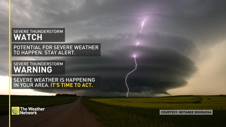
Watches mean conditions are favourable for the development of severe thunderstorms.
Warnings mean they are imminent or occurring in your area.
Thumbnail courtesy of Braydon Morisseau.
Stay tuned to The Weather Network for the latest updates on conditions across the Prairies.

