
Snow squalls, hazardous driving risk continues overnight for Ontario
It’s a have or have-not kind of weekend across southern Ontario, as folks across the province spend the final hours of winter dodging areas of low visibility in potent snow squalls.
Hazardous travel will remain likely as these bursts of snow greet motorists, so anyone planning to head out on Saturday night or early Sunday morning should use caution and stay alert for rapidly changing conditions.
MUST SEE: Canada warmest temperature of 2023 could arrive this weekend

Snow squalls continue throughout southern Ontario into early Sunday
Cold winds blowing over the ice-free lakes, combined with a chilly upper-level trough swinging over southern Ontario, gave rise to waves of potent snow squalls that crept across the region on Saturday.
Snow squall warnings and watches are in place for areas near Lake Huron and Georgian Bay, extending eastward into parts of cottage country.
DON’T MISS: Ontario just lived through its darkest winter in 73 years
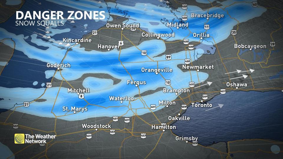
The heaviest snow and greatest potential for near-whiteout conditions will fall across the typical snowbelt regions along Lake Huron and Georgian Bay, potentially reaching into parts of cottage country, as well.
Travel will be especially tricky in these areas, as conditions could change rapidly from clear skies to near-zero visibility over short distances.
“Non-essential travel is discouraged as visibility will be suddenly reduced to near zero at times,” Environment and Climate Change Canada (ECCC) said in its warning. “Consider postponing non-essential travel until conditions improve.”
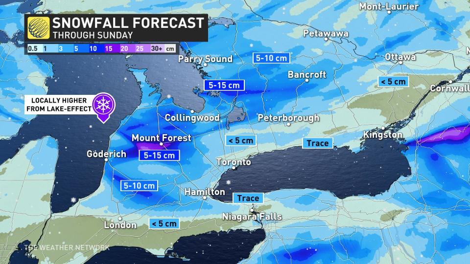
Accumulations should generally come in around 5-15 cm for most areas downwind of the lakes, with locally higher totals possible near the Huron shores.
Snow squalls should taper off to flurries by Sunday morning. Blustery winds will continue through the day Sunday, however, with widespread gusts of 40-60 km/h common throughout the region. Higher gusts are possible along the shores of Lake Huron and Georgian Bay.
Beyond this system, fairer weather will greet Ontario to begin the new workweek, with calmer conditions and near-seasonal temperatures expected to prevail as astronomical spring arrives on Monday. Forecasters are watching the potential for another system to arrive in the latter half of the week.
Stay with The Weather Network for the latest on conditions across Ontario.

