
Wildfire could reach Yellowknife's outskirts by weekend; N.W.T. gov't takes emergency responsibility from city
What you need to know about the N.W.T. wildfires, as of 12:30 p.m. Wednesday:
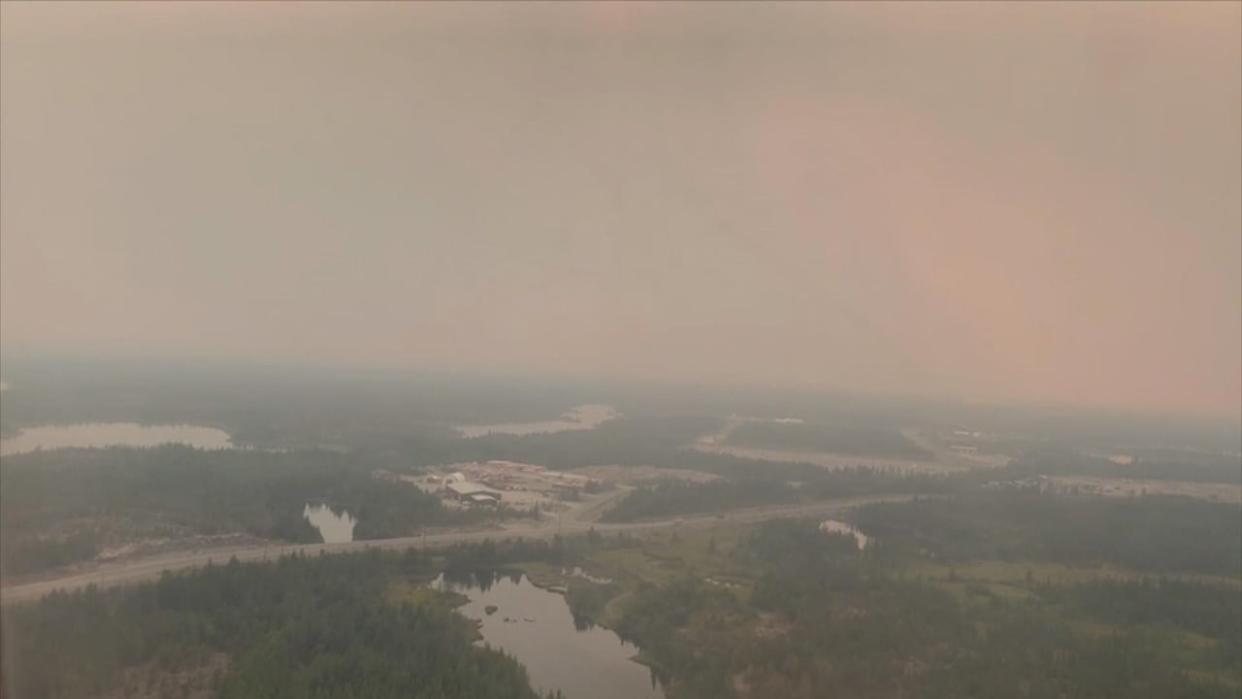
Wildfire now about 16 kilometres northwest of Yellowknife
The government of the Northwest Territories took over emergency measures for Yellowknife from the city
Evacuation alert issued for Yellowknife's Kam Lake business district, Grace Lake and Engle industrial areas
Evacuation order issued for Highway 3 from kilometre 284 to 329 – Yellowknife's boundary
Cots have been set up at Yellowknife Multiplex, the facility the city would use as an evacuation centre
All Yellowknife city facilities are closed to the public
Yellowknife under local state of emergency; N.W.T. under territory-wide state of emergency
Highways 1 and 3 are open; Highways 2 and 5 are closed; Jean Marie access road is closed
Evacuation orders issued for communities of Hay River, Kátł'odeeche First Nation, Fort Smith, Enterprise and Jean Marie River
Evacuation orders issued for cabin and home owners on Highway 3 from kilometres 284 and 329
Evacuation order coming no later than Thursday for North Prosperous Lake, North Prelude Lake and all of River Lake
Behchokǫ̀, Edzo, Frank Channel and Kakisa under evacuation alert
North Slave region territorial parks closing Thursday, campers asked to vacate Reid Lake, Prelude Lake, Fred Henne parks
South Slave evacuees, including those in Grande Prairie, Alta., now being asked to go to St. Albert, Alta., and register at Servus Place at 400 Campbell Road
Phone and internet interrupted through South Slave region
The N.W.T. government has taken over as the head of emergency measures for Yellowknife as a wildfire continues to threaten the city.
The announcement came in a news release just after 5 p.m. on Wednesday. The release cited work the city had done to protect the city such as constructing firebreaks in the west end and adding sprinklers.
The N.W.T. is able to take over the responsibility of emergency measures as a result of the territorial state of emergency that was announced by Municipal and Community Affairs Minister Shane Thompson on Tuesday.
Meantime, an evacuation order along Highway 3 has been extended to Yellowknife's municipal boundary, as the fire is burning about 17 kilometres to the west of the city.
N.W.T. Fire said Wednesday morning the order now covers kilometres 284 to 329 of the highway and that residents in this area "should leave as soon as it is safe."
Cots have been set up at the Yellowknife Multiplex, the facility the city said would serve as an evacuation centre if people are ordered to leave their homes.
The city of Yellowknife has also closed all city facilities to the public as of Wednesday afternoon.
Territorial parks in the North Slave region will also be closed as of Thursday afternoon. Visitors are asked to vacate Reid Lake, Prelude Lake and Fred Henne parks by 1 p.m. Thursday. Anything left behind cannot be retrieved later, and N.W.T. Parks says it is not liable for damage to any campers or gear left behind.
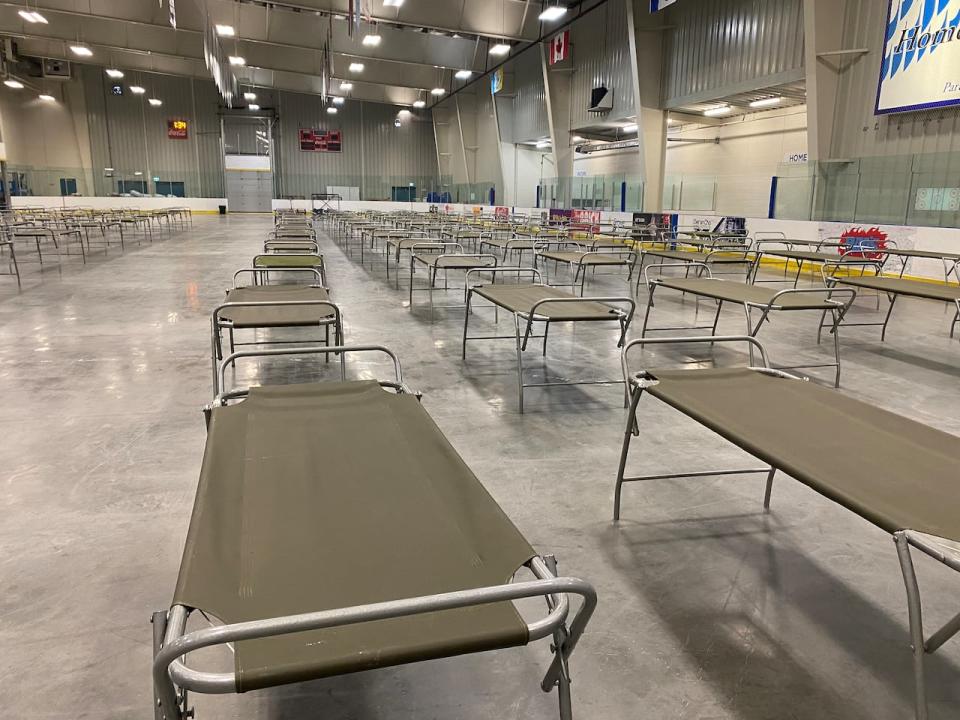
Cots were set up at the Yellowknife Multiplex as of 1:30 p.m. on Wednesday. The facility will be used as an evacuation centre if the city issues an order for residents to leave their homes. (Luke Carroll/CBC)
N.W.T. Fire said strong winds are expected to push the fire east toward the city on Wednesday.
In another update at 11:46 a.m. on Wednesday, N.W.T. Fire said the fire has now passed Boundary Creek and has progressed along the highway to kilometre 312.
It said if the area doesn't get rain, the fire could reach the outskirts of Yellowknife by the weekend.
"While rain is in the forecast, there are no guarantees," the update reads.
The fire agency added that strong west winds gusting up to 30 or 35 kilometres per hour could push the fire five kilometres closer to the city Wednesday.
On Thursday, it's expected to reach Highway 3 again, driven by north winds.
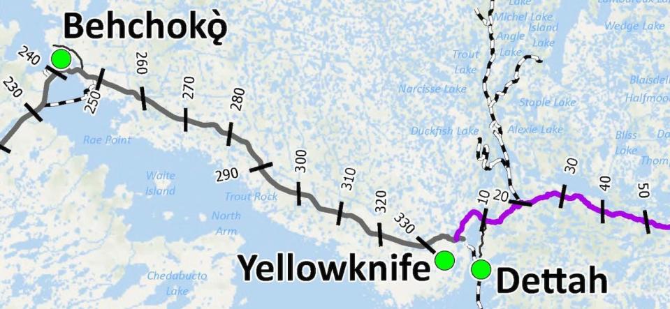
A map showing the kilometre markers from Behchokǫ̀ to Yellowknife. N.W.T. Fire said Wednesday that residents between kilometres 284 and 329 should evacuate their property. (N.W.T. government)
Specifics still scant on city-wide evacuation plan
Yellowknife Mayor Rebecca Alty said the city continues to work on fire breaks to the west near Deh Cho Boulevard and sandpits.
"We're bulldozing, clearing trees 100 meters wide," she said.
Earlier this week, Yellowknife declared a local state of emergency that would allow the city to call upon contractor services to do this protection work.
"Those fire breaks are are really important," she said.
Asked about a possible city-wide evacuation, Alty reiterated that the current situation is only an evacuation alert for the areas of Kam Lake, Grace Lake and Engle Business District.
She said the city would work with the territorial and federal governments in the case of a larger evacuation.
"If the highway was available, you know residents could go that way and then it would also be looking at the air," she said.
In case of an air evacuation, Alty said it would call upon partners.
"When you think of the military, they've got a lot of skills in this area," she said. "They've got the logistics and aircraft support. Of course, there's also commercial airlines. So that's where it's all levels of government and private companies working together on this evacuation."
Alty offered few specific details other than to say residents would be notified of next steps if an evacuation order was to happen.
She also said residents should have some bags packed with essentials, like medication, and important documents.
"We've got very skilled, experienced people who are working on this issue, and it's through their advice and expertise that we're drafting plans," she said.
The N.W.T. government said it would be having another news conference on the wildfire situation Wednesday evening at 7 p.m.
Evacuation order to be reinstated for Ingraham Trail areas
Meanwhile, an evacuation order for north Prelude Lake, north Prosperous Lake and all of River Lake will be reinstated no later than Thursday morning. That had been downgraded to an alert on Tuesday, but N.W.T. Fire said the wildfire threatening those areas grew "significantly" southward.
It went past a drainage area that was holding back its growth, even though air tankers were working on it. Winds coming from the north mean fire officials expect the fire to reach those areas of the lakes Thursday.
"There is threat to the Ingraham Trail. Without rain, the fire may reach the area by Friday," N.W.T. Fire wrote.
That wildfire is now four and a half kilometres from the north end of Prelude, about nine kilometres northwest of Prosperous and nine kilometres northeast of River Lake. It's also 11 kilometres north of kilometre 84 of the Ingraham Trail.
According to the territory's highway conditions map, Highway 3 is still open between Yellowknife and Behchokǫ̀.
N.W.T. Fire said even if the highway closes, residents that are in the evacuation order zone will be allowed to leave.
The territorial government has provided the following information for residents:

