
Wildfires prompt new B.C. protocols around flooding and mudslides
The province has placed travel advisories and signs on roads in the Interior telling drivers not to stop when it's raining to protect them from mudslides.
Last summer, major mudslides affected a number of highways in the Cache Creek/Clinton/Lillooet, B.C., area. Flows along Highway 99 forced 24 people from the Bonaparte Indian Band out of their homes.
In the Cache Creek area, mudslides closed the highway several times and killed one driver along Highway 97.
As a result, signs and warnings have been put in place along a stretch of Highway 97 from Cache Creek to just south of Clinton, and on Highway 99 near Lillooet, as well as on the back roads in the area.
Tim Giles, research geomorphologist with the Ministry of Forest Lands Natural Resource Operations and Rural Development, said the ministry has been working to get the message out that wildfires have fundamentally changed slope stability.
The signs outline what people should do if they're in an area prone to mudslides, Giles said.

Changes in soil
The Ministry of Forests is not the only provincial department concerned with the increased risk of mudslides. The Ministry of Transportation and Infrastructure has also flagged the rising danger, which is connected to climate-related events.
"The last two fire seasons ... fundamentally changed the landscape," said Mike Lorimer, the Transportation Ministry's executive director for the southern Interior.
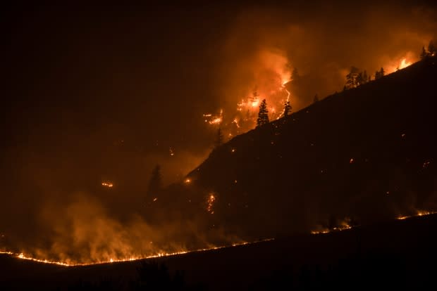
Wildfires, like the one at Elephant Hill in 2017, burn soil. In some cases this creates a hard crust on the surface that doesn't absorb water when it rains.
This allows water to run off and create floods or mudslides. Flows can start almost instantly when there's a heavy rain, Giles said.
New protocols developed
After the Elephant Hill wildfire, the Transportation Ministry developed new protocols based on what was learned from the mudslides.
Beyond increasing signage and online communications to the public, the ministry has made changes behind the scenes, including detailed weather forecasting for specific areas and real-time weather reports. Rain gauges have been installed in the backcountry, and contractors in areas affected by fires are now expected to increase monitoring when it's raining.
Despite the changes, some residents in areas affected by mudslides still have concerns.
Sherri Walker lives in Forest Grove in the Cariboo and regularly drives to Ashcroft along Highway 97. She worries about the tankers that drive the highway and what would happen if one was caught in a mudslide.
"It's not just a matter of fixing it. It's [about] preventative measures so these things don't happen again," she said.
However, Lorimer — from the Ministry of Transportation — believes new protocols will help reduce the risk of people being hurt on area highways.
"I love the highways being open, but if my engineers are telling us that that needs to be closed, it's not safe ... we will back them," said Lorimer.
"We will always err on the side of caution."
According to both the Ministry of Forests and the Ministry of Transportation, mudslides are expected to cause issues for three to five years after a major wildfire. After that time, enough vegetation will have regrown to help stabilize the slope.
Listen to the full story here:
With files by Daybreak Kamloops and Jenifer Norwell.
