
Prairies threatened with wintry weather as April snowstorm approaches
Spring is a turbulent season across Canada, with many ups and downs as we transition away from winter and head towards summer.
The Prairies are a perfect example of that. The region will be on the warm side of spring this weekend, with some areas in Alberta and Manitoba potentially hitting 20 degrees –– an April rarity for the city of Winnipeg, Man.
MUST SEE: No April fool: Almost every province could see snow next week
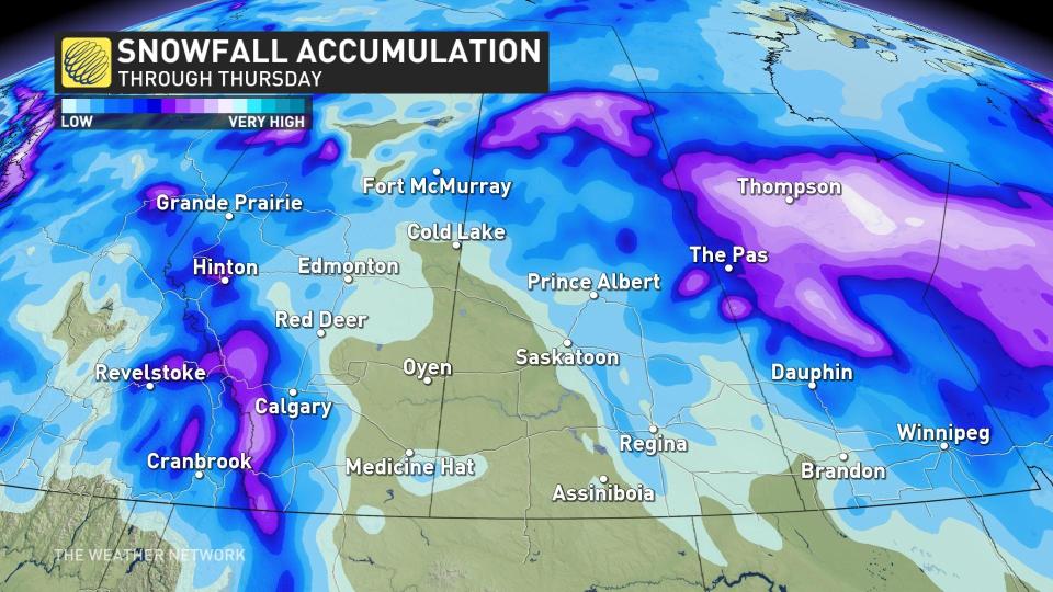
In typical Prairies fashion, though, temperatures are set to drop like a rock and usher in another threat of snowfall next week. In fact, for some areas, it will be a formidable, multi-day snowfall event –– possibly ending with more than 20 cm of snowfall for some locales.
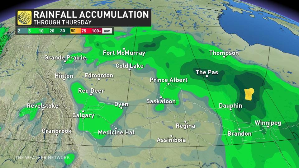
As well, heavy rainfall is in store for Manitoba, so with warm temperatures also helping to melt snow, a provincial flood warning has been issued for some areas.
Drivers are urged to adapt to the changing conditions during the height of the event, whether rain or snow, and especially if the winter tires have been removed already. Consider postponing non-essential travel until things improve.
Monday to Tuesday: Winter weather returns in typical Alberta fashion
A weak trough is forecast to develop across southern Alberta on Monday as an upper trough moves across the province and B.C. Precipitation will then gradually sink south across the province, with the tendency to transition over to wet snow due to the colder air in place.

Precipitation will increase across southern Alberta through Monday night, with periods of snowfall continuing through Tuesday before the system slides into Saskatchewan and Manitoba on Wednesday.
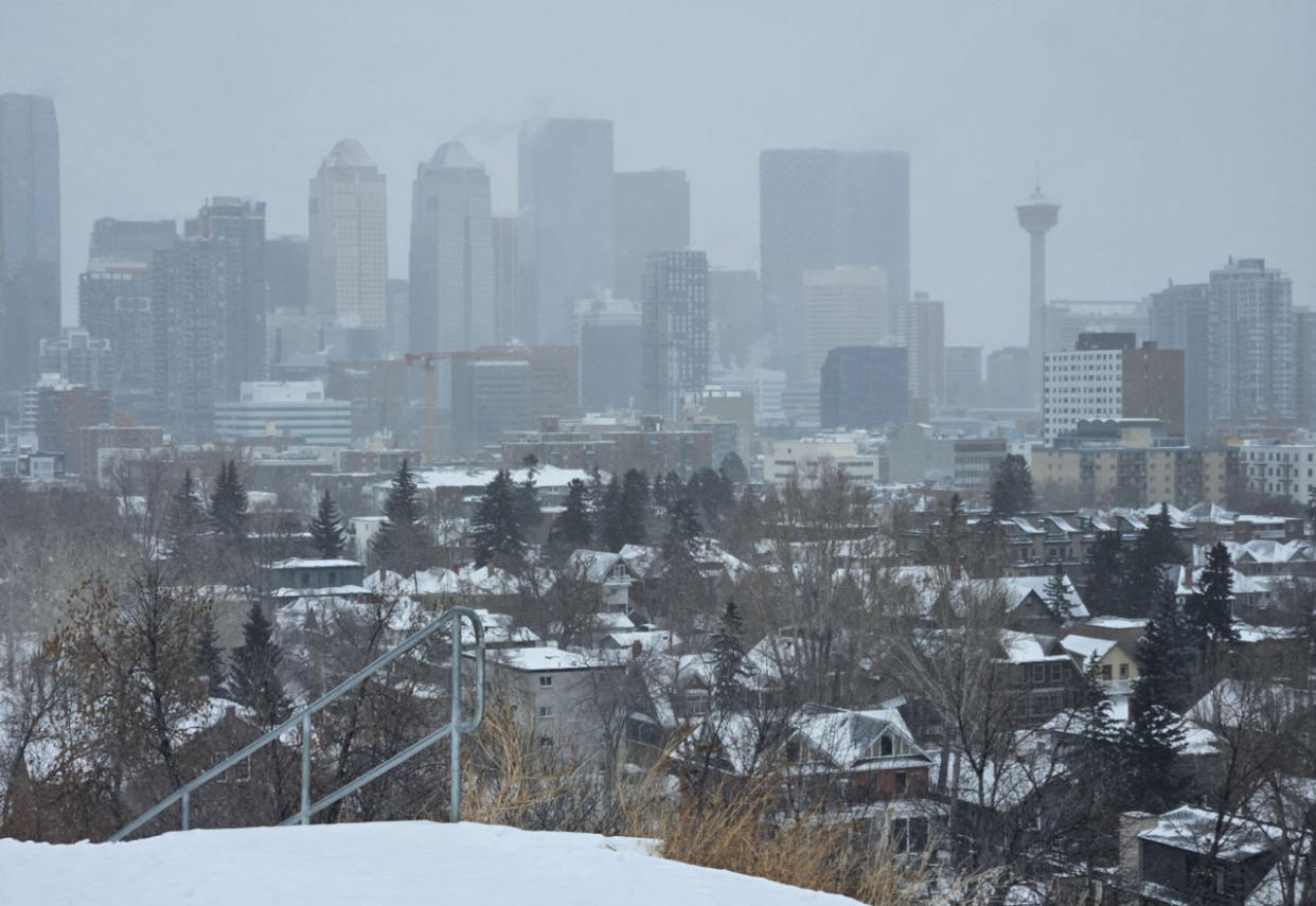
Bursts of wet snow will come to fruition around the city of Calgary, Alta., on Tuesday, made worse by gusty, northwesterly winds up to 60 km/h. Expect poor travel conditions during the heavy snowfall, along with increased commute times.
Tuesday to Wednesday: Snow slides east into Saskatchewan and Manitoba
As the trough continues to move east, heavy, wet snow will push across central and northern Saskatchewan, and Manitoba. As well, with the Assiniboine River under a flood warning, we’re watching for a heavy rainfall event across southern Manitoba Tuesday evening and overnight.
On Wednesday, the rain-snow line will slump south across Manitoba as northwesterly winds drop temperatures on the backside of the low.
However, there is still a lot of uncertainty as to where the band of heaviest snow will be. There is a signal for more than 20 cm of snowfall across northeast Saskatchewan and central Manitoba. There is also high uncertainty on the potential accumulation in the vicinity of Calgary.
LEARN MORE: How the tropics help produce big springtime snows on the Prairies
While the snow and rainfall won't be good for driving or the flood risk in Manitoba, the precipitation is sorely needed in a region long plagued by drought conditions.
We’ve seen several upslope events across southern Alberta, with about 25 mm of precipitation recorded around Calgary in April.
It’s a good sign, but it has to continue in order to chip away at the long-term moisture deficits. We're keeping an eye on the June monsoon for Alberta for the most significant and consequential summer rains.
Stay with The Weather Network for all the latest on this snowstorm across the Prairies.

