
Up to 3 inches of snow may blanket parts of North Carolina mountains. What to know
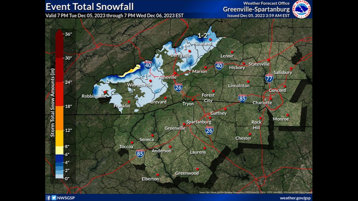
Snow is expected to continue falling in the North Carolina mountains, blanketing some areas with up to 3 inches.
Areas in several Western North Carolina counties are under a Winter Weather Advisory until 4 p.m. Wednesday, Dec. 6, as forecasters warn of the potential for power outages and slick roads at higher elevations.
“A Winter Weather Advisory for snow means that periods of snow will cause primarily travel difficulties,” the National Weather Service wrote on its website. “Be prepared for snow covered roads and limited visibilities, and use caution while driving.”
Snow hit some places overnight, and more could fall through late morning.
“For those who live at the highest elevations of the NC mountains, this will be the first day of the season you’ll wake up to freshly-fallen snow,” the weather service wrote in a 4:20 a.m. Facebook post.
In all, snowfall could total 2 to 3 inches in most places above 3,500 feet. Earlier forecasts had predicted more snow near the Tennessee border.
“The very highest elevations in the Smokies will see 5-6” total, and snow may continue falling here through at least late morning,” forecasters said as of about 3:20 a.m.
Weather advisories were issued for all of Ashe, Avery and Watauga counties as well as areas above 3,500 feet in Graham, Haywood, Madison, Mitchell, Swain and Yancey counties. After the advisories are set to end at 4 p.m., overnight temperatures could drop into the 20s, making it possible that any melting snow freezes over.
“That still seems unlikely for most locations given that highs won’t be warm enough to melt anything at the elevations where significant accumulations will be,” forecasters wrote.
‘Green shooting star’ streaks across night sky in 13 states, videos show. Take a look

