
Multi-day snowfall in Ontario likely to have hefty travel impacts
Bundle up, southern Ontario, as it's about to get even colder. Also, many areas will need to have their snow-clearing equipment ready for action as a multi-day, lake-effect snow event comes to fruition this week.
An Arctic air mass will bring the region its coldest temperatures of the season, and with that, will likely going to spark widespread lake-effect snow through the middle of the week.
DON'T MISS: Canada’s first -40°C reading a harbinger of a frigid week to come
Areas adjacent to Lake Huron and Georgian Bay will especially be impacted, with reduced visibility likely creating rather hazardous travel in some spots. Prepare for travel delays or possibly even road closures throughout southern Ontario.
Cold air ushered by in with Colorado low Sunday
A low-pressure system sliding into the Great Lakes will push a batch of precipitation over southern Ontario as we head through Sunday.
Cold rain is all that the Greater Toronto Area (GTA) will see on Sunday, but head north towards Fergus and Orangeville, and your odds of wet snowfall drastically increase.

Otherwise just 5-10 mm of rainfall is forecast across the GTA.
Farther east, forecasters expect light accumulations across the National Capital Region, but nothing too significant or disruptive.
SEE ALSO: What does a snowy fall mean for winter?
The best opportunity for shovels to get a workout will fall across the traditional snowbelts later this week.
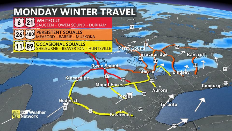
Travel could be significantly impacted by lake-effect snow
The system will open the doors for a lobe of the polar vortex to descend over Hudson Bay. That air will be the coldest so far this season, and will fire up the lake-effect machine once again.
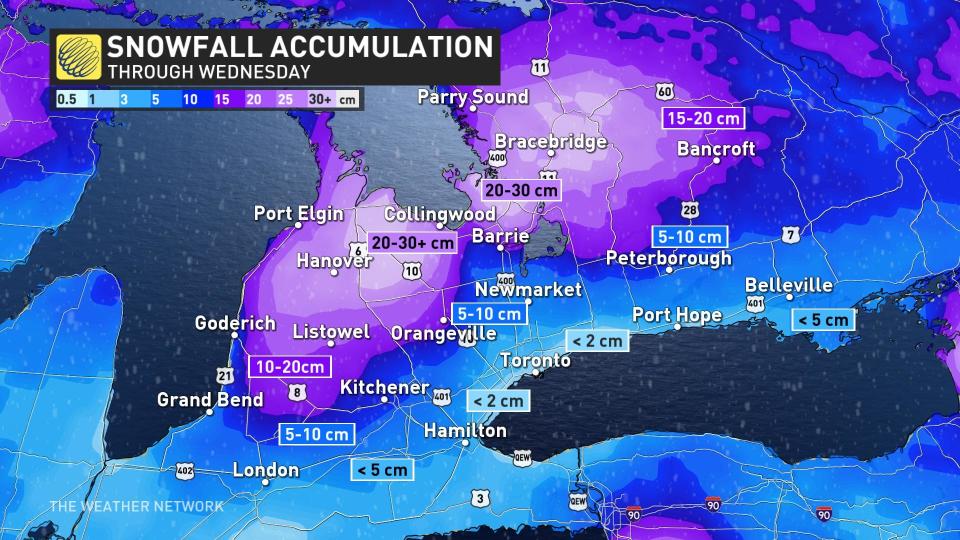
A multi-day snow event is forecast to meander off of Lake Huron and Georgian Bay, impacting the snowbelts Monday, Tuesday, and spilling into Wednesday even.
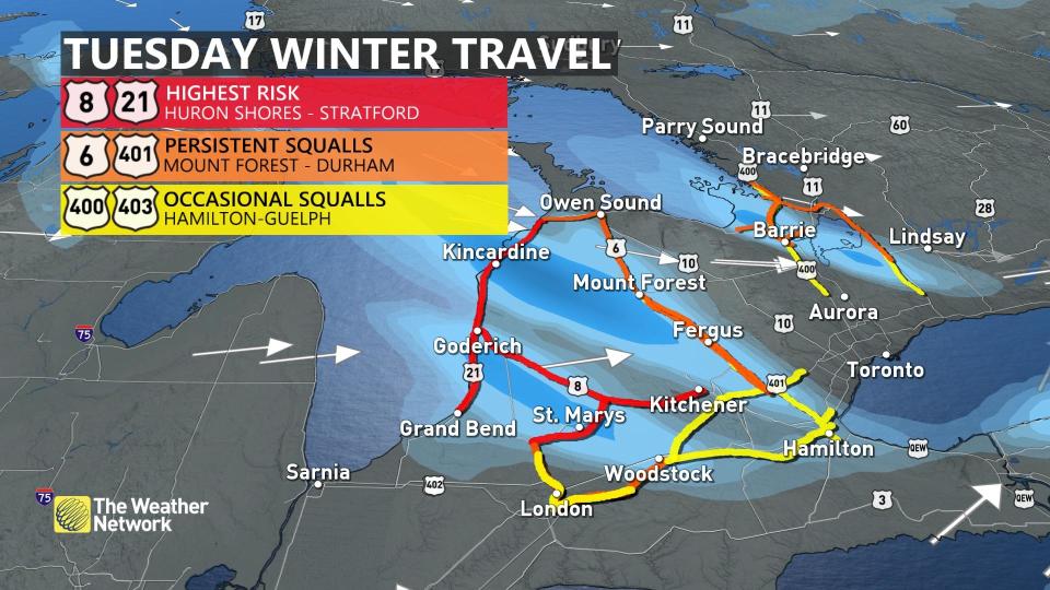
The narrow bands of snow will keep the heaviest accumulations highly localized, but travel impacts and road closures could be more widespread.
With bitter cold air and persistent northwesterly winds forecast, brief bursts of snowfall could temporarily move through the GTA.
When all is said and done, the strongest snow squalls could put down 30+ cm in the hardest-hit spots through Tuesday, predominantly in areas just south and east of Georgian Bay.
Don’t write the entire week off, though. This burst of chilly air won’t last for long, and seasonal to slightly above-seasonal warmth will work back into the region for the end of the week.
Thumbnail courtesy of Getty Images-108161650.
Stay with The Weather Network for all the latest on conditions across Ontario.

