
Cold, soaking rain hits southern Ontario, risk for some ice and snow
After a frosty start to the week across southern Ontario, temperatures will warm slightly into Tuesday, but at the cost of a messy system with a raw east wind. Rain will develop during mid-day, but could begin as a period of ice, primarily for areas north of the 401.
That means travel conditions could be compromised, and drivers are being urged to adjust to the changing conditions, especially if you don't have your winter tires on just yet.
DON’T MISS: Why the Great Lakes produce some of the world’s heaviest snow
Temperatures will bump up above seasonal through the latter half of the week, turning colder however, for the final weekend of November.
Wintry mix of rain, ice and snow through Tuesday
A weak Colorado low will meet up with a trough over the Great Lakes on Tuesday, creating a mess across portions of Ontario by the evening commute.
The region will face the whole spectrum of precipitation types as we progress through the second half of the day.
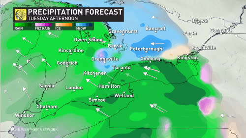
Most of southwestern Ontario will face a cold rain. Temperatures hovering just above the freezing mark however, could allow for snow to fall north of Guelph and the Greater Toronto Area (GTA).
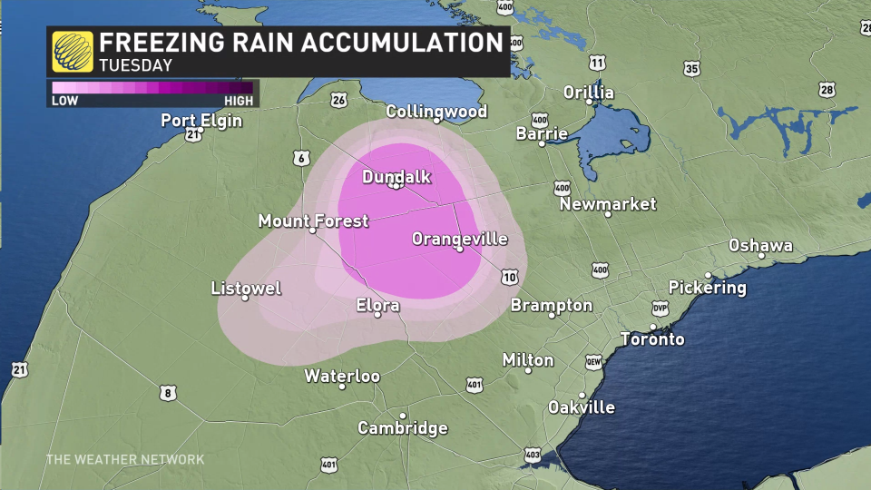
There’s a risk of a wintry mix with isolated freezing rain near Orangeville, as well, but it’s not expected to be widespread or disruptive.
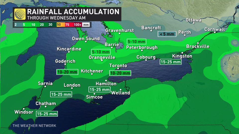
In all, a widespread 10-20 mm of rain is expected, with some locally higher amounts possible through Wednesday morning.
Late Tuesday evening, heavier snow spills across eastern Ontario with rain showers winding down through the evening and overnight for the GTA.
We can’t rule out the potential for a few centimetres of slushy, wet snow across northern portions of the GTA either, particularly north of Highway 407.
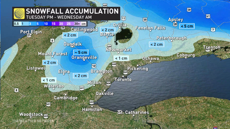
The largest snowfall with this system will likely occur across eastern Ontario, where totals could push 8-10 cm as the system eases in the pre-dawn hours Wednesday.
WATCH: Winter weather creeping close to Toronto for Tuesday's commute
Fair and near seasonal conditions will return to southern Ontario on Wednesday and across the region on Thursday. By Friday, things turn colder, with temperatures forecast to be a few degrees cooler than normal across the south, and well below normal for eastern Ontario and southern Quebec.
Near seasonal, or slightly cooler than normal, temperatures are expected through the end of November and into the first few days of December, but a milder pattern is expected to return during early December and continue through mid-December, as well
Stay tuned to the Weather Network for the latest forecast updates across Ontario.

