
How will the remnants of tropical storm Nicole impact New Brunswick?
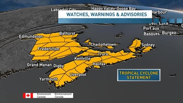
Tropical cyclone and special weather statements have been issued for New Brunswick as the province braces for a drubbing from another post-tropical storm.
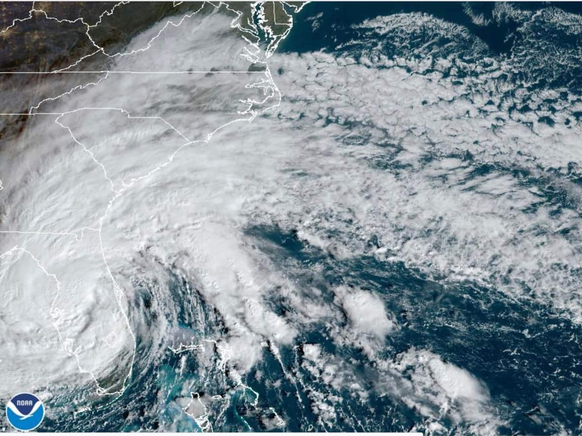
Tropical storm Nicole escalated to hurricane status on Wednesday night and brought a surge, waves and wind to Florida on Thursday, according to Environment Canada.
As of Friday morning, storm Nicole was reclassified as a tropical depression storm. Later on Friday, the storm will be called the remnants of Nicole, according to CBC meteorologist Tina Simpkin.
Nicole will travel north over the Carolinas and Georgia on Friday where it will become post-tropical before arriving in the Maritimes. Stormy conditions are expected from Saturday morning until Sunday.
"Some strong winds, we'll see some gusts 60, 70, even 80 km/h along that Fundy coastline — could see some gusts 50 to 60 even through Fredericton," said CBC meteorologist Ryan Snoddon referring to Friday into Saturday.
Environment Canada's tropical cyclone statement says it does not expect winds will be "much of a concern," except possibly over the Acadian Peninsula area of New Brunswick and Gulf portions of Quebec.
The statement says these winds may be up to 90 km/h.
This storm comes just over a month after post-tropical storm Fiona hit the Maritimes, knocking out power for 50,000 N.B. Power customers. Nicole is not expected to be as severe as Fiona.
"It will essentially be an autumn type storm while impacting Eastern Canada," reads the tropical cyclone statement issued by Environment Canada.
"Rain and wind is expected over the Maritime provinces with very mild, tropical temperatures and gusty winds south of the track and strong, cold northeasterly winds north of it."
New Brunswick could receive 50 to 100 mm of rain. Elevated water levels are expected along the Bay of Chaleur and Gulf of St. Lawrence coastlines with the possibility of minor coastal flooding.
The New Brunswick government issued news release on Tuesday for "Storm Preparedness Week" which advised New Brunswickers to prepare for storms with emergency kits, situational plans and knowledge of risks.
In the release, NB Power president and CEO Lori Clark said despite preparation, outages can still happen and that New Brunswickers need to be prepared.
In a release issued by the City of Saint John Thursday, the Saint John Emergency Management Organization asked residents to be cautious walking or driving. It said travel is not recommended.
"The City's Public Works and Transportation crews are preparing trucks with road barricades and signage and will continue to inspect major catch basins and drainage gutters across the City," read the release.
It said people should clear catch basins and gutters if possible, tie down loose items, reduce driving speeds and prepare an emergency kit.
Environment Canada's tropical cyclone statement says another information statement is planned for Friday at 2 p.m.

