
Weekend winter storm threatens blizzard-like conditions, ushers in intense cold
Winter may have taken its time to arrive across Ontario, but after this week's rounds of snow, there will be little to question in terms of the season.
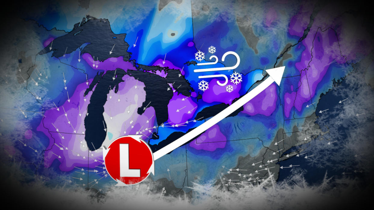
After a blast of heavy snow and rain through the early part of the week, all eyes are now on a massive and powerful winter storm as we head into the weekend.
Low pressure will rapidly intensify as it heads northeast into the Great Lakes region, and this storm is set to bring widespread strong winds and heavy snow late Friday and into Saturday. With more cold air to work with, snowfall totals could be significant in some areas. There's also the risk for extensive blowing and drifting snow, and localized wind damage and power outages.
Going somewhere? Check out the current highway conditions before heading out!
Thursday: Weak clipper drops quick burst of snow
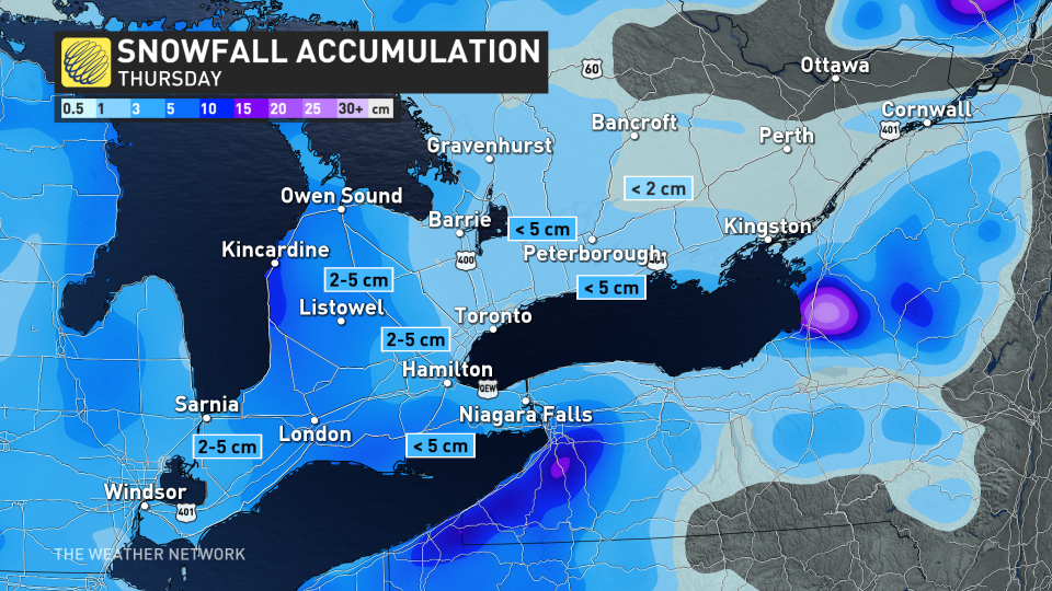
Ahead of this bigger weekend storm, a weak clipper system from the U.S. Midwest will track through southern Ontario on Thursday, bringing with it a couple of centimetres of snow. Snow moves into the southwest during the early morning hours, spreading across the Greater Toronto Area (GTA) through the morning commute, but ending in the early afternoon ahead of the afternoon commute.
Up to 5 cm of snow is possible for most areas, which could be enough to slow travel times. Snow will remain south of Bracebridge and Bancroft, and will depart Kingston into the evening hours.
PHOTOS: First dose of winter hits, with more snow coming to Ontario this week
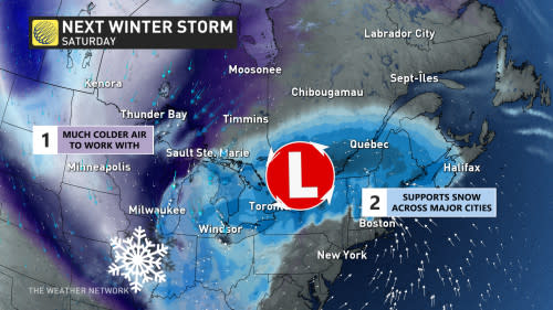
Friday into Saturday: Large and impactful winter storm takes aim
Late Friday and into Saturday, another strong, colder system is forecast to bring widespread, heavy snow and blizzard-like conditions to the province. Low pressure will rapidly intensify as it heads northeast into the Great Lakes, bringing widespread strong winds and heavy snow to the Great Lakes region.
The storm is forecast to directly impact the Friday evening commute in the GTA. There is still uncertainty with exact snow totals and the storm's track, but confidence is growing on impactful winter travel. This storm will be much different than the last as it will pull in colder air from the north and have stronger winds, but will also be drier than the previous winter storm.
The colder air will lend to more widespread snow, and keeping it around rather than rain washes it out, so get those shovels handy. We are still expecting some to transition into a rain/snow mix, particularly along Lake Erie and Lake Ontario shores. The stronger winds increase the risk for whiteouts and blizzard-like road conditions in southern Ontario.
By Friday late afternoon, the system will move into southwestern Ontario and quickly intensify by the evening. This is where a high impact scenario may take place as millions of commuters attempt to get home. Expect heavy snow coinciding with gusts up to 70 km/h. Travel is not recommended.
The system will engulf the rest of the province by midnight. Snowfall rates could reach 3-5 cm per hour, making for some treacherous travel through the night. The heaviest snow will fall through the overnight hours, and linger into Saturday morning for eastern Ontario.
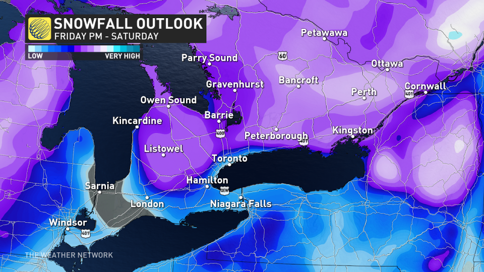
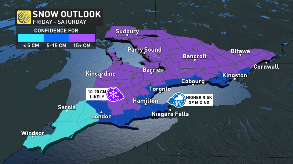
A widespread swath of 10-20 cm of snow is possible, with some localized areas possibly exceeding the 20 cm mark. We will have to keep an eye on areas that could transition into rain, which could see just slightly less than 10 cm. The line between significant snow and rain/snow mix will once again be razor thin for the GTA and Golden Horseshoe.
Extensive blowing and drifting snow is likely amid gusty winds, and depending on the exact storm track, there's also the potential for localized wind damage and power outages. Sustained winds of 40-50+ km/h are likely, and gusts of 70-80+ km/h. While the snow will be too wet and sticky for whiteouts, visibility will still be very poor. If the snow sticks to trees, that could spell trouble for power lines.
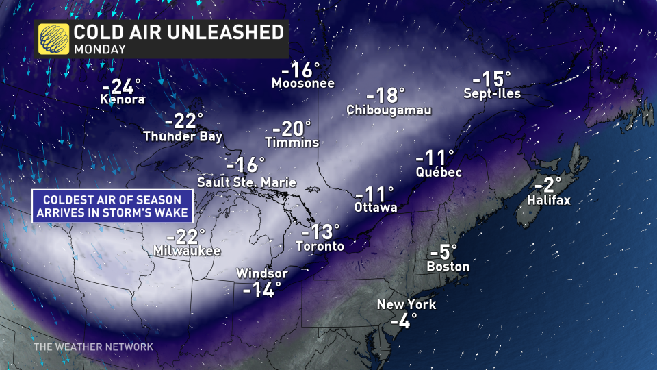
Multi-day lake-effect snow squalls with coldest air of the season
Colder than seasonal temperatures will dominate starting Sunday, and continue into next week, as well. An extended lake-effect snow squall event of more than five days is also likely, as arctic air floods into the region.
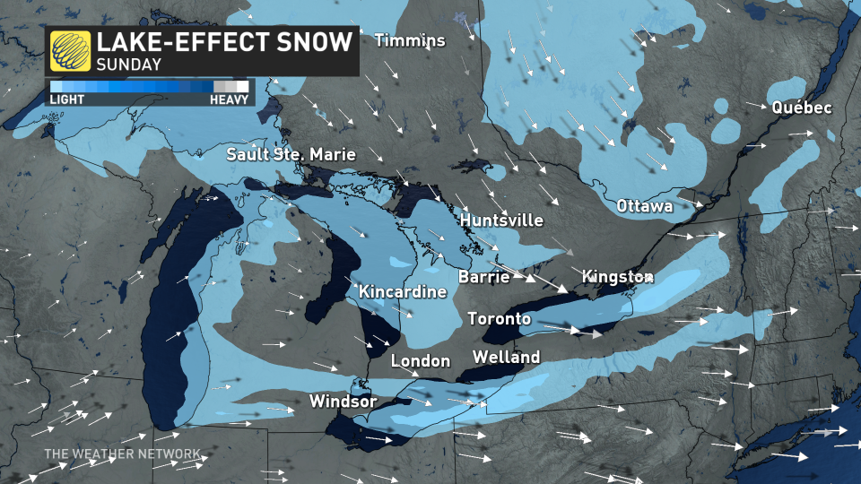
The wind direction will be changeable through the event, so the snow squalls will meander across the snow belts resulting in widespread significant snow and hazardous travel.
The meandering bands should prevent the truly impressive totals that we sometimes see for specific locations when the wind does lock into place.
A milder pattern is expected for the final week of January, but winter will return for February once again.
WATCH: Weather 'hat-trick' hits Ontario and Quebec, creating treacherous travel conditions
Be sure to check back for the latest weather updates across Ontario.

