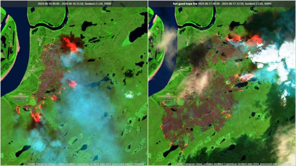
Fort Good Hope, N.W.T., wildfire now headed toward 2017 burn area, away from community
Winds are now pushing the wildfire at the edge of Fort Good Hope, N.W.T., toward an old burn area from 2017 and away from the community, N.W.T. Fire said Wednesday.
In a 10 a.m. update on Wednesday, wildfire information officer Frank McKay said crews are focused on putting out hotspots and burning off a 50-foot buffer of fuel so the wildfire has a harder time moving toward the community.
They're also working with aerial support to put out hotspots along Fort Good Hope's airport road.
The evacuation order for the community, issued last weekend, remains in place. Five fire crews, two fire techs, three helicopters and numerous water tankers are dedicated to this wildfire.
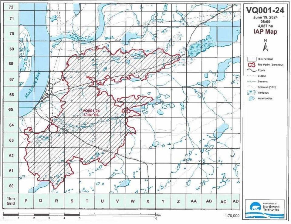
The fire's burn area has grown beyond 4,000 hectares, N.W.T. Fire said. Some rain fell Tuesday, with more expected Wednesday.