
Historic Thanksgiving snows are on the table for parts of Ontario
Fall reclaimed its time in style over Ontario this long holiday weekend as a powerful upper-level low makes itself at home over the province for another couple of days.
A sliver of the polar vortex diving south over Ontario will not only drive down temperatures, but it’ll bring the chance for historic snows to some and hefty lake-effect rains for others. Some communities could see their first snowy Thanksgivings on record.
Temperatures will register 5-10 degrees below seasonal across the province through the long weekend.
DON'T MISS: Lake-effect machine threatens hefty Thanksgiving rains in Ontario
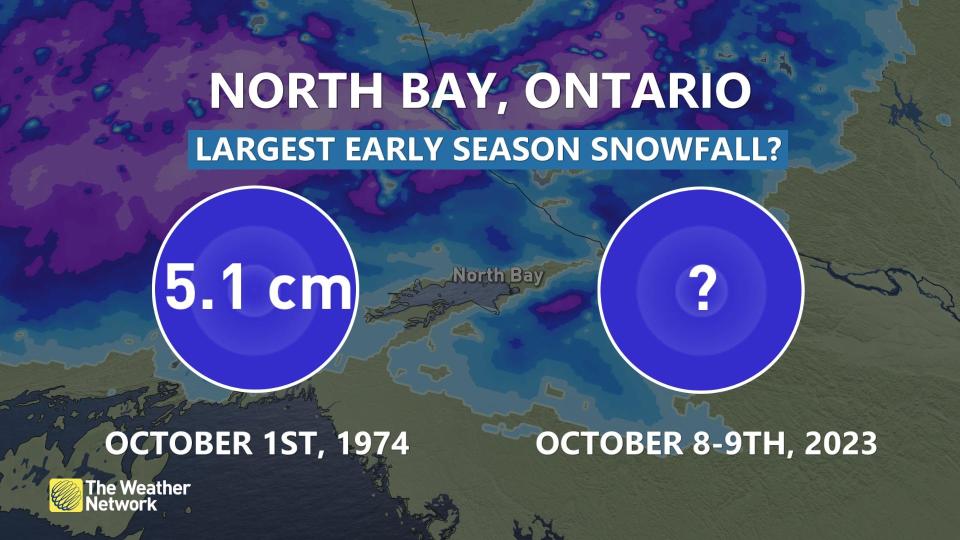
There’s even an outside chance this will become one of the heaviest early-season snowfalls on record across northeastern Ontario. If the community of North Bay records more than 5 cm of snowfall, it’ll be the most snow they’ve ever recorded this early in the season. Records there date back to 1939.
Autumnal weather arrives, along with snow for some
Areas: Southern and northeastern Ontario
Timing: Through the long weekend
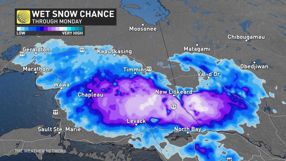
Weather: Wet snow and localized accumulation is in the forecast for Thanksgiving across parts of Ontario as conditions plunge from July to November over a matter of days. There’s even an outside chance this will become one of the heaviest early-season snowfalls on record across northeastern Ontario.
Wet snow will lead to localized accumulations for parts of Ontario through Thanksgiving as conditions lurch from July-like to resembling November in a matter of days.
Temperatures on Monday will struggle to reach the double-digits throughout the province, with Toronto’s daytime high expected to register just 10°C on Thanksgiving Monday.
It’ll be even worse farther north.
Some folks will wake up to a modest coating of snow by Thanksgiving morning, and there’s a chance that North Bay could break that record.
Visit our Complete Guide to Fall 2023 for an in-depth look at the Fall Forecast, tips to plan for it and much more!
Temperatures will hover just above freezing beneath bouts of heavier precipitation, converting lingering rainfall into a wintry mix from Sudbury to Kapuskasing. Precipitation may oscillate between rain and snow depending on intensity.
Highways 11 and 144 stand to receive the highest snowfall amounts, with localized totals higher than 10 cm possible north of the Trans-Canada Highway.
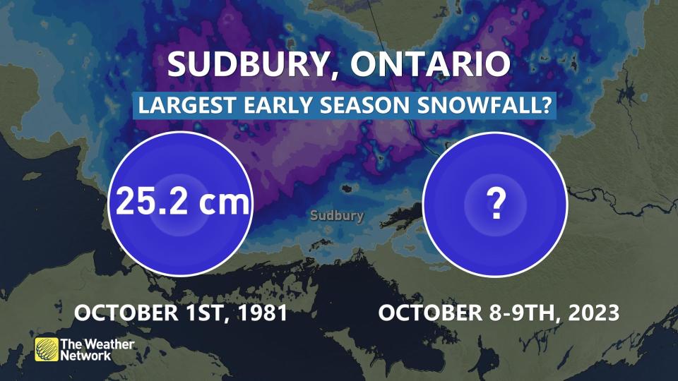
It’s highly unlikely that Sudbury will see its greatest early-season snowfall on record, as more than 25 cm of snow fell there back on October 1, 1981.
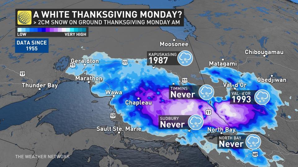
But the prospect of an inaugural white Thanksgiving might become reality for Timmins, Sudbury, and North Bay, where they’ve never recorded measurable snow on Thanksgiving Day since 1955. Kapuskasing has seen a snow-free Thanksgiving since 1987.
Farther south, this system will produce an impressive lake-effect rain event for the traditional snowbelts downwind from Lake Huron and Georgian Bay. A strong temperature gradient between water temperatures and air temperatures will lead to repetitive squalls of heavy rain sweeping inland, possibly bringing 75-100 mm of rain to some communities.
This setup could also lead to funnel cloud and waterspout sightings over the lakes.

Temperatures will trend closer to seasonal values in the mid-teens for mid-and late next week, but with the potential for another system late next week or weekend.
Find out what the rest of October has to offer in our October outlook.

