‘Impossible’ travel forecast for Sierra Nevada, Grapevine. Rain predicted in Fresno
Heavy snowfall was predicted for the coming weekend in central California, potentially causing delays on the Grapevine on Interstate 5 and rivaling storms seen last year, according to weather watchers.
As much as 12 feet of snow could fall in areas of the Sierra Nevada above 6,000 feet between late Thursday and Sunday morning, triggering a winter weather watch, according to the National Weather Service in Hanford.
There could be 2 feet of snow down to 4,000 feet, the service said.
It is more likely than not — a chance of 60% to 70% — the snow will lead to extreme winter storm impacts, meteorologists warned Tuesday.
Snow may get down to 1,500 feet on Sunday morning, forecasters said.
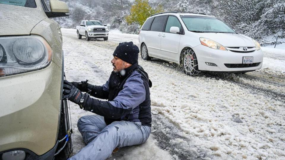
Drivers should not travel in the area Friday and Saturday unless it’s an emergency, the service said. Commuters should carry an emergency survival kit in case they get stuck and anyone who is stranded is advised to stay with their vehicle and wait for help.
“Expect dangerous to impossible mountain travel conditions,” the agency said, with rapidly deteriorating road conditions and visibility near zero.
Heavy snow is possible in the Sierra Nevada foothills above 2,500 feet Saturday through Sunday morning. Light snow is conceivable along I-5 over Tejon Pass and along Highway 58 over Tehachapi Pass Saturday night and Sunday morning. This snowfall may cause travel delays. #CAwx pic.twitter.com/qfbJzGa4Rv
— NWS Hanford (@NWSHanford) February 27, 2024
Forecasters advised folks to hit the road before 4 a.m. Thursday or after Sunday morning to avoid the worst of the weather.
The Tejon Pass, commonly called the Grapevine, and the Tehachapi Pass on Highway 58 will be difficult to traverse on Saturday and Sunday, the service said. Drivers were warned to expect delays.
Snow on the Grapevine is most likely Sunday, when an inch was predicted to fall, according to Dan Harty, a meteorologist with the National Weather Service.
“It only takes a little amount to cause a lot of trouble,” he said.
Weather forecast for Fresno
Fresno is expected to get a total of more than an inch of rain through the four-day storm system, according to Harty.
The high of 70 degrees Thursday is expected to give way to cooler temperatures, falling to 57 by Sunday, forecasters said. The lows are expected to go from mid-40s down to 38 degrees in the same amount of time.
Expected precipitation totals between 400 pm PST Thursday and 10 am PST Sunday. #cawx pic.twitter.com/cyB7vD5jIw
— NWS Hanford (@NWSHanford) February 27, 2024
Winter storm watch issued for Lake Tahoe area
On Monday afternoon, the National Weather Service issued a winter storm watch for the greater Lake Tahoe area, including the cities of Stateline, South Lake Tahoe, Glenbrook, Markleeville, Truckee, Incline Village and Tahoe City.
The watch will be in effect late Wednesday night through Sunday morning.
During that time period, the weather service is predicting snow accumulations of 2 to 4 feet for Lake Tahoe communities, with 4 to 8 feet of snowfall at spots above 7,000 feet.
Winds will gust up to 60 mph in lower elevations and more than 100 mph over Sierra mountain ridges, the weather service said.
“Travel could be impossible due to blizzard conditions,” the agency said. “Very strong winds could cause extensive damage to trees and power lines.”
The Sacramento Bee contributed to this report.