
January thaw melts snow, brings rain and freezing rain risk to Ontario
Snow lovers in southern Ontario hopefully enjoyed Tuesday's winter wonderland. That's because it will be the last shot of snow for the near future.
A wall-to-wall warm-up in North America will bring an extended thaw across southern Ontario, so it will not keep things white for long, especially on Wednesday and as we end off January next week.
DON’T MISS: Winter takes a breather in major Canadian cities with January thaw
With a surge of milder air in place, the next system will bring rain to the region on Wednesday as temperatures rise above the freezing mark.

However, eastern sections will still see cooler air at the surface, so freezing rain will be problematic for any travelling Wednesday overnight and Thursday morning. Freezing rain warnings are in place. Surfaces such as highways, roads, walkways and parking lots may become icy and slippery. Ice buildup may cause tree branches to break. Utility outages may occur. Be prepared to adjust your driving with changing road conditions.
More on the timing and impacts, below.
Wednesday: A milder, rainy pattern with the risk of freezing rain for some
As warmer air moves into the region, more moisture will come in on Wednesday, starting to bring light rain to southwestern Ontario in the morning and the Golden Horseshoe in the afternoon.
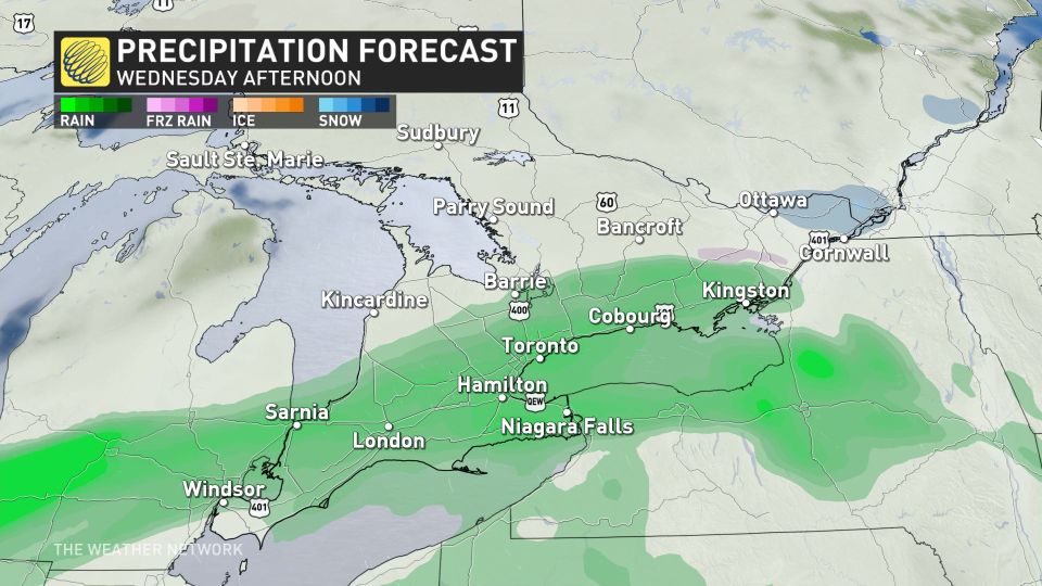
This one will pack a lot more mild air, which translates to rainfall versus snow. 5-10 mm of rain is expected for most areas south of Georgian Bay, extending down to Lake Erie and Lake Ontario.
WATCH: Risk increasing for multiple rounds of freezing rain in eastern Ontario
There is a small risk for a brief period of freezing rain for areas around Orangeville as the system comes in late afternoon, but won’t last long as warmer temperatures move in.
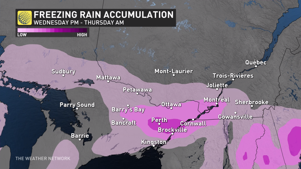
There is an elevated risk of freezing rain in eastern Ontario as colder air will stay in place at the surface, raising the chance of slippery and icy conditions Wednesday overnight to Thursday morning.
RELATED: Freezing rain forces cancellation of school buses in Windsor-Essex, Chatham-Kent
The commute could be icy Thursday morning, so be careful on untreated roads and drive accordingly.

Thursday and beyond: More rain and freezing rain risk, fog chance rises
Another system will move in Thursday evening and overnight, pushing rain farther north into Sudbury and North Bay as temperatures warm up.
There is still the risk of freezing rain for some areas, stretching from Algonquin Park to the Quebec border, including Ottawa. It will cause slippery conditions once again on Friday morning.
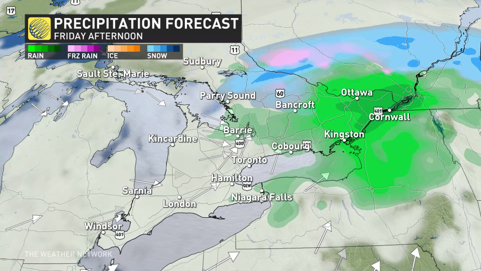
It’s also setup ripe for fog development, with the warmer air mass traversing the chillier Great Lakes. Look out for this mid-week and beyond.
A couple days of colder weather are forecast early next week, especially for eastern Ontario, but much milder weather and early spring-like temperatures are forecast for the second half of next week, and continuing well into the first week of February, as well.
However, winter is not over. We are watching the potential for an extended stretch of colder winter weather from mid-February through early March.
Stay with The Weather Network for the latest on your forecast across Ontario.

