
Marathon snow event parks over Atlantic Canada, hazardous travel expected
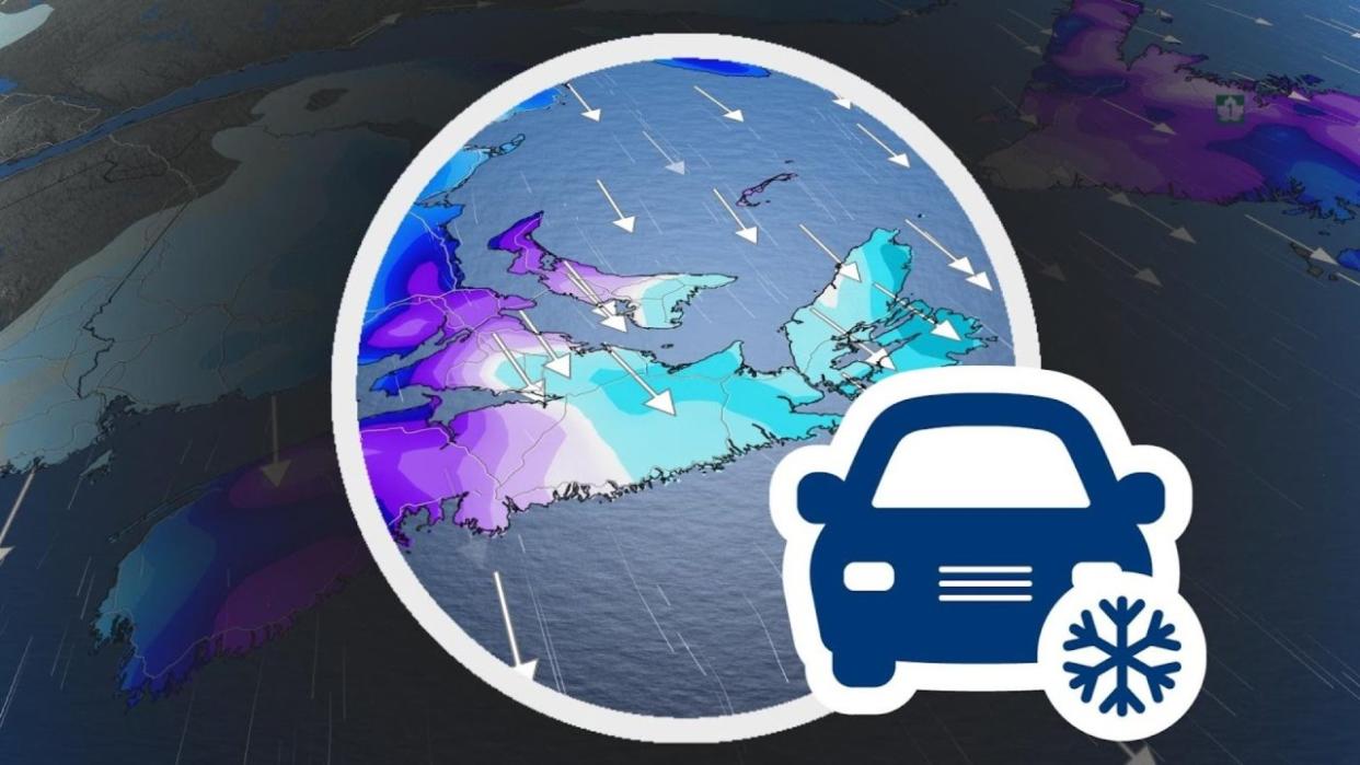
Residents on the East Coast hopefully stored enough storm chips to last through the weekend because that's how long they can expect the latest round of heavy snow and strong winds to persist for.
In fact, it is likely to even stretch into Monday, impacting travel plans and work commutes until then. People are being asked to avoid unnecessary travel.
MUST SEE: El Niño and the polar vortex take centre stage for winter’s final chapter

Confidence is greatest that Cape Breton and parts of Newfoundland will see the most substantial snowfall totals by the time snow finally stops early next week.
Visibility may be suddenly reduced at times in heavy snow. Surfaces such as highways, roads, walkways and parking lots may become difficult to navigate due to accumulating snow. Heavy snowfall accumulation may cause tree branches to break.
In fact, around 5,000 Nova Scotia Power customers are in the dark as of Saturday morning. That will likely fluctuate through the weekend.
East Coast on track to see substantial snowfall
An unusual stalling low-pressure system will be dancing off the coast of Nova Scotia, bringing the highest snowfall totals of the entire season for a big swath of Atlantic Canada.
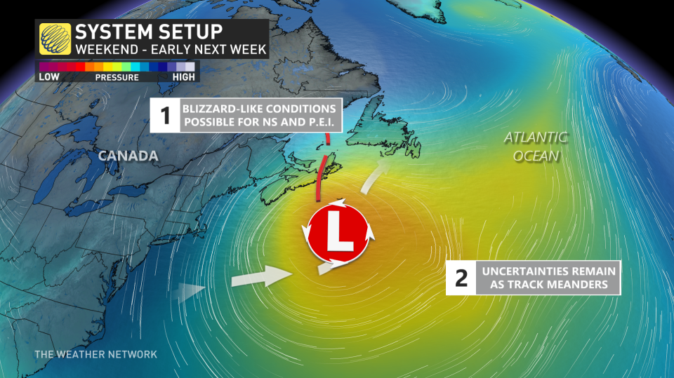
A low-pressure system is going to hit the pause button and stall just southeast of Sable Island for 48 hours. An arctic high over Labrador will supply the cold air, which will be a blockbuster snowfall event for those in the eastern Maritimes and central Newfoundland.
WATCH: Treacherous travel this weekend across Nova Scotia, stay home if you can
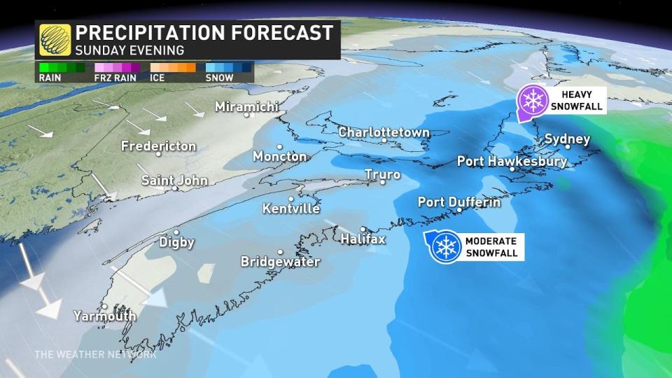
Sunday
Conditions improve for Halifax, but become even more intense across Cape Breton and those communities along the Northumberland Strait. While snowfall rates remain below 1 cm an hour for Halifax, it’s possible they’ll be as high as 5 cm per hour across Cape Breton.
KNOW THE SIGNS: How shovelling heavy snow can lead to heart attacks
If your county is listed below, may special attention to the weather forecasts the next 24 hours and reserve travel for emergency situations only.
Antigonish County
Inverness County
Victoria County
Cape Breton County
Richmond County
Guysborough County
WATCH: Halifax continues to see high winds and heavy snowfall totals through weekend
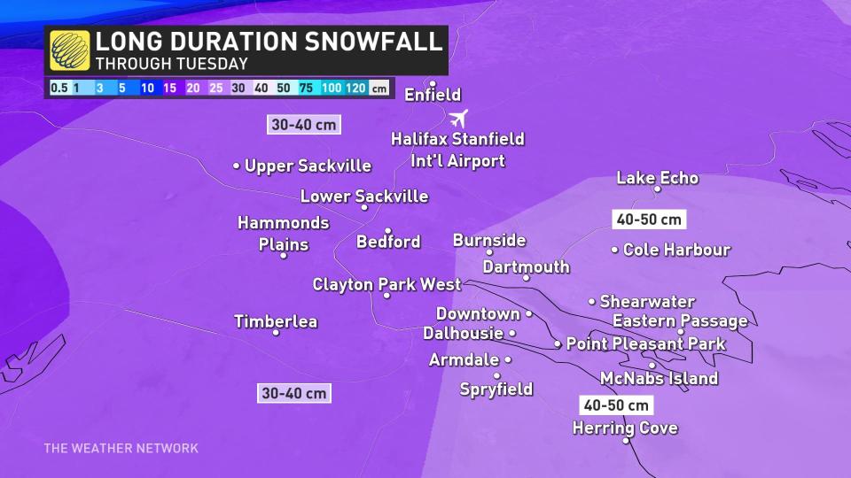
Reported and forecast snowfall totals throughout the event
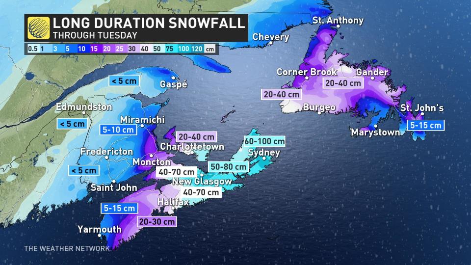
Over 40 cm of snowfall is forecast for the city of Halifax, but that will be on the lower range of what is forecast across eastern Nova Scotia through Tuesday morning.
Cape Breton looks to be the "sweet spot" for this storm. East of Truro, along Highway 104, is where the totals really pile up passed half a metre of snowfall.
New Glasglow, 60-80 cm of snowfall is forecast through Tuesday morning, including Antigonish, as well.
These communities listed here are forecast so see an obscene amount of snowfall over the next 60 hours. Guysbrough, you’re looking at over 80 cm of accumulated snowfall.
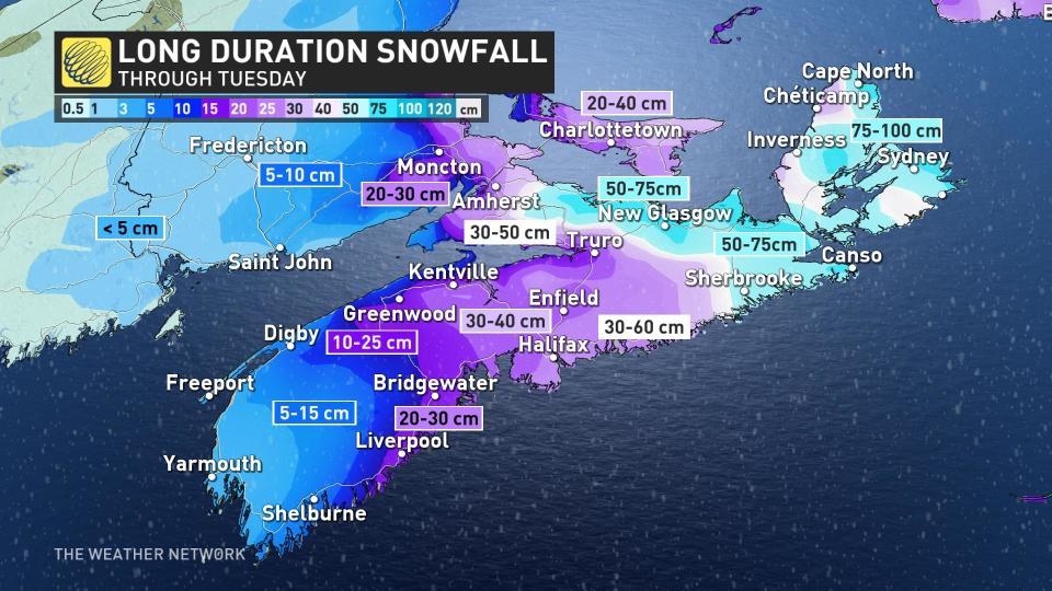
The Cape Breton region, including Sydney and Glace Bay, are forecast to see up to 100 cm of snowfall accumulation.
With these snowfall rates forecast, a long-duration blizzard is likely to linger through much of Sunday.
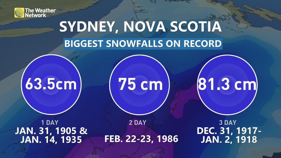
Although the single-day snowfall record is safe, the two- and three-day snowfall records are in serious jeopardy. With more than 80 cm of snowfall forecast through Monday, it will make this one of the greatest snowstorms in history for Sydney, N.S.
Just 5-15 cm of snowfall is forecast for St. John’s and the Avalon as warmer air eyes the peninsula, causing much more mixing. Farther Inland, and west along the Trans-Canada Highway, expect 20-40 cm of snow from Gander to Deer Lake.
Gusty winds of 60-80 km/h will accompany the snowfall across Newfoundland, leading to a risk for near-blizzard conditions during periods of moderate to heavy snowfall.
Much like we’ll see in the Maritimes, travel will be difficult if not impossible during these whiteouts.
The storm will eventually weaken and depart the area early Tuesday morning.
Stay with The Weather Network and continue checking back through the weekend as forecasters break down the details on this long-duration snowstorm across Atlantic Canada.

