Ontario faces its warmest stretch of summer through Labour Day

It certainly hasn’t been a hot summer across much of Ontario, but the season is bound for a strong finish in the days ahead as a ridge of high pressure promises the region’s hottest stretch of temperatures so far this year.
It’s been nearly two months since some communities in southern Ontario reached the 30-degree mark, and most went all of August without hitting that symbolic mark.
That streak is on borrowed time this long holiday weekend as a spell of muggy heat is on track to stick around through the beginning of the week.
LOOK AHEAD: Warm or cool? Reversing patterns to dominate Canada in September

An unseasonably cool August failed to see any days with a high temperature of 30°C or warmer for much of the province. This was the first time in 15 years that Toronto failed to hit 30 degrees during the month of August.
Most folks across southern and eastern Ontario haven’t seen a daytime high of 30°C or warmer since July, with London, Kingston, and Cornwall making it nearly two full months without reaching the mark.
We’ll see that trend reverse in a hurry as we head into the first full week of September. Widespread heat warnings are in effect across Ontario as the hot temperatures and stifling humidity build in the days ahead.

A strong ridge of high pressure building over the Great Lakes will have millions waiting a little longer for fall, even as school buses hit the road this week and pumpkin spice-flavoured everything lines the shelves.
Sinking air beneath the ridge, combined with bright sunshine and humid winds blowing into the region, will lead to an extended spell of warm and muggy conditions across Ontario.
MUST SEE: Full house: Atlantic packed with storms as peak season approaches
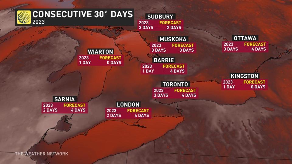
Daytime high temperatures will likely crack the 30-degree mark several days in a row for many communities. Forecasters expect most major cities, including Toronto and Ottawa, to see their longest stretch of 30+ degree highs of the summer through next week.
Toronto’s latest forecast calls for four days in a row of 30°C or warmer, besting the previous streak of three days hitting the mark.

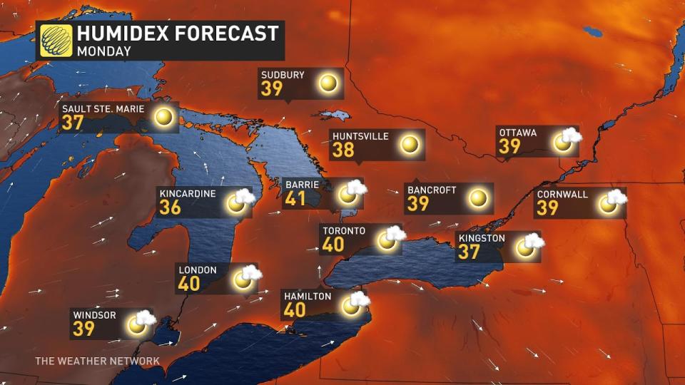
Monday could rival the city’s warmest temperature of 2023, which currently stands at 32.3°C back on June 2. This is also likely to be the first time Toronto’s cracked 30 degrees during the month of September in three years.
The humid warmth will even push deep into cottage country and northern Ontario.
Several days of very warm temperatures are on the way for Barrie, Muskoka, and even farther north into Sudbury.
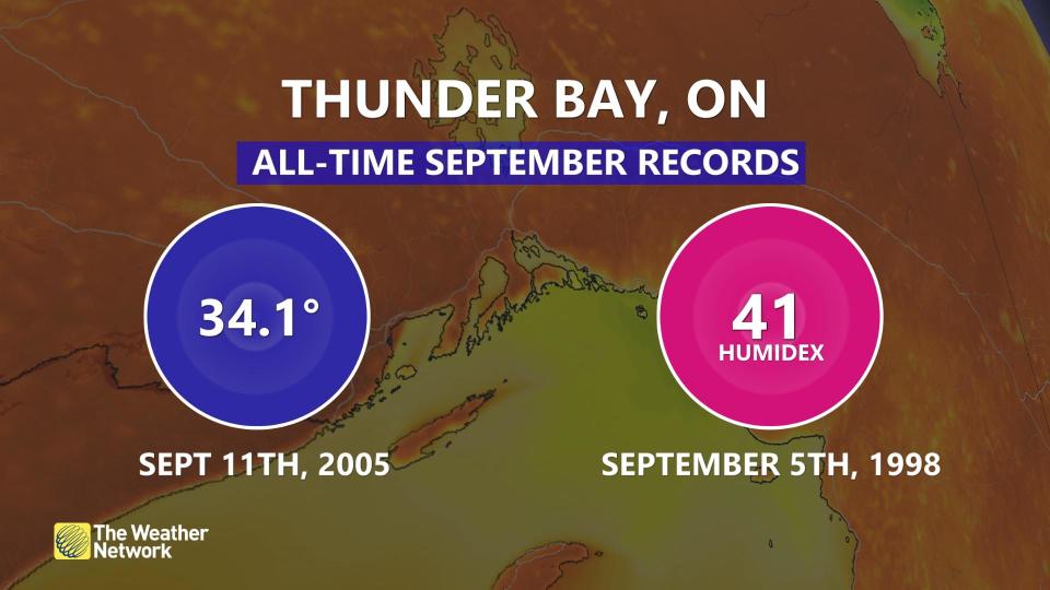
Thunder Bay will get in on the heat, as well, where Sunday’s predicted humidex of 43 could smash the month’s old record of 41 set back in 1998.

RELATED: The importance of staying hydrated in warm weather
While next week’s forecast is perfect for those who never want summer to end, the muggy conditions and bright sunshine carry dangers of their own.
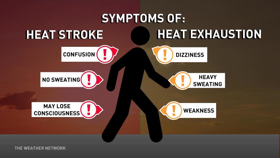
It’s easy to overdo it in heat like this, especially with feels-like values creeping beyond 40 at times throughout Ontario. Even the fittest folks are susceptible to heat-related illnesses. Stay hydrated, take frequent breaks, and stay up on the symptoms of heat exhaustion and heat stroke.

The arrival of September marked the start of meteorological fall, though the autumnal equinox doesn’t officially occur until the wee morning hours of Saturday, September 23.
Join us for the release of our 2023 Fall Forecast on Wednesday, September 13. Our experts will take a look at temperature and precipitation trends for the upcoming season, revealing what you can expect during this highly changeable season across Canada.
WATCH: What longer, hotter, and more frequent heat waves means for your health
Stay tuned to The Weather Network for more forecast updates for Ontario.


