
Severe thunderstorms, flooding downpours to blast Southeast into next week

AccuWeather meteorologists are watching a series of storms that will bring rounds of heavy rain and the risk for severe thunderstorms, including tornadoes, across the Southeast.
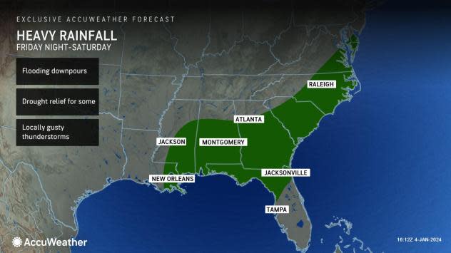
The same expansive storm that is expected to spread accumulating snow in the Ohio Valley and the Northeast will bring heavy rain and thunderstorms from the Gulf Coast into the Southeast Friday into the weekend. While the rain will be largely welcomed since ongoing extreme to exceptional drought remains across parts of the lower Mississippi and Tennessee valleys, it will come with the risk of flooding downpours.
 |
Along with the heavy rain, there is the risk of locally gusty thunderstorms as the system moves through the region, including the chance for a few strong thunderstorms with damaging winds.
"With the more stable air in place ahead of the storm, this should keep any risk of severe weather lower overall. The risk is non-zero though, as we are watching the Gulf Coast Friday and across the Florida Peninsula Saturday," said AccuWeather Meteorologist Joe Bauer.
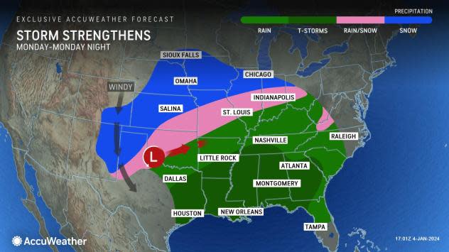
A higher threat of severe weather is in store for next week, as another powerful storm is poised to impact the central and eastern United States.
 |
The new storm will draw in moisture and warmer air from the Gulf of Mexico, setting the stage for a higher risk of severe weather across the Southeast Monday and Tuesday.
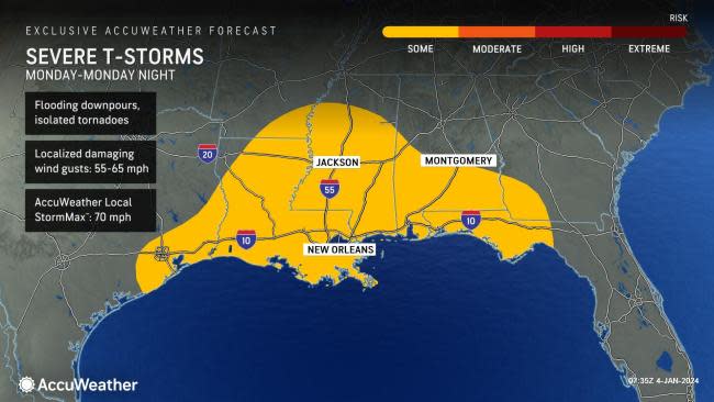
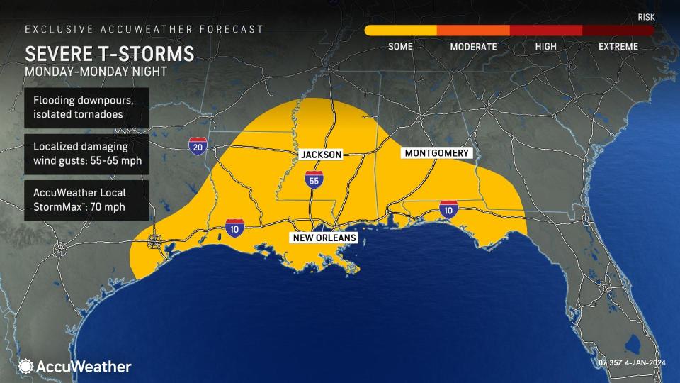
Monday into Monday night, the risk for severe weather is expected to focus across the Gulf Coast states from far eastern Texas, including Houston, into the panhandle of Florida. All modes of severe weather will be possible, including damaging wind gusts and isolated tornadoes.
 |
Forecasters are also concerned about the threat of nocturnal tornadoes, as severe storms are expected to continue into the night.
"A nocturnal tornado threat is especially dangerous since people are often asleep or cannot see the tornado approaching, so it is of critical importance that people have a NOAA weather radio and have downloaded the AccuWeather app and have their severe weather alerts enabled," said Accuweather Senior Meteorologist Dan Pydynowski.
Along with the severe weather potential, the potent storm will spread heavy rain across the Gulf Coast and Southeast early next week, raising flooding concerns. Those traveling in the air and on roadways are urged to be prepared for travel disruptions due to the heavy rain.
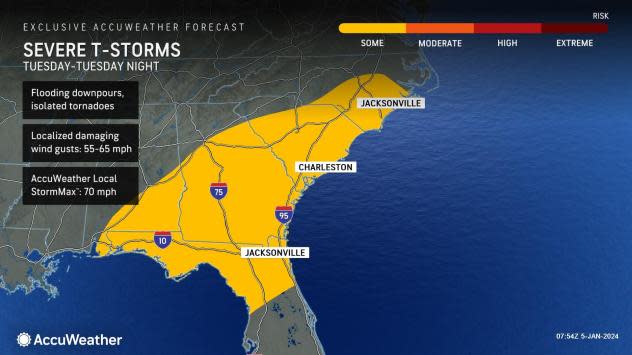
The risk for severe weather will push eastward on Tuesday, impacting an area stretching from southern North Carolina into northern Florida. Many of the same severe weather threats on Monday will also be seen on Tuesday.
 |
Outside of the Southeast, AccuWeather meteorologists are watching for the potential for accumulating snow across the Plains into the Great Lakes on the northern side of the storm. Strong, gusty winds are expected to accompany the storm, creating the potential for blizzard conditions in the Plains. Check AccuWeather often for updates on the storm.
Want next-level safety, ad-free? Unlock advanced, hyperlocal severe weather alerts when you subscribe to Premium+ on the AccuWeather app. AccuWeather Alerts™ are prompted by our expert meteorologists who monitor and analyze dangerous weather risks 24/7 to keep you and your family safer.
