
Tornadoes, egg-sized hail and damaging winds forecast in Wichita area and Kansas
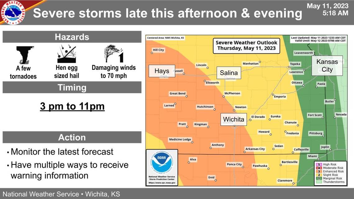
Egg-sized hail, damaging winds and a few tornadoes will be possible Thursday afternoon and evening in a large swath of Kansas that includes the Wichita area, according to the National Weather Service.
The severe weather is expected to hit an area west of Hutchinson between 3-6 p.m. before moving on to the Wichita area between 6-9 p.m. The severe weather alert — when you should be on the lookout — for the Wichita area is between 3-11 p.m.
The Wichita area is in a large swath, which includes most of western Kansas, under the highest risk of severe storms across the state. On a one to five scale, that area is a three, or enhanced risk. An area to the east of Wichita, which includes El Dorado, is under slight risk and then the eastern part of the state, just past Chanute, is under marginal risk.
The most severe weather could bring tornadoes, egg-sized hail and damaging winds up to 70 mph. To better protect yourself, monitor the weather in multiple ways, like TV, phone and radio, and have a plan of where to go if a tornado hits.
Severe storms will be possible for areas generally west of I-135 in the 3 to 6 pm time frame and for locations along and west of I-135 in the 6 to 9 pm time frame. #kswx pic.twitter.com/rfZ36SdMrk
— NWS Wichita (@NWSWichita) May 11, 2023

