
Multi-day bouts of freezing rain impedes travel in eastern Ontario, Quebec
A prolonged period of freezing rain will slick up travel conditions for millions of motorists across eastern Ontario and southern Quebec. Expect dicey roads Thursday and Friday.
Freezing rain warnings are in place across eastern Ontario and parts of southern Quebec, even extending as far west as parts of cottage country.
Slow down driving in slippery conditions. Watch for taillights ahead and maintain a safe following distance. Surfaces such as highways, roads, walkways and parking lots may become icy and slippery.
Ice buildup may cause tree branches to break. Utility outages may occur. Be prepared to adjust your driving with changing road conditions.
DON’T MISS: Winter takes a breather in major Canadian cities with January thaw
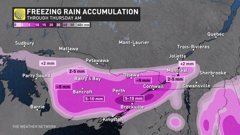
Into Thursday: Prolonged freezing rain threat
Expect a tricky commute into work Thursday morning. A prolonged period of freezing rain may have some seeing significant ice accretion on surfaces.

Freezing rain began Wednesday afternoon in for Bancroft, Brockville and Perth, Ont., eventually spreading east into Cornwall and Ottawa, Ont., then hitting Montreal, Que., Wednesday evening.
RELATED: Rounds of rain, mild temperatures to wash out recent snow in southern Ontario
Stubborn-cold air at the surface will allow the falling rain to freeze on contact with roads, sidewalks and trees, creating a glaze of 2-5 mm of ice waking up Thursday morning. This will not only create slippery surfaces on untreated objects, but also increases the risk of a few localized power outages.
It is possible for some areas around Montreal to see some snow and ice pellets through the overnight period, which could hide or make some of the ice hard to see.
Expect the icy conditions to linger through Thursday morning, with near 10 hours of icing possible.
Drivers are urged to check current highway conditions before venturing out during this time.
Friday: Another round of icy weather to watch
Forecasters are tracking a second freezing rain setup in the same region for Thursday overnight through Friday. While there's still some uncertainty at this time, especially when it comes to exact totals and locations impacted, very similar ingredients are present.
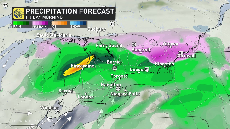
By Friday morning, freezing rain is expected to build into the same region of eastern Ontario, eventually spreading into Montreal and the southern St. Lawrence. Where this forecast gets tricky is in the storm’s track, and how far north milder air may get.
There is a growing chance the region sees freezing rain to start, with an afternoon switch to rain likely for most, but not all areas. Conditions will likely clear up by Saturday.
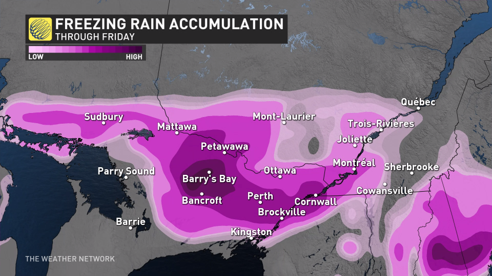
Meanwhile, Trois- Rivieres and Quebec City will likely hold onto 5-15 cm of snowfall through the event. Check back with us as we nail down your forecast.
A couple days of colder weather are forecast early next week, especially for eastern Ontario, but much milder weather and early spring-like temperatures are forecast for the second half of next week, continuing well into the first week of February, as well.
However, winter is not over. We are watching the potential for an extended stretch of colder winter weather from mid-February through early March.
Stay with The Weather Network for the latest on your forecast across Ontario.

