
Why do islands impacted by Hurricane Beryl appear brown in satellite imagery?
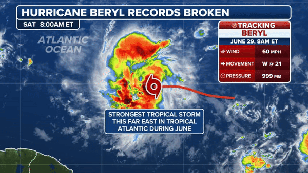
A record-breaking hurricane that impacted the eastern Caribbean around July 1 left some islands scarred to the point that damage is now visible from space.
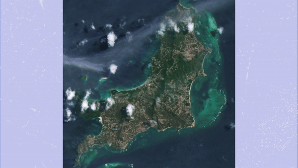
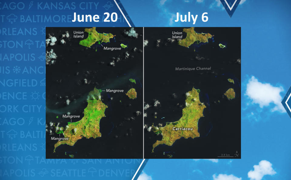
NASA recently released imagery of Carriacou Island, which took a direct hit from Category 4 Beryl with sustained winds around 150 mph.
The major hurricane reportedly damaged nearly every structure on the island, with at least two deaths attributed to the storm.
Imagery taken before the strike showed the lush green landscape, with structures that were centered around the coast.
After landfall, the vegetation appeared brown in color from space, with evidence of debris strewn around the islands.
Jess Zimmerman, an ecologist professor of ecology at the University of Puerto Rico, said Beryl’s intense winds likely defoliated many of the trees.
"All vegetation would have been defoliated," Zimmerman stated. "Thus, the brown is the exposed wood."
BEFORE-AND-AFTER PICTURES SHOW DEVASTATION TO CARIBBEAN AFTER BERYL SLAMS ISLANDS
NASA specialists said hurricanes are known to disturb temperate and tropical forests, but Carriacou’s deciduous and dry thorn-scrub forests took an extremely hard hit.
"Due to the island’s relatively low topographic relief, little of the plant life would likely have been spared from Beryl’s raging winds," Zimmerman stated.
The images are courtesy of Landsat 8, which was launched in 2013 and can capture data across multiple spectral bands, ranging from visible light to infrared waves.
NASA says healthy plants appear bright green because they reflect near-infrared light, whereas Carriacou’s have lost their bright-green signature, indicating widespread damage.
Significant storms are also known to uproot mangrove trees, which can impact ecosystems and water quality along the shore.
HURRICANE BERYL BECOMES UNWELCOME GUEST TO COUPLE’S ANNIVERSARY CELEBRATION IN STORM’S PATH
Significant impacts were also reported in Jamaica, Mexico’s Yucatán Peninsula and the Texas coastline.
Satellite imagery has not shown the same level of destruction to the vegetation, which could be a result of differences in terrain or the strength of the storm.
Initial damage estimates from private firms stated insured wind and storm surge losses in the Lone Star State were between $700 million and $1.5 billion, but the figure would likely rise in the days after the disaster.
Original article source: Why do islands impacted by Hurricane Beryl appear brown in satellite imagery?

