
Monday on repeat: More storms brewing across eastern Ontario, Quebec Tuesday
After a day of widespread active weather across parts of Ontario and Quebec on Monday, Tuesday may feel a bit like déjà vu for folks in eastern Ontario and southern Quebec as the slow-moving low pressure system driving this active weather makes its way east.
DON'T MISS: Forecast calls for flexible plans for your long Canada Day weekend
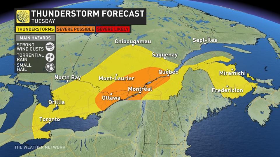
Tuesday
Areas: Eastern Ontario, including Ottawa; southern Quebec, including Montreal
Timing: Through the afternoon and early evening
Weather: The same humid air mass means torrential rain that may disrupt commutes will once again be on the table. Localized rainfall amounts over 50 mm is possible with these storms, and since they’ll be moving quite slowly, that this will increase the threat of some flooding.
SEE ALSO: The science and celebration of the Summer Solstice
The greatest risk of severe thunderstorms will be across southern Quebec, where the upper-level winds will be more organized. The severe storm threat will be diminished across eastern Ontario compared to Monday, but we’ll still watch for a storm that approaches severe limits -- particularly closer to Highway 401, east of Brockville.
Confidence: High confidence for the development of widespread shower and thunderstorm activity, similar to Monday
Going forward
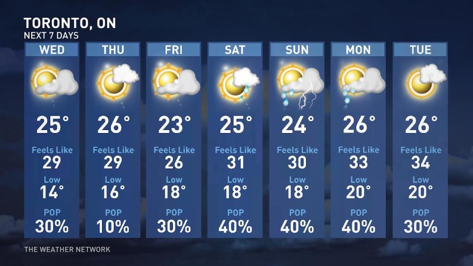
The Greater Toronto Area will see its final day of pop-up thunderstorm activity on Tuesday, with Wednesday looking quite fair and dry.
Unfortunately, the smoke will once again return to southern Ontario Tuesday and Wednesday. This time in a special way. This current low pressure system that is bringing in severe thunderstorms and heavy rainfall will also be responsible for sending the wildfire smoke all the way into Michigan and southwestern Ontario.
The winds around this low pressure system travel counter-clockwise, allowing the smoke to travel southwards and impact Sarnia, Windsor, and London on Tuesday, as well as the GTA by Wednesday.
Current indications are that Canada Day looks unsettled with the risk of thunderstorms and some natural fireworks possible as another trough moves in.
Keep checking back to The Weather Network for more forecast information and updates for Ontario and Quebec.

