
Road closures possible as 30-40 cm of snow bury northwest Ontario

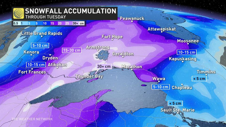
A prolonged snow event is underway across northwestern Ontario as a sprawling storm creeps toward the region. Folks around Thunder Bay could see 30-40+ cm of snow over the next couple of days.
Expect widespread and long-lasting travel issues across the region, including along the Trans-Canada Highway. Road closures are possible at times, especially on Tuesday during the most impactful conditions.
DON'T MISS: Canada’s widespread drought may fuel the upcoming wildfire season
Expect persistent snows through Wednesday
This latest bout of disruptive weather arrives courtesy of a Colorado low moseying across the region. Some communities down in Kansas endured tornado warnings and blizzard warnings at the same time as this system ramped up on Sunday.
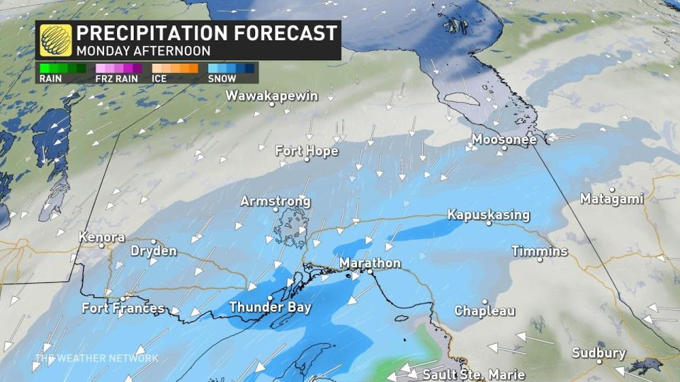
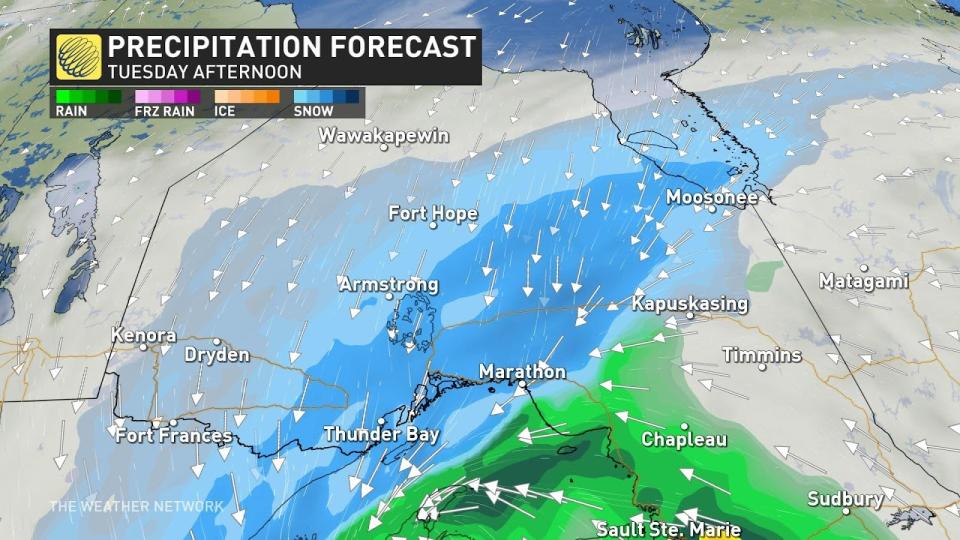
We’re looking at the potential for 48 to 60+ hours of snowfall across much of northwestern Ontario. Snow arrived late in the day Sunday. Residents can expect periods of snow to continue straight through the day Monday and Tuesday before the system finally pulls away and tapers off into Wednesday.
Residents can expect snowfall rates of about 1 cm per hour through Monday. The heaviest snows will arrive during the day Tuesday as the storm reaches peak strength and snowfall rates approach 1-3 cm per hour north of Lake Superior.
STAY SAFE: Be aware of your heart while shovelling heavy snow
Gusty winds will lead to blowing snow and poor visibility on Monday and Tuesday, especially near the Lake Superior shores and during periods of heavy snow.
The sheer duration of snowfall expected throughout the area will contribute to the impressive snowfall totals forecasters expect through Wednesday. Some areas may see 30-40 cm of snow by Wednesday morning, including Thunder Bay.
This will be a heavy, wet snow for many communities. Please use extra care while shovelling over the next few days.
There remains some uncertainty in precise totals, though, as some models show the potential for even higher totals near the shores of Lake Superior. On the flip side, a small westward shift in the storm’s track could bring milder air into the region. This would force rain to mix in at times and reduce snowfall totals.
Regardless of the final totals, travellers can expect treacherous road conditions during the storm, especially along the Trans-Canada Highway and Highway 11. Road closures are a real possibility. Consider postponing non-essential travel until conditions improve.
MUST SEE: How the tropics help produce big springtime snows on the Prairies
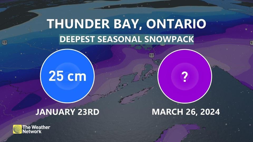
Thunder Bay is one of many communities across Canada affected by a snow drought this season. The city witnessed a rare ‘green Christmas’ this past December, and the deepest snowpack at the airport only amounted to 25 cm at the end of January.
The onset of spring is no match for a far-reaching storm. Early spring storms can generate more bountiful snows than their mid-winter counterparts because of the abundance of tropical moisture surging north out of the Gulf in March and April.
Header image courtesy of Lorenzo Joseph.
Be sure to check back for the latest weather updates across northern Ontario.

