
Seekers of heat and storms in southern Ontario may be disappointed, again

Thirty-degree temperatures are sweeping across Ontario, Quebec and Atlantic Canada -- but if you're seeking the heat in Toronto, you may end up disappointed, yet again.
One of Ontario’s most northern towns, Moosonee, continues to add tallies for 30-degree days -- healthily beating Toronto’s mere three in May and June so far. So what gives? Two words: Rex block.
SEE ALSO: Global pattern in turmoil; Flip to El Niño triggers come-and-go summer
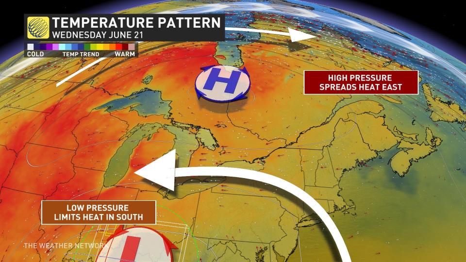
A Rex block is a fancy term meteorologists use to describe Eastern Canada’s current atmospheric setup. A ridge of high pressure in the Far North will usher in southerly air and sunshine into Atlantic Canada by the weekend.
Typically this is all we would need for summer or extreme heat, or even a heat wave in southern Ontario. Instead, joining the party is a cutoff low. It’s sluggishly approaching southern Ontario from stateside and will drive this weekend's weather in a much different direction.

Increasing cloud cover and chances for showers Friday into Saturday will limit daylight, and keep temperatures cool and comfortable. While some in the south, such as Windsor and London, may still see temperatures creep into the 30s, Toronto’s chances are looking extra slim.
Adding to the seasonably cool weather are winds from the east. This direction blows cooler air above Lake Ontario directly to the lakeshores, keeping the Golden Horseshoe below seasonal for the most part.
This isn’t bad news for the city.
Those without proper air conditioning or those who experience heat sensitivity can breathe a sigh of relief. Meanwhile, expect heat warnings to continue to be misplaced in the north. Northern Ontario, much of Quebec and parts of Atlantic Canada will experience 30-degree summer heat heading into the first weekend of the summer solstice.
A major concern is that the hot and dry outlook for these regions will increase fire danger ratings once again, in addition to little rain relief for those already ongoing.
Storm seekers also let down by recent forecast
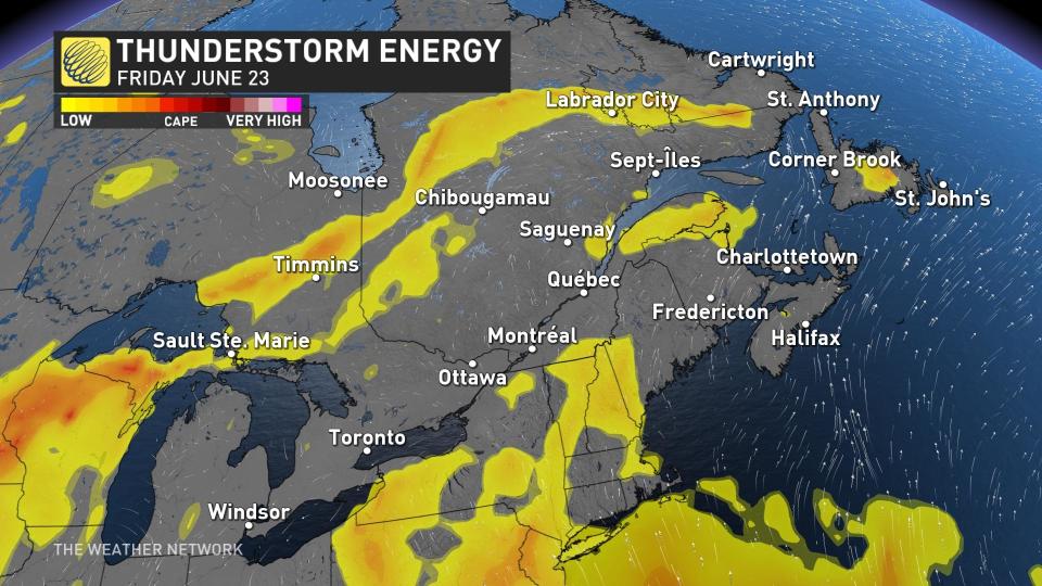
If you think you might catch more than just some lightning and rainfall with this weekend’s showers, think again. For more potent thunderstorms, we need those higher temperatures that we just aren’t getting.
Warmer temperatures create a more unstable air mass for classic summer pop-up thunderstorms, and also adds to the energy pool over the region. The thunderstorm potential will continue to follow the boundary, where the hot and cool air meet, bringing risks in the north once again.
But, on Saturday, the cold front riding the boundary could slip south into Toronto, which will be the city’s best shot for stormy summer weather.
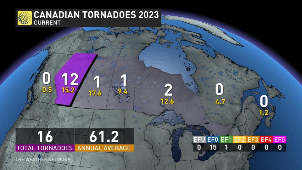
If you want to see how quiet the storm season in southern Ontario, one only needs to look at the current number of tornadoes in the region this year, or the lack of.
With files from Nathan Howes, a digital reporter at The Weather Network.

