
SLO County gets a perfect day for eclipse viewing. See the photos
A total eclipse blotted out the sun across parts of the East Coast and Midwest Monday, giving millions a firsthand view of a rare astrological phenomenon.
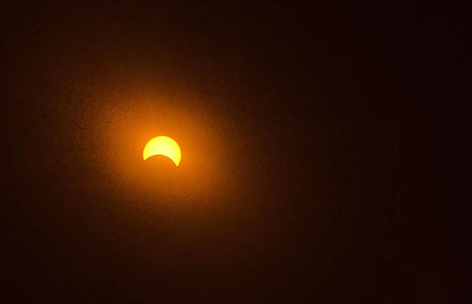
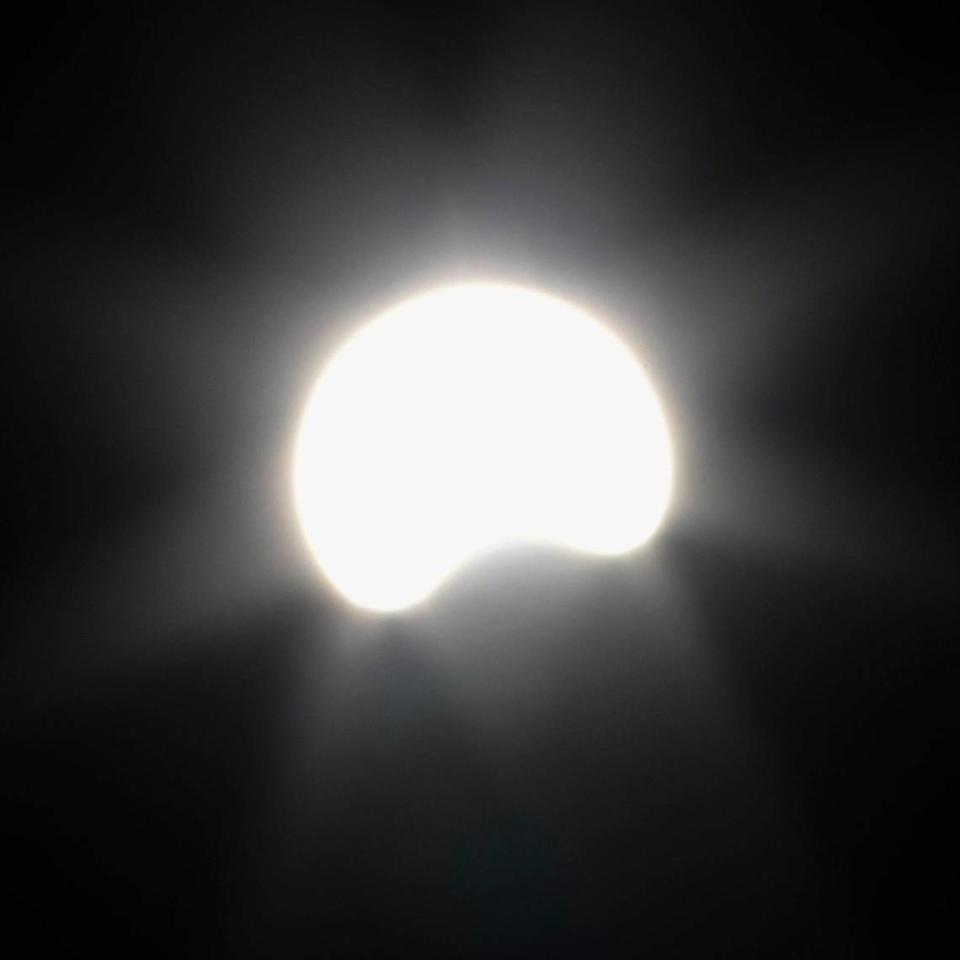
In San Luis Obispo County, the eclipse maxed out at a bit more than 40% before the moon began to retreat.
But clear, bright skies made for excellent viewing on the Central Coast.
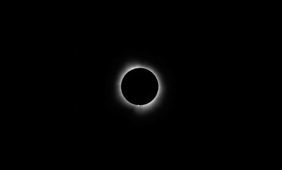
Tribune reporter John Lynch was in central Indiana on Monday in the path of the totality and captured photos of the event. The moon began to cross the Sun’s path around 1:45 p.m. EST and reached a total eclipse around 3:17 p.m. EST.
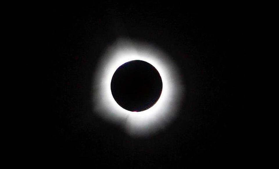
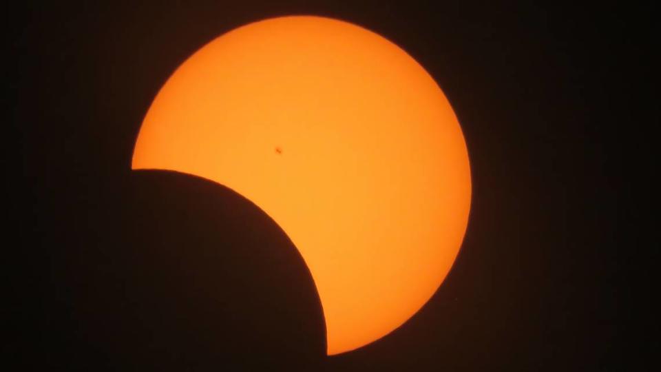
As the eclipse grew to totality, light gradually began to dim, getting darker by the minute until the sun was completely obscured by the moon’s path, leaving only a silvery ring of light that could be observed by cameras and people with safe viewing glasses.
The total eclipse darkened the daytime sky to nighttime levels, making stars and other extraterrestrial bodies temporarily visible in the middle of the afternoon.
How did the eclipse look from San Luis Obispo?
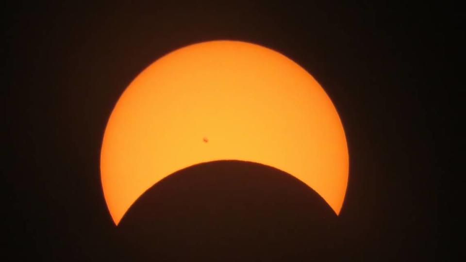
Also known as the Great North American Eclipse, the astronomical event appeared as a partial eclipse for other parts of the U.S., including California.
San Luis Obispo County was able to observe a partial solar eclipse of nearly 41.6%, peaking at 11:11 a.m., according to an interactive map by National Solar Observatory. The eclipse grew for about an hour before reaching its peak and then receding.
San Diego saw the most substantial portion of the eclipse in California — 53.9% — as it swept northward, while Los Angeles saw 48.9% of the eclipse, according to NationalEclipse.com. San Francisco saw about 34%.
Did you capture a great photo of the eclipse in SLO County? Send your photos to jlynch@thetribunenews.com.

Those in the path of totality. #eclipse pic.twitter.com/2kAXHYTzXY
— Greg Fiske (@g_fiske) April 3, 2024
What was in the path of totality?
The National Solar Observatory interactive map shows a path of totality that stretches from Mexico to the United States.
Mexico’s Pacific Coast was be the first location in North America to see the eclipse totality, at 11 a.m., Pacific Time.
“The path of the eclipse continues from Mexico,” NASA said, “entering the United States in Texas, and traveling through Oklahoma, Arkansas, Missouri, Illinois, Kentucky, Indiana, Ohio, Pennsylvania, New York, Vermont, New Hampshire, and Maine.”
It ended in Newfoundland, Canada, at 5:16 p.m. local time — or 12:46 p.m. Pacific Time.


