
Squalls begin to ease in Ontario, but the snow parade marches on
What a week it has been in southern Ontario, with a long stretch of lake-effect snow squalls that have led to hefty accumulations since last weekend, alongside extreme cold on Wednesday.
While the extreme cold will relax a bit, the snow will be staying with the region for the near future.
Going somewhere? Check out the current highway conditions before heading out!
Back-to-back system snowfall will spread across the Golden Horseshoe and southwestern Ontario Thursday, with more snow squalls and cold weather into the weekend.
The snow squalls will ease for most areas Thursday, but will linger for others. Consider postponing non-essential travel until conditions improve. If you must travel, keep others informed of your schedule and destination and carry an emergency kit and cellphone.
PHOTOS: Powerful snow squalls bury communities with knee-high totals
Multiple shots of snow Thursday and beyond

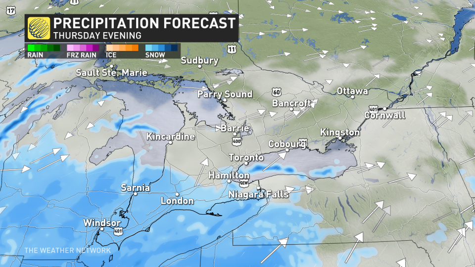
Lake-effect snow squalls will finally weaken in Parry Sound and the snowbelts by Thursday afternoon. However, the Niagara region and Prince Edward county will still battle intense snow squall weather, as well as widespread system snow.
Two weak systems will track south of the border, bringing widespread, accumulating snowfall through Thursday. Both morning and rvening commutes will likely be impacted, so expect a slower drive.
The first round begins Wednesday overnight into Thursday morning for Windsor, London, Hamilton, Toronto and regions to the south. The system snow will become disorganized by the afternoon, with a brief break until round 2 tracks through the evening.
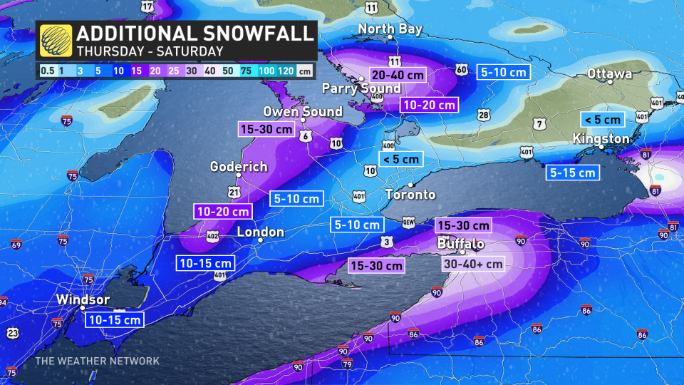
A very similar region will be targeted once again. Lake enhancement will likely bring heavier totals along the Niagara Peninsula, with persistent squall embedded within the system snow.
Near 5 cm is expected west of the Greater Toronto Area (GTA), 5-10 cm for Hamilton and London and near 10 cm for Windsor. The heaviest totals of 15-30 cm are expected along Lake Erie shores and the Niagara peninsula.
For Friday, lake-effect snow squalls fire back up, but they will originate from a different location. A change in wind direction is anticipated.
With winds coming from the northeast, bands off of Lake Huron and Georgian Bay will spill locally heavy snowfall along Highway 21.
RELATED: Why snow squalls are one of the hardest events to forecast
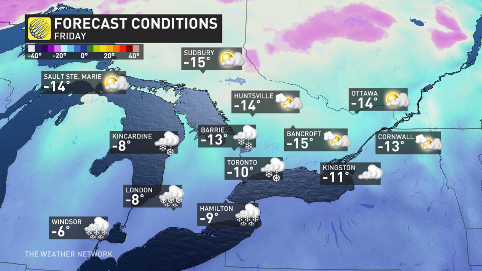
Cold weather will continue to be felt across southern Ontario until next week where a January thaw is anticipated to bring slightly warmer-than-normal temperatures.
That will be followed by a colder pattern once again for the start of February.
Stay with The Weather Network for the latest on this high-impact storm across Ontario.

