
Storm walloping parts of Newfoundland, with St. John's getting up to 85 cm of snow

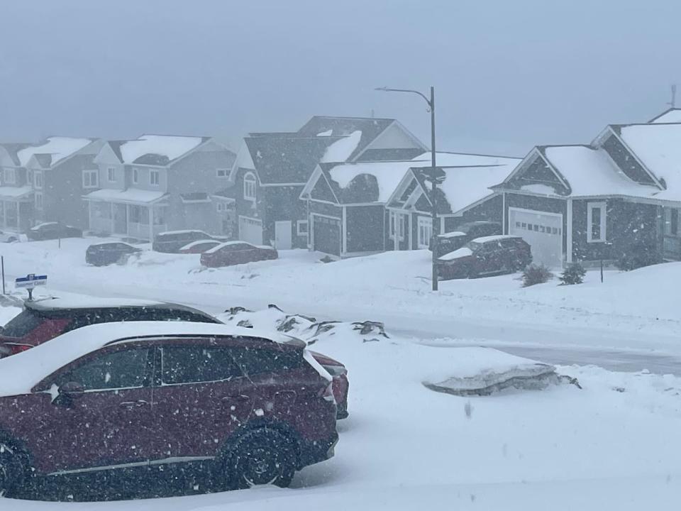
Schools, government offices and businesses are closed throughout parts of Newfoundland in the midst of a weather alert. An estimated 55 to 85 centimetres of snow is expected to fall in the St. John's area. (Daniel MacEachern/CBC)
Much of the Avalon Peninsula, including schools and public transportation, is shuttered Friday due to an ongoing storm bearing down on parts of Newfoundland.
Environment Canada has issued winter storm warnings for about half the island, stretching from the Avalon Peninsula to Buchans and the interior, as well as parts of the southern shore.
The weather service has forecast the St. John's area could see anywhere from 55 to 85 centimetres of snow.
According to NLSchools' status report, schools across the island are closed either for the full day or for the morning with updates to come.
Metrobus and GoBuses will also not be on the road and Memorial University's St. John's, Marine Institute and Signal Hill campuses, as well as its child-care centre, are not opening.
City of St. John's facilities and provincial government buildings in the city are also closed.
The storm is also affecting health-care services.
Newfoundland and Labrador Health Services has announced that all Eastern-Urban and Eastern-Rural zone administrative buildings, as well as community buildings and health sites that don't provide a 24-hour service, are closed. The exception is dialysis treatment centres at Mount Pearl Square and Clarenville's Coish Place.
Urgent-care services at Whitbourne's Dr. William H. Newhook Community Health Centre are also closed.
The Rooms, which is home to the provincial archive, museum and art gallery, will also not open and its planned public programs have been cancelled.
Newfoundland Labrador Liquor Corporation also won't open its liquor stores in St. John's, Mount Pearl, Paradise and Conception Bay South.
St. John's law courts, including the sheriff's office and family justice services, are also closed, as are the Autism Society's St. John's Resource Centre and Basilica of St. John the Baptist.
The Public Service Credit Union and Scotiabank locations in the St. John's area, Bay Roberts, Carbonear, Burin Peninsula, Clarenville and Bonavista also won't open Friday.
Justin Boudreau, a meteorologist with the Gander weather office, said as of Friday morning the island is about one-third of the way through the storm, which is expected to carry on until Saturday morning.
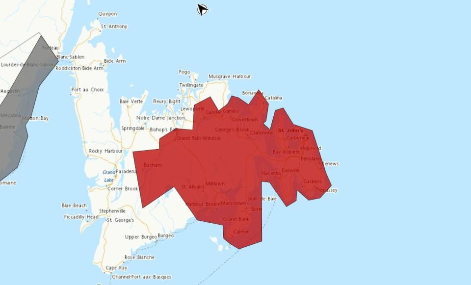
Environment Canada has much of Newfoundland under weather alerts for Friday. (Environment Canada)
In St. John's, he said, ice pellets should start to move southward in the morning and off the Southern Shore in mid-afternoon.
"After that, it's basically just a snowfall event moving forward," Boudreau.
"So tonight another 15 to 25 centimetres on top of that 20 to 30 from earlier today and two to four for Saturday. So it's just a little bit of extra sugar on top."
Boudreau said the ice pellets over the Burin Peninsula will probably change to just snow later in the morning, dumping 10 to 20 centimetres of snow Friday.
The Clarenville area is expected to get about 10 to 15 more centimetres of snow on Friday, after getting 20 to 25 centimetres Thursday night.
Saturday wrap up
Boudreau said by Saturday the conditions won't be as bad.
"The tail end won't be so bad because he'll be down in a sort of some more lighter snow. Still be pretty windy for most of the day but looks like the snow should taper off around noon on Saturday for sort of the northern area," he said.
Snowfall on the southeastern Avalon should taper off by mid-afternoon, he added.
However, he said, with so many different types of prescription in the the mix it can be challenging to make forecasts.
"It's pretty tricky just because there's such a difference between what areas would experience, sort of the just snow and then you've got to nail down that sort of snow-to-ice pellets [transition]. But then you also have to nail down the ice pellets-to-freezing rain," he said.
"As you might expect, it doesn't really follow the borders of our regions very well," he added with a chuckle.
He also said the weather conditions are also making it challenging to get accurate information in some areas.
"It does look like we probably won't be getting any good observations from the winds on the south coast because most of the anemometers are all frozen over."
Download our free CBC News app to sign up for push alerts for CBC Newfoundland and Labrador. Click here to visit our landing page.

