
Things heat up with a taste of early summer moving into B.C.
Temperatures are on the rise across the West Coast, with an early taste of summer-like weather arriving in British Columbia in time for the Mother's Day weekend.
DON'T MISS: Race to grab Canada's first 30 C this year heats up: Who will win?
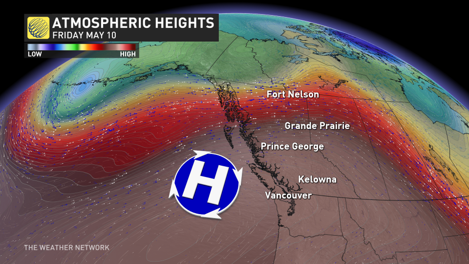
The pattern change has forced a ridge to build over the province, bringing a long stretch of very dry and unseasonably warm weather across the region this week. We're even talking the chance for some 30-degree heat, which would mark the first of the year for the country if reached.
Temperatures heat up through the weekend
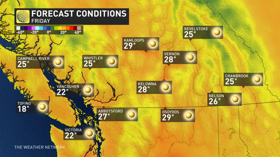
Temperatures will begin their steady climb on Thursday, with some areas seeing daytime highs about 10-12°C above normal for this time of year through the weekend.
Highs soaring into the upper 20s will be pretty widespread away from the coasts. By Friday, places like Squamish, Lytton, Kamloops and Osoyoos are all forecast to see a daytime high of 29°C, making it pretty likely for some communities to reach that first 30-degree day.
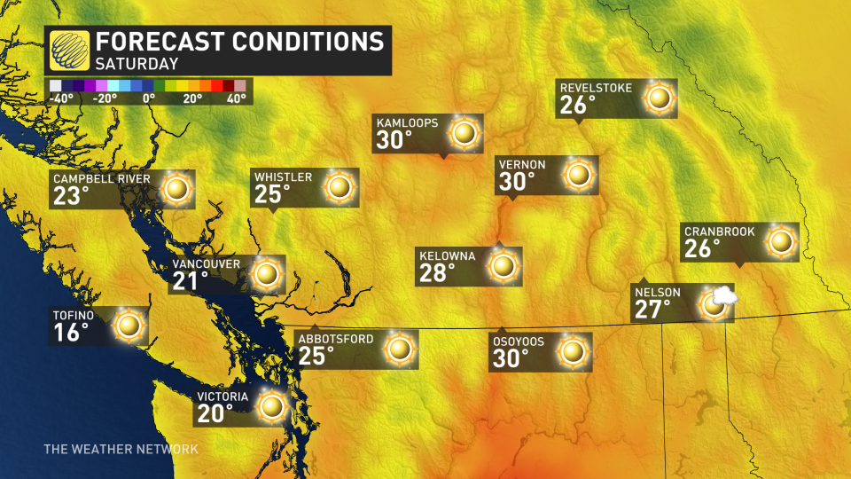
Temperatures will increase a degree or two more into Saturday, which will lock in the chance for several locations to hit 30°C, especially across the Interior.
Saturday will be the peak of the heat however, as the ridge begins to slowly break down on Sunday and into Monday.
This pattern will certainly dry out many locations that saw a stretch of gloomy and wet weather at the end of April. Though welcomed by summer lovers and heat-seekers alike, it's not the best news to have such dry and hot weather this early in the fire season.
The only bright side to this pattern is that the warmest temperatures will likely miss northern B.C., which has been hardest hit by the ongoing drought conditions.
CANADA'S WILDFIRES: Visit The Weather Network's wildfire hub to keep up with the latest on the active start to wildfire season across Canada.
A cooler pattern is expected to take shape for next week, though much of southern B.C. will remain within a few degrees of seasonal.
Southern B.C. will also be mostly dry in the long range, with an active and wet pattern likely for the northern and central coast.
YOUR MAY OUTLOOK: Spring into summer or a stalling spring ahead, Canada?
Stay tuned to The Weather Network for your latest forecast across British Columbia.

