
This week's exceptional warm spell won't be a freefall into summer, Ontario
After a turbulent start to the spring season, an extraordinary stretch of warm and dry weather has finally reached southern Ontario. In fact, this week features the longest stretch of dry weather since at least September 2022.
Temperatures for some will be more typical of May, and even a taste of June, later this week, with abundant sunshine making things feel ever warmer.

Toronto finally hit its first 20-degree day of the year on Monday, and there will be many more chances for that with the warmth continuing. Temperatures will soar to the low- to mid 20s, with a few spots possibly even hitting the upper 20s, feeling like 30, later this week.
A southwesterly flow is helping to minimize the lake-breeze influence, bringing warmth even to some coastal areas.
DON’T MISS: This week’s abundant sunshine will pack a severe sunburn risk
With the warmth, also comes a high UV index, with sunscreen application or sun exposure probably not currently at top of mind -- especially after southern Ontario just came out of the darkest winter in 76 years due to an active storm track and cloudy lake conditions.
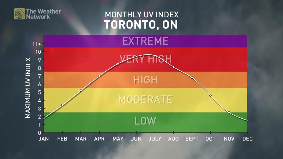
"We'll see a UV index of 6 to 7 (high), so use caution if you are planning to spend extended time outdoors," says Michael Carter, a meteorologist at The Weather Network. "Be careful with that patio lunch!"
Warning: This week won't be the freefall into summer that you may be hoping for
While it's been a long wait for this well-deserved spring warm spell, April is still a changeable month. We are not by any means locked into summer just yet. A classic Canada spring returns as early as next week.
A cold front is expected to track across southern Ontario on Sunday, possibly sparking a period of showers and thunderstorms.
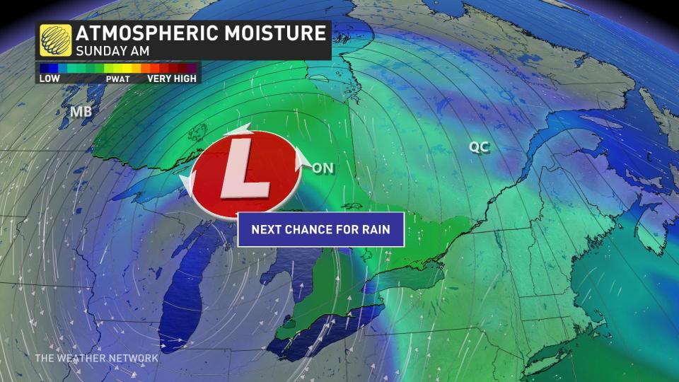
Conditions will then turn much colder behind the front, with temperatures sitting a few degrees cooler than seasonal early next week. For some, it will be nearly a 20-degree drop from the summer-like values that will span the region this week.
It's not just the drop in temperatures, either. Snow flurries are likely, especially across the higher terrain east of Lake Huron and Georgian Bay. Outlying areas may also see frost and the potential for grauple.
MUST SEE: Tick season really isn’t that far off. Get equipped to face it, here
Be sure to check back for the latest weather updates across Ontario.

