
This is Boise’s hiking Grand Slam: 34 miles, more than 10,000 vertical feet — close to home
This story was originally published in April 2017.
Tom Lopez, creator of the Idaho: A Climbing Guide website, came up with the Grand Slam peaks of the Boise area as a four-step training regimen for his summer climbs.
Over the years, others have latched onto the concept as a goal unto itself, or a circuit worth completing against the clock.
The trailheads for the four peaks are less than an hour from town, with one actually starting within the city limits. Their summits range from 4,987 feet to 6,336 feet, which makes them accessible earlier in spring than the more daunting mountains that climbers like Lopez attack in the summer.
Cervidae Peak — just north of Lucky Peak Lake — is short but relentlessly steep. Kepros Mountain, in the Danskin Mountains east of town, is a long walk on mostly rolling terrain. Lucky Peak is a challenging hike, right out of a residential neighborhood, with the most-established trail. And Mt. Heinen is the hike that will test your resolve with its terrain and sometimes-fuzzy trail.
“It’s good, varied terrain,” Lopez said. “You can start with Cervidae in February. The best way to get in shape is to hike. ... I always felt like once I did Heinen, I was ready for doing the big peaks.”
Lopez has hiked to each of the peaks at least a dozen times since he began tracking his ascents in 1990. Heinen is his favorite but he’s climbed Cervidae — by far the quickest climb on the list — the most (30).
Dan Paulson of Kuna, who climbs peaks all over the state, also uses the Grand Slam peaks for training.
“It’s almost like really slow, sustained interval work,” he said. “You go up something really steep, then you get a break, then you go up something steep, then you get a break. When you’re going up the bigger mountains, it’s a lot more sustained.”
In 2016, Erik Pohlmann of Boise cranked up the difficulty by biking all four peaks in one day (20 hours, 13 minutes). He covered 81 miles by bike and 12 by foot, including the distance between peaks.
“That’s pretty amazing what (Pohlmann) did — all self-propelled the whole way,” Lopez said. “Heinen is so far out of the way that it makes it hard.”
Another couple has recently broken the Grand Slam Peaks Speed Record. According to an article published on Lopez’s website, runners Anne Hamby and Matt Stallings climbed the Grand Slam peaks in 9 hours and 8 minutes with a driving time of 1 hour and 19 minutes, making their complete journey a total of 10 hours and 27 minutes.
Here are the details on the four peaks, in the order I’d recommend tackling them. For more detailed information, visit Lopez’s site, IdahoAClimbingGuide.com.
Kepros: A long walk
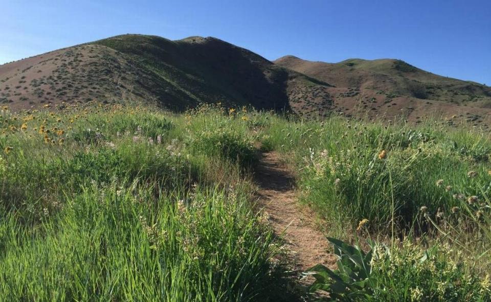
What to expect: Kepros is unique among the Grand Slam peaks in that there’s little challenging uphill hiking, but it’s a long hike and you have to do some climbing on the way out — always a bummer when your legs are tired. The hike begins on an easy-to-follow trail and eventually connects to a hunting road that you follow to the summit. That route follows the ridge line, with all its ups and downs. However, Lopez and the animals that roam the area have established several bypass trails that allow hikers to avoid some of the high points (detailed on Lopez’s website). I’m told the wildflower displays can be terrific, but the flowers hadn’t bloomed yet when I was there. It’s primarily a spring hike, with heat in the summer and hunters in the fall as deterrents.
Stats: The bypass routes create so many options that stats will vary. My hike totaled 9.2 miles. The elevation gain was about 1,200 feet on the way in (261 per mile) and 400 on the way out.
Location: Kepros is in the Danskins and is accessed from Blacks Creek Road, which is southeast of Boise off I-84 (exit 64). Go north, turn left toward Prairie and park in the large dirt area on the right side of the road. It’s 9 miles from the freeway. The trailhead is across the road from the parking area.
Cervidae: Up, up and more up
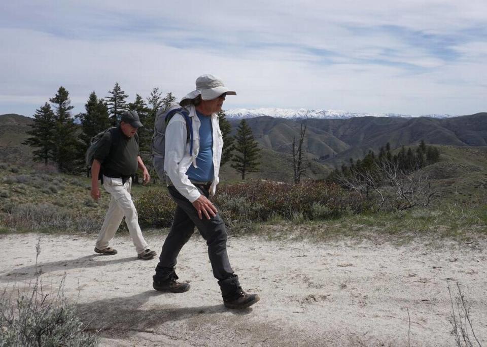
What to expect: This is the shortest Grand Slam hike with the lowest summit (4,987 feet) but it’s a relentless climb from the time you step out of your car. The hike proved popular with readers when we wrote about it in 2016 because of the easy access from town and the fantastic views of the Boise River’s reservoir system. However, some people found the climb more difficult than they’d like. The low elevation makes the peak accessible when some others aren’t and you can do the round trip in 2 1/2 hours, which makes it suitable for a weeknight. It is on the Boise River Wildlife Management Area, though, so it’s best to stay away when deer and elk are present. Dogs must be on-leash at all times. Interesting note: Dan Robbins named the peak after the animals that live in the area (elk and deer are part of the cervidae family).
Stats: It’s a 1,854-foot climb in 2.25 miles to reach the summit — an average of 824 feet per mile. The second mile climbs 968 feet.
Location: The east route begins from a large pullout on the right side of Arrowrock Road after you pass Spring Shores Marina. The parking area is 2.2 miles from Idaho 21. The trail begins on the gated road across the street.
Lucky Peak: The roof of the city
What to expect: The 5,908-foot summit of Lucky Peak (aka Shaw Mountain) might be the best picnic spot in town — and certainly one of the most difficult to reach. You’re treated to a sweeping view of the Treasure Valley, which seems impossibly far below considering your hike started in a residential area not far from the Boise River. The first segment, the Homestead trail, covers 2.1 miles and nearly 1,000 feet of elevation gain. This is a good trail to train on before attempting the entire hike. You’ll cover nearly 2,100 feet of elevation gain in the next 3 miles, a lung- and leg-searing hike.
Stats: From the Homestead trailhead, it’s a 10.2-mile round trip with 3,067 feet of elevation gain — an average of 601 feet per mile on the way up.
Location: From Warm Springs Avenue in East Boise, turn north on Council Spring Road. The trailhead is at the end of the road. You’ll take Homestead trail to Lucky Peak trail. Near the top, look for the narrow footpath hikers have established to shorten the hike. But you’ll climb 510 feet in a half-mile to reach the summit.
Heinen: Some route-finding required
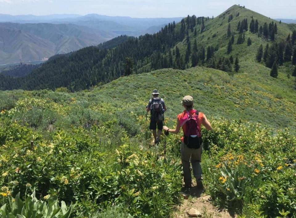
What to expect: The initial climb is brutally steep and slippery because of loose dirt/rock, which is as much of a problem on the way down as it is on the way up. But you can take your mind off that with gorgeous views of Arrowrock Reservoir and the Boise River. After that first climb, it’s a long, steady hike to the summit through some trees, bushes and fields of wildflowers. The setting is terrific. The summit sits at 6,336 feet.
Stats: Our hike covered 9.8 miles round trip. It was a 3,318-foot climb to the top — or 677 feet per mile. You’ll add another 300 or so feet of elevation gain on the way out. Total hiking time was 6 hours, about 90 minutes longer than any of the other Grand Slam hikes I took.
Location: The traditional route begins at the Irish Spring access to Arrowrock Reservoir, which is several miles beyond Arrowrock Dam. I recommend taking someone who’s gone before unless you’re comfortable finding your own way. On my hike last May, even someone who had visited Heinen before lost the trail.
Boise's Neighborhood Guides
The Idaho Statesman is publishing a series of neighborhood guides. Explore a few:
• Boise Bench Guide: The city's multicultural wonderland
• East Boise Guide: An old — but new — part of downtown
• Garden City Guide: The up-and-coming hot spot
• North End Guide: Boise's hiking and biking neighborhood
• North Meridian Guide: Idaho’s fastest-growing city
• Northwest Boise Guide: Exploring West State Street

