
California fire map: Track the Corral Fire as it burns east of San Francisco
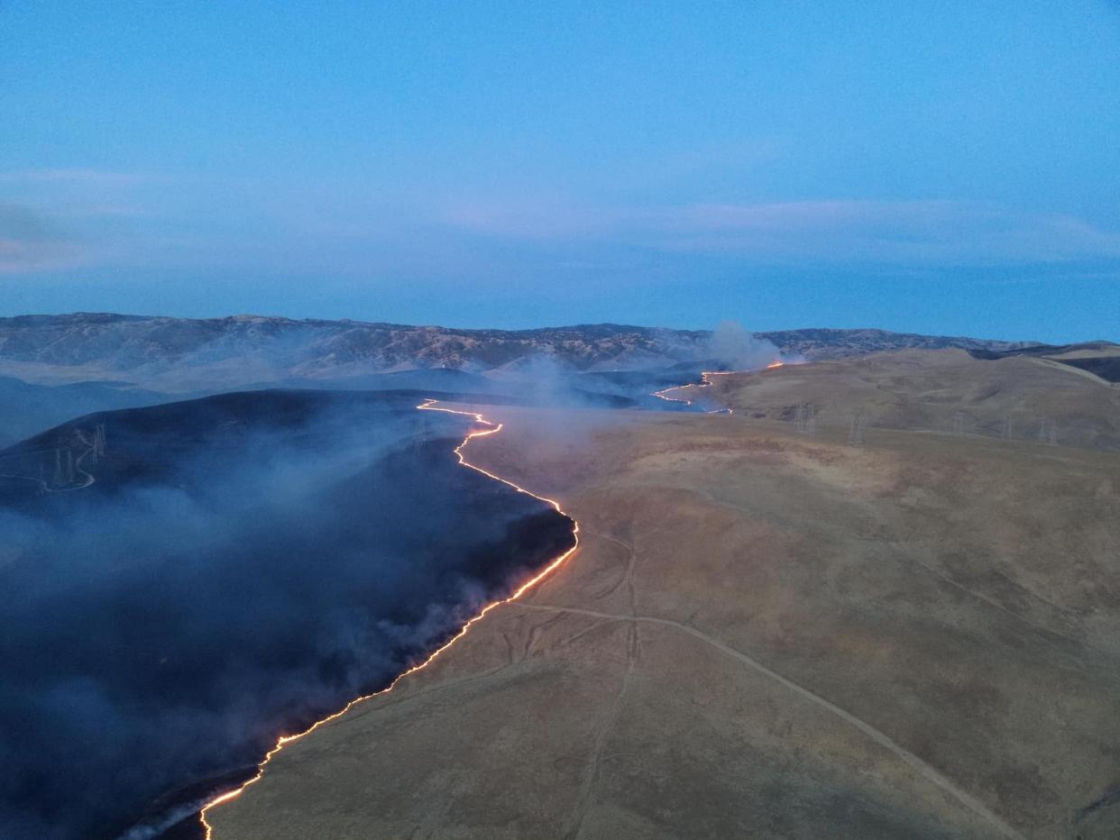
Emergency responders are still battling the Corral Fire in San Joaquin County that has spread to 14,000 acres and was 75% contained as of Monday morning, according to Cal Fire.
Since it began Saturday afternoon near Tracy, California, the fire has injured two firefighters and prompted evacuations. Hundreds of firefighters and other emergency responders have been deployed to the area.
Fueled by high winds, the blaze has spread across hundreds of acres of tall grass, burning around 22 square miles. The cause of the fire remains under investigation, CalFire said.
The wildfire started on property maintained by the Lawrence Livermore National Laboratory about 40 miles southeast of downtown Oakland. Officials said the proximity between the fire and the federal lab, which conducts experiments on nuclear reactions, lasers, and atomic structure, did not immediately pose a threat.
The fire has prompted road closures for nonresidents in some areas while the San Joaquin County Health Department urged residents to boil "tap water or bottled water for drinking and cooking purposes as a safety precaution."
California fire map
US Wildfire, smoke map
Contributing: Christopher Cann
This article originally appeared on USA TODAY: Corral Fire fire map: Track the blaze burning east of San Francisco

